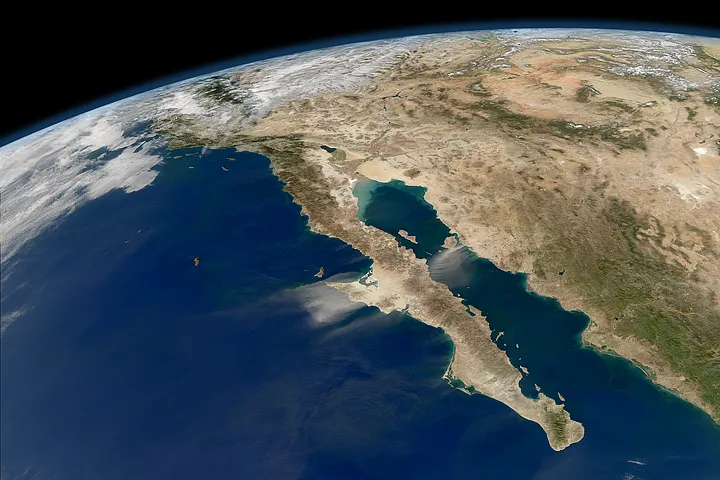
The entire length of Mexico's Baja California peninsula is visible in this stunning image taken by a NASA satellite that also shows the curvature of the Earth.
The natural-color images required to make this oblique view were acquired during nearly cloud-free conditions on Nov. 27, 2011, by the Moderate Resolution Imaging Spectroradiometer (MODIS) on NASA's Aqua satellite.
With the clear skies, other features like a dust storm on the mainland and a phytoplankton bloom in the Gulf of California can be seen. (A recent study suggests that the Gulf of California formed in as little as 6 million to10 million years — much faster than most other ocean basins across the globe.)
Latest Videos From
The Ocean Color Team at NASA Goddard processes images like this to help assess the presence of sediment and plankton in the sea. Dust storms interfere with that processing, as the sandy aerosols block much of the incoming sunlight and the outgoing, reflected light, according to a NASA statement.
Dust storms can disturb human activity on land, but once they blow out over the Gulf of California and Pacific Ocean, they help fertilize the waters with nutrients that promote phytoplankton blooms. In winter, the waters around Baja are often full of whales, as the largest creatures in the sea often eat the smallest plankton, NASA said.
The dust storms in this case actually helped researchers calibrate measurements on two instruments on the GOES weather satellites.

 Live Science Plus