On the western edge of the Asian country of Turkmenistan, a vast desert meets the world's most expansive inland water body, the Caspian Sea.
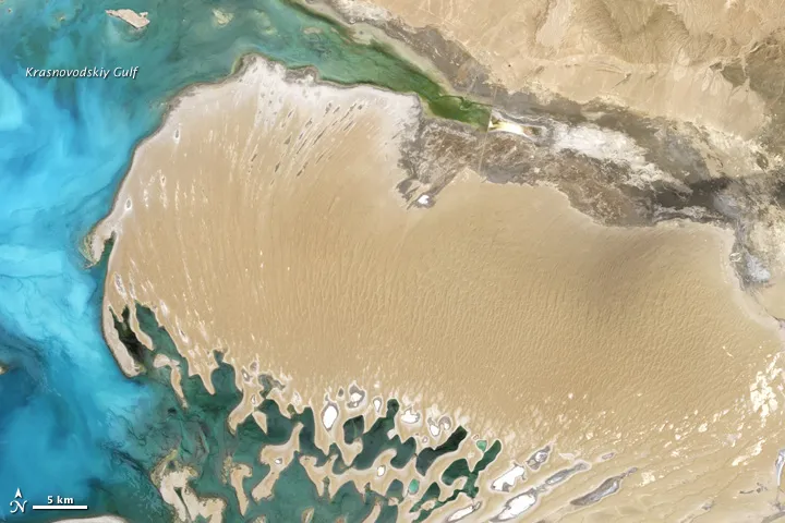
This natural-color Landsat 7 satellite image, taken on June 16, 2000, shows the sand-covered Dardzha Peninsula sticking out in to the Caspian. The peninsula is a landscape of sand dunes and salt flats that extends from Turkmenistan's Garagum (or Karakum) Desert, which covers most of the country.
Dunes on the peninsula are long, linear features stretching mostly along the north-south direction. Toward the east, the dunes transition to level, sandy plains. Along the peninsula’s southern edge lies a network of partially submerged dunes, interspersed with shallow, salty lakes. These dunes separate the Dardzha from a neighboring peninsula, the Cheleken.
Latest Videos From
A river known as the Uzboy used to flow through the Garagum Desert toward the Caspian Sea. Exactly when the river dried up is a matter of debate, but when the river was active, its estuaries periodically flooded. The flooding deposited vast quantities of sand, eventually forming the Dardzha Peninsula. Today, winds blowing over the Garagum Desert can pick up dust that is later deposited on arable lands of the Volga River Valley, impeding agriculture, according to a NASA statement.
Falling water levels in the Caspian Sea, partially driven by human activities such as river damming, contributed to the buildup of silt on the Dardzha Peninsula, especially after 1960. The average surface level of the Caspian is 89 feet (27 meters) below sea level.