Deadly tornadoes raked across Alabama on April 27, 2011, killing as many as 210 people as of April 29, according to a NASA statement.
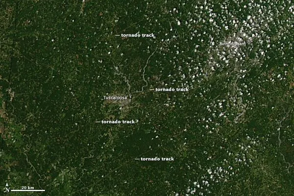
The hardest-hit community was Tuscaloosa. The top image, acquired by the Moderate Resolution Imaging Spectroradiometer (MODIS) on NASA's Aqua satellite on April 28, shows three tornado tracks through and around the city. The lower image, from April 12, shows the area before the storm.
The tracks are pale brown trails where green trees and plants have been uprooted, leaving disturbed ground. Though faint, the center track runs from southwest of Tuscaloosa, through the gray city, and extends northeast towards Birmingham. Two other tracks run parallel to the center track. The northernmost track is in an area where the National Weather Service reported a tornado , but no tornado was reported in the vicinity of the more visible southern track. In the southern region, strong winds were reported.
The tornadoes were part of a larger weather pattern that produced more than 150 tornadoes across six states, said the National Weather Service. The death toll had nearly reached 300 on April 29, making the outbreak the deadliest in the United States since 1974.
For the science geek in everyone, Live Science offers a fascinating window into the natural and technological world, delivering comprehensive and compelling news and analysis on everything from dinosaur discoveries, archaeological finds and amazing animals to health, innovation and wearable technology. We aim to empower and inspire our readers with the tools needed to understand the world and appreciate its everyday awe.