New Study Describes How Earth's Surface Moves

Get the world’s most fascinating discoveries delivered straight to your inbox.
You are now subscribed
Your newsletter sign-up was successful
Want to add more newsletters?

Delivered Daily
Daily Newsletter
Sign up for the latest discoveries, groundbreaking research and fascinating breakthroughs that impact you and the wider world direct to your inbox.

Once a week
Life's Little Mysteries
Feed your curiosity with an exclusive mystery every week, solved with science and delivered direct to your inbox before it's seen anywhere else.

Once a week
How It Works
Sign up to our free science & technology newsletter for your weekly fix of fascinating articles, quick quizzes, amazing images, and more

Delivered daily
Space.com Newsletter
Breaking space news, the latest updates on rocket launches, skywatching events and more!

Once a month
Watch This Space
Sign up to our monthly entertainment newsletter to keep up with all our coverage of the latest sci-fi and space movies, tv shows, games and books.

Once a week
Night Sky This Week
Discover this week's must-see night sky events, moon phases, and stunning astrophotos. Sign up for our skywatching newsletter and explore the universe with us!
Join the club
Get full access to premium articles, exclusive features and a growing list of member rewards.
The Earth's surface marches to the beat of its own drum, so to speak, a new study of how Earth's rocky plates move atop an oozy river of sorts suggests.
The study's findings could potentially shake up the traditional notions of the theory of plate tectonics.
This new thinking, if it holds up, explains a longstanding mystery about how the planet's crust moves and collides over time, causes volcanoes and earthquakes, and reshapes the Earth's surface. In addition, the idea could explain why some of the rocky slabs that make up Earth's outer surface move faster than others.
Mantle motions
Scientists have long thought that the slow ooze of the scorching molten rock that underlies Earth's surface, a region called the mantle, drove the motions of the huge rocky plates that make up the crust. As the oozy mantle surges below, it carries the plates along, crashing them into each other in some spots, and pulling them apart in other regions.
But scientists were at a loss to explain why some pieces of crust move much faster than others.
A new study suggests these tectonic plates control their own speed more than the mantle does. The findings, detailed in the July 16 edition of the journal Science, give a new explanation for why some plates are speedy and others slow, relatively speaking, which will help scientists piece together how the Earth's surface evolved into its present-day formation.
Get the world’s most fascinating discoveries delivered straight to your inbox.
"The Earth's surface is covered with tectonic plates that move with respect to one another at centimeters per year," said geologist and study co-author Wouter Schellart of Monash University in Melbourne, Australia. "These plates converge at deep-sea trenches, plate boundaries where one plate sinks (subducts) below the other at so-called subduction zones. The velocities of these plates and the velocities of the boundaries between these plates vary significantly on Earth."
Plate pulling
A penny sinks through a jar of honey the same way a tectonic plate sinks into the mantle at a subduction zone, said geophysicist and co-author Dave Stegman of the Scripps Institution of Oceanography in La Jolla, Calif.
Stegman, Schellart and their colleagues used observational data and computer models to develop a new formula that describes how the velocities of Earth's plates depend both on the sizes and edges of the subduction zones.
"The computer models demonstrate that the subducted portion of a tectonic plate pulls on the portion of the plate that remains on the Earth's surface," Stegman said. "This pull results in either the motion of the plate or the motion of the plate boundary, with the size of the subduction zone determining how much of each."
Geodynamicist Kevin Furlong of Pennsylvania State University, who was not involved in the research, said the study is an "important advance" and helps explain how plate boundaries evolve and gives details about how subduction works.
The discovery explains why the Australian, Nazca and Pacific plates move up to four times faster than the smaller African, Eurasian and Juan de Fuca plates.
Explaining North America
The study also helps explain why western North America looks the way it does today. Around the time the supercontinent Pangaea began to break apart, a tectonic plate called the Farallon Plate sank into the mantle below the west coasts of North and South America, slowly changing the landscape.
"This plate slowed down during eastward motion from about 4 inches (10 centimeters) per year some 50 million years ago to only 0.8 in (2 cm) per year at present," Schellart said.
The plate slowed down because the subduction zone it was sinking into shrank from 8,700 miles (14,000 kilometers) in width to only 870 miles (1,400 km).
"This had a dramatic effect on the topography and the structure of the North American continent," Schellart said. "Until 50 million years ago, the west coast of North America was characterized by a massive mountain chain similar to the present-day Andes in South America, and ran from Canada in the north to southern Mexico in the south."
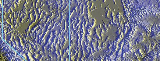
As the subduction zone got smaller, the stress along the west coast of North America decreased, which destroyed the giant mountain range. This created the Basin and Range province, a 772,000-square-mile (2 million-square-kilometer) area of elongated basins and ridges that characterizes the present-day western North American landscape.
Like any new study, however, more work is necessary. Furlong said the new ideas about the changes in the western North America landscape are interesting and testable, but that at this stage the model is not sufficient to explain many other events in this region at that time.
 Live Science Plus


