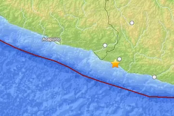
An earthquake of preliminary magnitude 5.8 struck Mexico today (March 26), according to the U.S. Geological Survey (USGS).
The temblor's epicenter was 11 miles (17 kilometers) southwest of Santiago Pinotepa Nacional, Mexico, 37 miles (60 km) south-southeast of Ometepec, Mexico, and 231 miles (371 km) south-southeast of Mexico City.
It originated 6.2 miles (10 km) deep and struck at 06:04:48 a.m. local time, the USGS reports.
Latest Videos From
Earthquakes of this size are often felt across a wide area and may cause minor to moderate damage, such as cracked plaster. They can cause significant damage in areas with outdated building standards. But the damage caused by any single event depends on the quake's depth, proximity to populated areas, building standards in the region, as well as the type of earthquake. The USGS frequently updates the magnitude of an event after more data is analyzed.
An earthquake's magnitude is a measure of the energy released at the source. It is just one predictor of the shaking that may ensue, which is affected by local and regional geology. Scientists know in a general sense what causes Earthquakes but are unable to predict specific quakes.
This article will be updated if significant additional information becomes available. Find more earthquake news here.