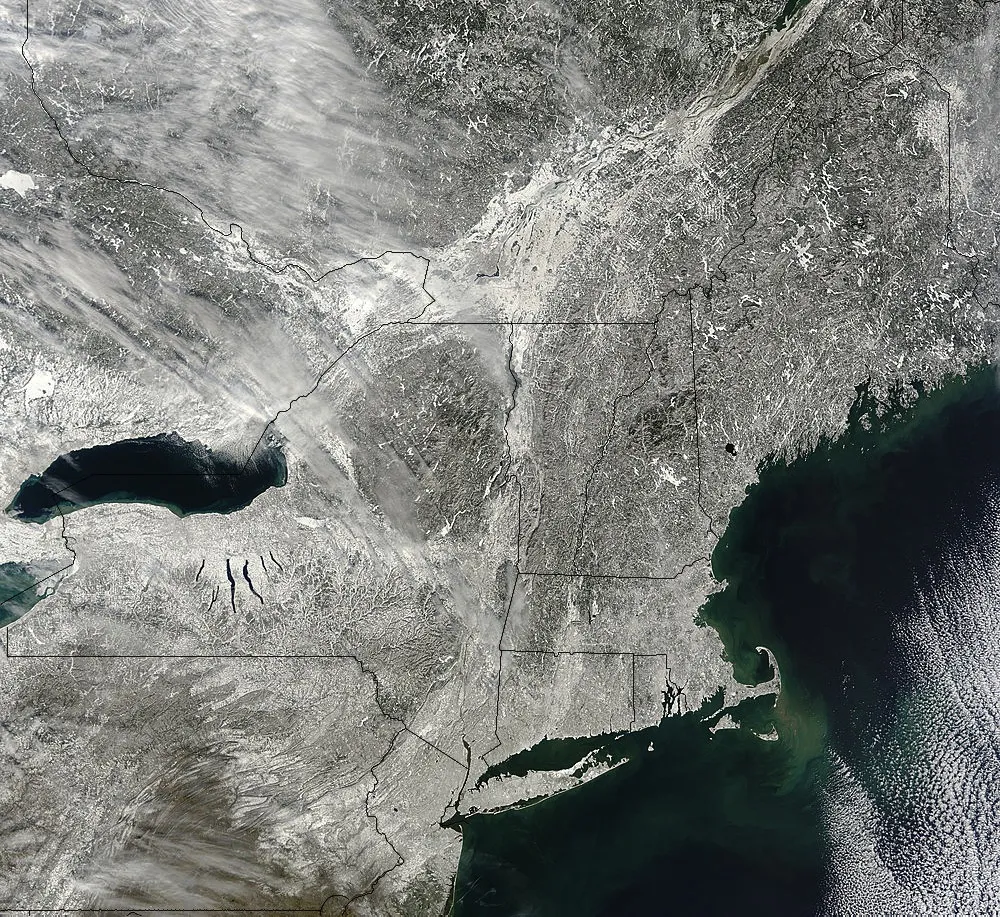
The aftermath of Saturday's massive snowstorm was spotted from space by NASA's Terra satellite on Sunday (Feb. 10).
The snow started falling Friday when a frigid Arctic air mass from Canada collided over the Northeast with warm, moist air sweeping up from the South. Heavy snow combined with strong winds to create blizzard conditions, with more than 2 feet (0.6 meters) of snow dropped in New York, Connecticut, Massachusetts, New Hampshire, Rhode Island and Maine.
The clouds had mostly cleared when the Moderate Resolution Imaging Spectroradiometer (MODIS) on the Terra satellite snapped the winter wonderland stretching from Pennsylvania to Maine.
Latest Videos From
As of Sunday, Hamden, Conn., won the prize for the weekend's highest snowfall, with 40 inches (101 cm), Accuweather.com reported. While the total wasn't a record for Hamden, Portland, Maine, was buried in 31.9 inches (81 cm) of flakes, the greatest snowfall ever for the city.
Wind-driven snowdrifts blocked doors and built up sedimentarylike layers on windowsills, according to pictures and video posted online. Gusts over 60 mph (96 km/h) chilled residents from Maine to New York, according to Accuweather.com. In Portland and Westport, Conn., the winds topped more than 80 mph (128 km/h).
Commuters battling the snow won't get much respite, according to the National Weather Service (NWS). The NWS forecasts a much warmer storm system moving through the region today (Feb. 11), with freezing rain.
Editor's note: This story has been updated to reflect that 5.7 inches of snow fell in Allentown, Penn.
Reach Becky Oskin at boskin@techmedianetwork.com. Follow her on Twitter @beckyoskin. Follow OurAmazingPlanet on Twitter @OAPlanet. We're also on Facebook and Google+.

 Live Science Plus