


Nadine May Aggravate the Azores
This article was provided by AccuWeather.com.
Nadine will wander the Central Atlantic this weekend but could venture near the Azores later next week.
Steering winds are forecast to allow Nadine to drift northward during much of the weekend, well away from any land areas. However, these steering winds are also forecast to change next week.
According to Dan Kottlowski, head of the AccuWeather.com Hurricane Center, "An upper-level high pressure area will help guide Nadine in a general east to northeast motion next week and could bring the system close to the Azores by around Wednesday."
There is a possibility of building surf and gusty squalls reaching the islands, depending on the track and strength of Nadine.
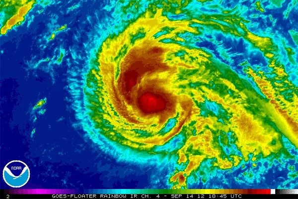
As of the midday Friday, Sept. 15, 2012, Nadine was hovering just below hurricane strength with maximum sustained winds of 70 mph and higher gusts.
Nadine was being affected by wind shear, which was limiting development, since Thursday.
Get the world’s most fascinating discoveries delivered straight to your inbox.
According to Meteorologist Brian Edwards, "The strong upper-level winds were pushing the top of Nadine east of the low-level center of circulation."
If the wind shear eases, the two parts of the storm would become more aligned and could allow further strengthening.
Tropical cyclones can ramp up quickly when over warm water, away from dry air and wind shear effects.
Interests in or venturing to the Azores next week should continue to monitor the progress of Nadine.
© AccuWeather.com. All rights reserved. More from AccuWeather.com.