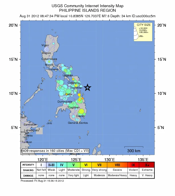
The large earthquake that struck off the eastern coast of the Philippines today (Aug. 31) at 8:47 p.m. local time sparked tsunami warnings across a large swath of the neighboring Pacific region, yet those warnings were canceled not long after.
The magnitude-7.6 earthquake hit about 58 miles (63 kilometers) from shore along a tectonic boundary known as a subduction zone, where an oceanic plate is diving beneath a continental plate.
Earlier reports put the quake's magnitude at 7.9, but after more data from global networks of seismometers arrived, officials at the U.S. Geological Survey downgraded the magnitude to 7.6.
Latest Videos From
"There's a significant difference, but they're both really big earthquakes that can generate tsunamis, and if they occur on land they can kill lots of people," said Paul Caruso, a geophysicist with the U.S. Geological Survey in Golden, Colo.
In this case, the oceanic Philippine plate shoved deeper below the Sunda plate, a continental plate home to the Philippines, and portions of Indonesia, Malaysia, Thailand and Vietnam.
The quake ruptured at a depth of about 22 miles (35 km). That's fairly shallow, Caruso said, and shallower earthquakes are more likely to cause tsunamis.
"When you get a really deep quake, a lot of the energy is absorbed before it reaches the seafloor, and what causes a tsunami is the seafloor being pushed up," he told OurAmazingPlanet.
However, tsunami warnings that were in effect for the Philippines, Indonesia and Belau were cancelled by the Pacific Tsunami Warning Center in Hawaii at around 11 a.m. ET.
So-called subduction quakes — those that occur when an oceanic plate suddenly jolts deeper beneath a continental plate — are the most powerful type of earthquakes that occur on our planet.
They're also very good at shoving the seafloor, and the sheer area of the seafloor that is thrust upward — the length of the rupture, and its horizontal and vertical displacement — determines the size of the tsunami that follows.
Data from sensors in the ocean near the site of the quake indicate a tsunami was generated, and waves are coming between 10 and 14 minutes apart, but it appears the waves aren't packing so much energy that they'll take a significant toll once they reach land.
In deep water, tsunami waves appear small, and only reach a massive size once they make it into shallower waters close to shore.
So, although today's quake was a significant one, it appears it didn't move the seafloor enough to cause a large tsunami.
However, Caruso warned that earthquakes can also trigger undersea landslides, which can, in turn, cause tsunamis.
It appears the earthquake has caused at least one death after a house collapsed, and Philippine authorities are warning residents to remain vigilant, in case any further earthquakes occur, the AP reported.
The tectonic region that ruptured today has a long history of shallow, strong earthquakes.
Reach Andrea Mustain at amustain@techmedianetwork.com, or follow her on Twitter @AndreaMustain. Follow OurAmazingPlanet on Twitter @OAPlanet. We're also on Facebook & Google+.