Angkor, the ancient capital of the Khmer Empire, has been mapped for the first time using laser light.
The technique called LIDAR, which uses billions of reflected light beams to map the topography below a thick forest canopy, revealed that the city was even more massive than previously thought.
The new analysis "shows there were hundreds, if not thousands of settlements, mounds, ponds, roads and urban blocks which actually organized a quite dense city," said study co-author Christophe Pottier, an archaeologist and co-director of the Greater Angkor Project. "This area of dense occupation was much bigger than what we were expecting." [See Images of Angkor Wat, New Temple City]
Latest Videos From
The findings were published today (July 8) in the journal Proceedings of the National Academy of Sciences.
Ancient empire
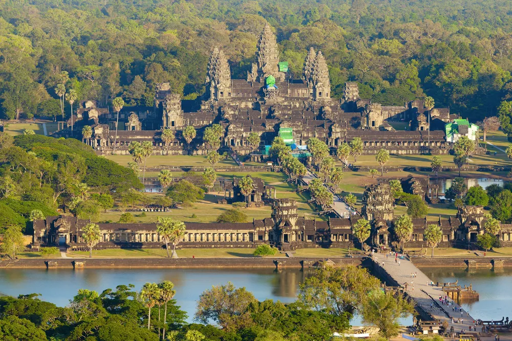
Angkor is located in modern-day Cambodia, and for several centuries, was the capital city of the Khmer Empire. The city and its surrounding areas may have housed up to 1 million people and, at its height, was considered the largest city in the world. Angkor flourished until the 15th century, when it was mysteriously abandoned. The crown jewel of the complex, Angkor Wat, is a temple built between A.D. 1113 and 1150 that rises 213 feet (65 meters) into the air and spans 500 acres (200 hectares).
After the city was abandoned, the jungle took over, covering the area in a thick canopy of vegetation. In the past, researchers had tried to study its extent using radar and satellite images. But much of the ancient city's footprint remained hidden.
In 2012, Pottier and his colleagues began mapping the terrain using airborne laser scanning, or LIDAR. The team used a helicopter and sent out billions of beams of laser light that were able to pass through the tiny spaces between dense jungle canopy to hit the earth below. The reflected beams were then analyzed to determine whether the light bounced off leaves, soil or other features.
The LIDAR uncovered hundreds of bumps on the landscape that ancient inhabitants formed when moving earth to build dikes, dams, huge reservoirs, canals, family ponds and roads. The new map reveals that the city made heavy use of cultivation and water-storing techniques. (Scientists recently discovered a lost Khmer city known only from inscriptions using the same technology.)
In addition, the city's dense core was much larger than thought: about 27 square miles (70 square kilometers), Pottier said. The core alone may have housed 500,000 people, he added.
The new map also sheds light on why the city was abandoned. The city's economy depended on the network of intricate hydraulic systems. But those systems depended heavily on reliable monsoon rains, Pottier said. Other environmental studies have revealed that the monsoons became irregular during the14th and 15th centuries, he said.
That alone may not have caused Angkor's demise, but was probably a factor, Pottier said.
Follow Tia Ghose on Twitterand Google+. Follow LiveScience @livescience, Facebook & Google+. Original article on Live Science.