


A new map made from satellite data reveals Cambodia's Angkor Wat temple was the center of one of the largest cities of the pre-industrialized world.
The research also sheds light on the extent of the city's sprawl and on its mysterious downfall, factors that could be linked in a way that bears on today's extensive and suburbanized metropolises.
Using ground-sensing radar provided by NASA, researchers found evidence that the ancient Cambodian capital took up an area of nearly 400 square miles (1,000 square kilometers). For comparison, Philadelphia covers 135 square miles, while Phoenix sprawls across more than 500 square miles, not including the huge suburbs. Each has about 1.5 million residents in the city limits.

"In terms of population, however, Angkor would only have had a few hundred thousand people," said study team member Damian Evans, an archaeologist at the University of Sydney in Australia. "There were cities with much larger populations—for example, in China—before, during and after the Angkor period."
The new radar technique, which senses differences in plant growth and soil moisture content created by topographical differences, also identified more than 1,000 new manmade ponds and more than 70 long-lost temples.
The work, detailed in the Aug. 14 issue of the journal for the Proceedings of the National Academy of Sciences, provides fresh evidence for an idea put forward more than 50 years ago— that Angkor relied on a complex irrigation system consisting of linked ponds and that the city's downfall might have been the result of land overexploitation.
The Khmer capital
Get the world’s most fascinating discoveries delivered straight to your inbox.
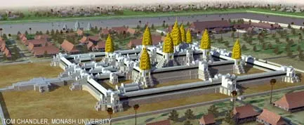
Angkor was the capital city of the Khmer empire from the 9th to the 16th centuries. The now-crumbling and decadent temple, Angkor Wat , was constructed in the 12th century at the bidding of one of its kings.
The new maps show that Angkor's water system consisted of canals in the North that funneled water into massive reservoirs in the city's center where the temple resided. "From there, a series of distributor canals dispersed the water through the southern parts of Angkor and down towards the lake," Evans explained.
In the 1950s, the late archaeologist Bernard-Philippe Groslier speculated that traces of a hydraulic network were part of an ancient irrigation network that ferried water to farmers in the city's suburbs. Groslier also argued that the breakdown of the network, triggered perhaps by overexploitation of the landscape, was implicated in Angkor's downfall.
Supporting Groslier's hypothesis, the new maps and excavations reveal breaches in dykes and attempts to patch up the system. Whether such phenomena were the cause, a symptom or a result of Angkor's decline remains to be determined, Evans said.
Modern lessons
"Our research shows that Angkor was certainly extensive enough, and that land-use was certainly intensive enough, to have impacted profoundly on the regional ecology," Evans told LiveScience.
Angkor was surrounded by a vast expanse of rice fields that would have required extensive forest clearance. Over time, the intense farming could have led to serious ecological problems, including those associated with deforestation, overpopulation, topsoil degradation and erosion.
The consequence of overexploiting the environment isn't the only lesson Angkor's fate has for modern society, Evans said. Angkor required a massive infrastructural network of canals and roads to keep it running.
"This increasingly complex elaborate system would have been very difficult and expensive to maintain," Evans said. "This is obviously something to bear in mind, considering that many cities in our contemporary world are expansive, low-density urban sprawls as Angkor appears to have been."
- Top 10 Ancient Capitals
- Image Gallery: The Seven Ancient Wonders of the World
- Top 10 Emerging Environmental Technologies