


In Images: IceBridge Investigates Antarctica
Operation IceBridge
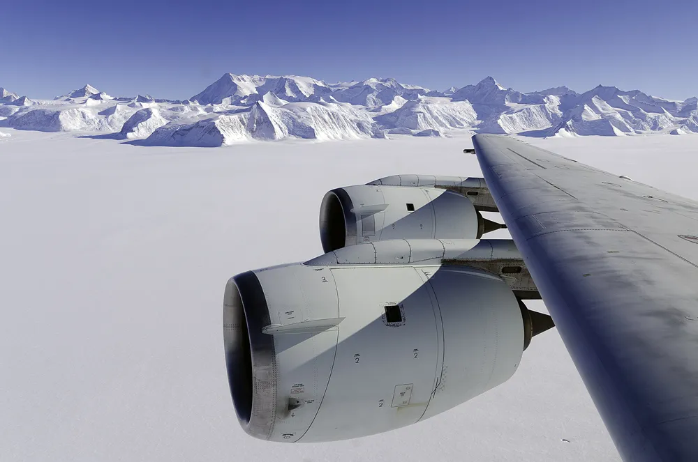
NASA's Operation IceBridge is a six-year mission to survey land and sea ice at the poles. The program's DC-8 research plane, loaded with remote-sensing equipment, captured spectacular images of Antarctica's mountains and glaciers in October 2012, the first half of this year's campaign. Combining new measurements with previously gathered data gives researchers a more detailed view of ice dynamics. The resulting information will help improve computer models that predict how ice sheets change over time.
Mount Murphy

Mt. Murphy, a shield volcano in Marie Byrd Land, Antarctica, seen from the IceBridge research plane as it flies over Thwaites Glacier on Oct. 12.
Bellingshausen Sea

Sea ice in the Bellingshausen Sea, Antarctica, seen from the IceBridge research plane 1,500 feet above ground on Oct. 12.

Tiny shadow on Bellingshausen Sea

Sea ice in the Bellingshausen Sea, Antarctica, on Oct. 12. The shadow of the DC-8 plane, flying at 1,500 above ground, is visible in the center of the image.
Various shades

This complex mixture of Antarctic sea ice was photographed on Oct. 13 in the Bellingshausen Sea with the Digital Mapping System (DMS) onboard the IceBridge research plane. Different types of sea ice in the Southern Ocean include dark black (open water), a thin grease-like covering (grease ice), and thicker grey ice.
Calving edge of Thwaites Ice Shelf
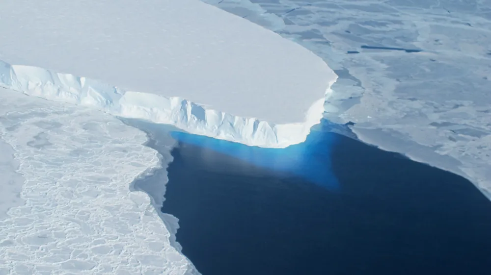
The calving front of Thwaites Ice Shelf photographed from the IceBridge research plane. The water acts as a blue filter for ice visible below the water's surface. Thwaites Glacier flows into Pine Island Bay, in West Antarctica.
Mount Vinson
Mount Vinson is the highest peak in Antarctica, with an elevation of 16,066 feet (4,897 meters).
Get the world’s most fascinating discoveries delivered straight to your inbox.
Shackleton Range and Recovery Glacier

The Shackleton Range and Recovery Glacier in Antarctica as seen from the IceBridge research plane on Oct. 18.
Ellsworth Mountains Ice Fall

Ice fall in the Ellsworth Mountains viewed from the IceBridge research plane on Oct. 22 as it flies along the grounding line of the Ronne Ice Shelf.
The Sentinel Range

View of the Sentinel Range in the Ellsworth Mountains seen on Oct. 22 during an IceBridge research flight.
Embedded Iceberg in Bellingshausen Sea

An iceberg embedded in sea ice in the Bellingshausen Sea, photographed from the IceBridge research plane on Oct. 19. "Thickness in the Bellingshausen has increased slightly while area has decreased. We're looking at why that is," said sea ice scientist Nathan Kurtz of NASA's Goddard Space Flight Center.
