See Antarctica's Entire Seafloor With New Map

Get the world’s most fascinating discoveries delivered straight to your inbox.
You are now subscribed
Your newsletter sign-up was successful
Want to add more newsletters?

Delivered Daily
Daily Newsletter
Sign up for the latest discoveries, groundbreaking research and fascinating breakthroughs that impact you and the wider world direct to your inbox.

Once a week
Life's Little Mysteries
Feed your curiosity with an exclusive mystery every week, solved with science and delivered direct to your inbox before it's seen anywhere else.

Once a week
How It Works
Sign up to our free science & technology newsletter for your weekly fix of fascinating articles, quick quizzes, amazing images, and more

Delivered daily
Space.com Newsletter
Breaking space news, the latest updates on rocket launches, skywatching events and more!

Once a month
Watch This Space
Sign up to our monthly entertainment newsletter to keep up with all our coverage of the latest sci-fi and space movies, tv shows, games and books.

Once a week
Night Sky This Week
Discover this week's must-see night sky events, moon phases, and stunning astrophotos. Sign up for our skywatching newsletter and explore the universe with us!
Join the club
Get full access to premium articles, exclusive features and a growing list of member rewards.
Oceanographers often proclaim maps of Mars are more complete than charts of Earth's seafloor.
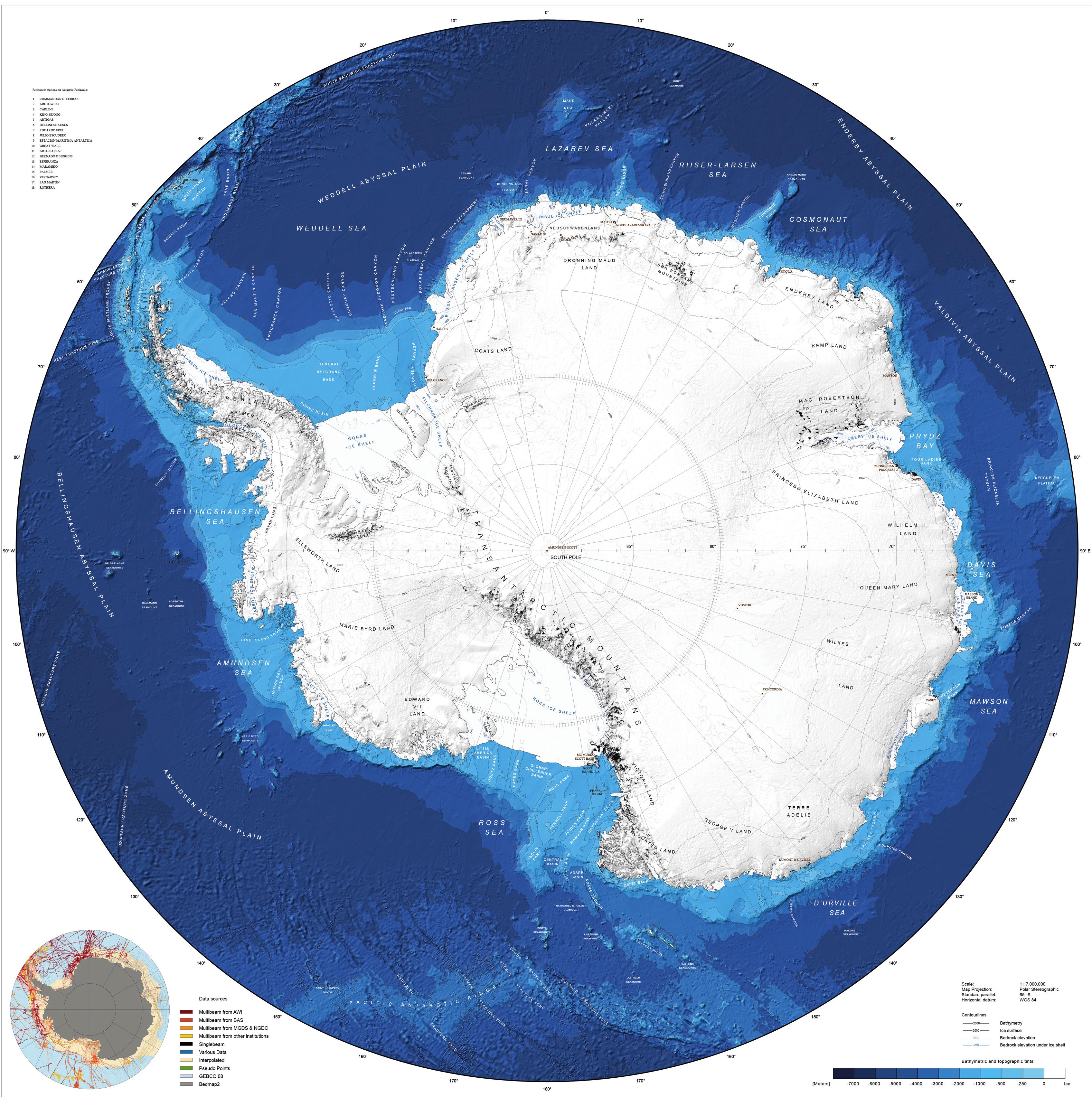
Now, the planet's depths are a little clearer thanks to a newly released bathymetric map of the Southern Ocean surrounding Antarctica. For the first time, the deep canyons and steep mountains south of the 60th parallel appear in detail, according to a statement from the Alfred Wegener Institute's Helmholtz Centre for Polar and Marine Research.
Because the undersea topography influences sea ice, ocean currents and marine life, the digital map will help researchers who model Antarctic processes, Jan Erik Arndt, an editor on the project, said in a statement.
Only 17 percent of the Antarctic seafloor has reliable bathymetric data, so researchers creating the map interpolated existing measurements, filling in gaps between known points. The data set and a digital map copy are available online at ibsco.org.
Read more: Alfred Wegener Institute
Email Becky Oskin or follow her @beckyoskin. Follow us @OAPlanet, Facebook or Google+.
Get the world’s most fascinating discoveries delivered straight to your inbox.

 Live Science Plus


