New satellite imagery of California reveals not just the extent of its wildfire damage, but the depth of the loss.
The maps derived from the satellite data show how far two major fires spread as well as how badly each region burned. Darker colors represent near-complete loss — charred landscapes with little to no living vegetation left. Lighter tan regions represent areas where the fire was severe, but some trees and plants still survive.
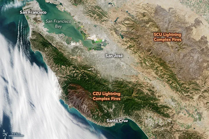
The satellite data was collected by Landsat 8 on Sept. 26, during a clear day after weeks of smoke that blanketed the Bay Area.
"We needed a clear view of the land surface to make these measurements, and we were lucky enough to get one after so many smoky days," Christopher Potter, a remote-sensing researcher at NASA's Ames Research Center, told NASA's Earth Observatory. "It was the first satellite image we could use to tell how severe the burn was across a broad area."
The imagery captured the CZU Lightning Complex fire near Santa Cruz, and the SCU Lightning Complex fire in the Diablo Mountains. The CZU Lightning Complex fire began on Aug. 16, according to Cal Fire, and burned for 37 days before being contained. The fire burned 86,509 acres (135 square miles, or 350 square kilometers). The SCU Lightning Complex ignited on Aug. 18 and burned 396,624 acres (619 square miles, or 1,605 square kilometers) over the next 44 days, according to Cal Fire.
By comparing near-infrared and shortwave-infrared wavelength data from Sept. 26 to the same data collected on July 24, before the fires, Potter and his colleagues created a normalized burn ratio showing how much vegetation was lost in each fire. The resulting maps show that the CZU Lightning Complex scar was burned deeply into the land, likely leaving little but charred tree stumps, ash and soot behind. Most of the SCU Complex fire shows more surviving vegetation.
Green areas on the map show a gain in vegetation, which is probably due to seasonal growth or agriculture outside of fire scars.
Sign up for the Live Science daily newsletter now
Get the world’s most fascinating discoveries delivered straight to your inbox.
According to the Earth Observatory, the CZU Lightning Complex fire devastated coastal forests full of tanoaks, Douglas firs and redwoods.
"It is disturbing to see how much of the redwood forest was burned," Potter said.
The SCU Complex fire burned grassland and oak woodlands.
"It is rare that we get more than one large lightning-induced fire in a year in California; this year, we had 10 lightning complex fires," Potter told the Earth Observatory. "Some researchers think these lightning storms may be related to climate change. If global warming means more lightning storms like this in California, then we are in trouble."
Stephanie Pappas is a contributing writer for Live Science, covering topics ranging from geoscience to archaeology to the human brain and behavior. She was previously a senior writer for Live Science but is now a freelancer based in Denver, Colorado, and regularly contributes to Scientific American and The Monitor, the monthly magazine of the American Psychological Association. Stephanie received a bachelor's degree in psychology from the University of South Carolina and a graduate certificate in science communication from the University of California, Santa Cruz.