Nepal Earthquake Photos: Odd Effects of Kathmandu Temblor
The devastating Nepal earthquake lifted the land near Kathmandu about 3 feet (1 meter) while Mount Everest seems to have shrunk, according to before-and-after radar images of the area taken by a European satellite. Here's a look at the Nepal images. [Read the full story on the Nepal earthquake's odd effects]
Before and after
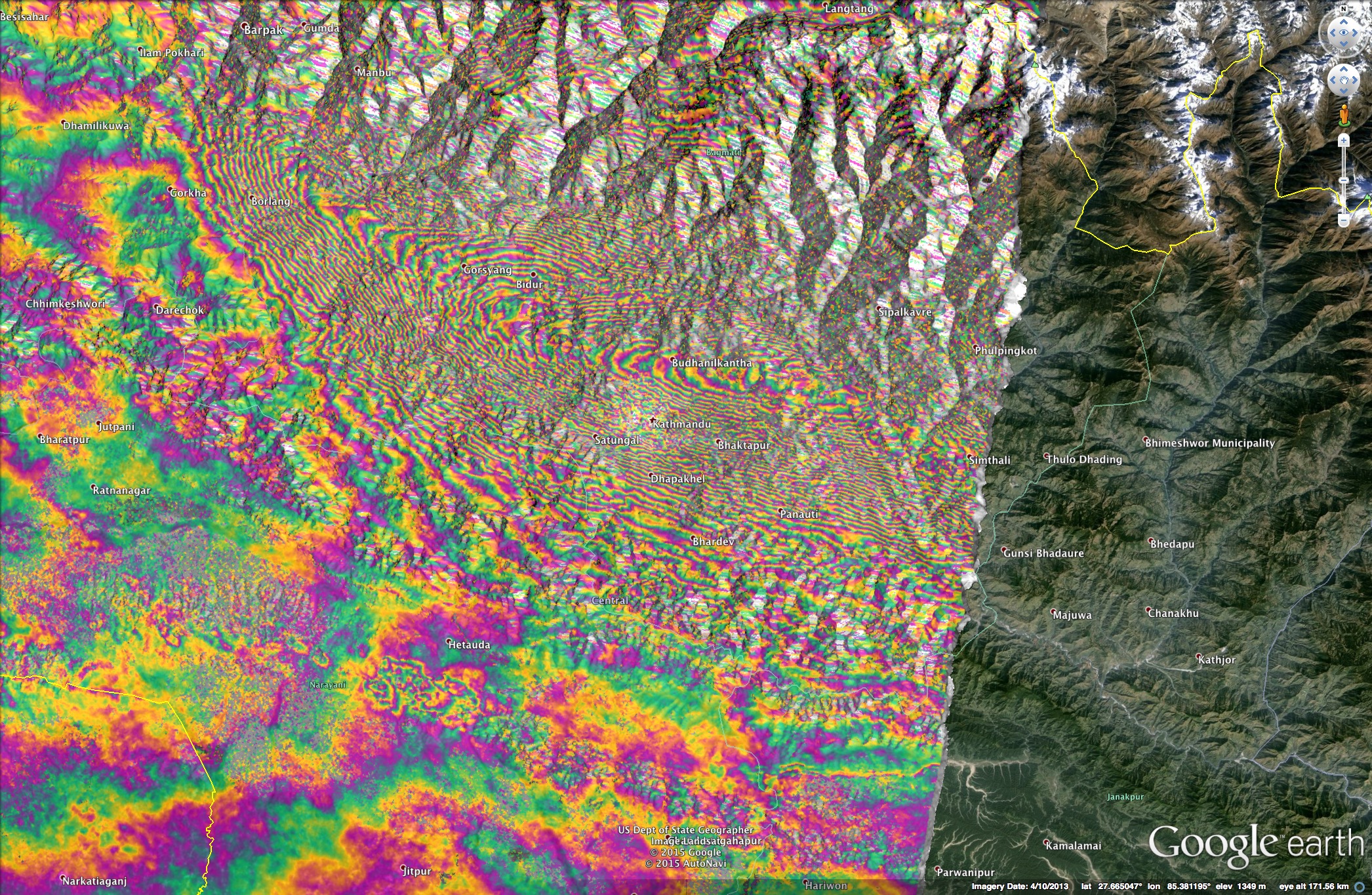
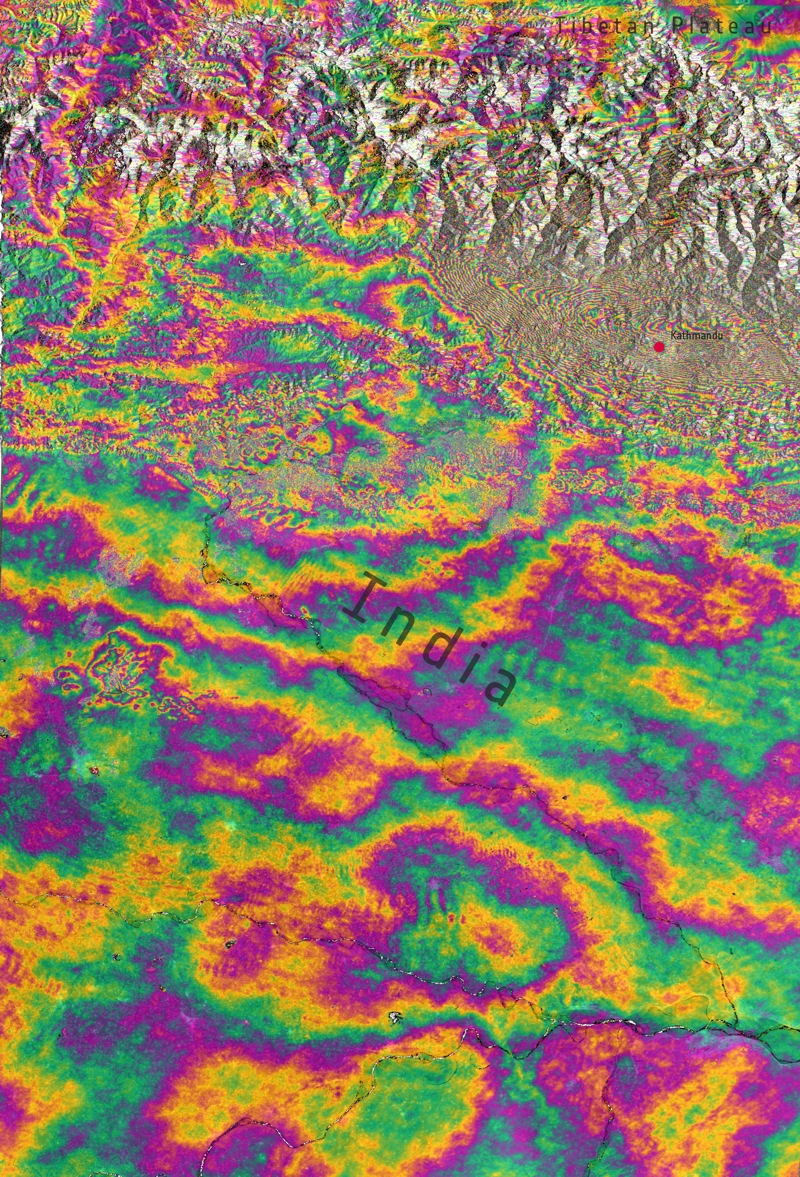
European Space Agency's (ESA) Sentinel-1a radar satellite passed over Kathmandu, Nepal, Wednesday (April 29). By comparing radar scans taken on April 17 with the new ones, scientists revealed deformation of about an inch (3 centimeters), indicating ground motion of 3 feet or more. They used a technique called an interferogram, with the resulting rainbow-colored images indicating ground movement between the two dates. Each colorful "fringe" represents vertical movement of about an inch. (Image Credit: Contains Copernicus data (2015)/ESA/DLR Microwaves and Radar Institute/GFZ/e-GEOS/INGV–ESA SEOM INSARAP study)
Moving up
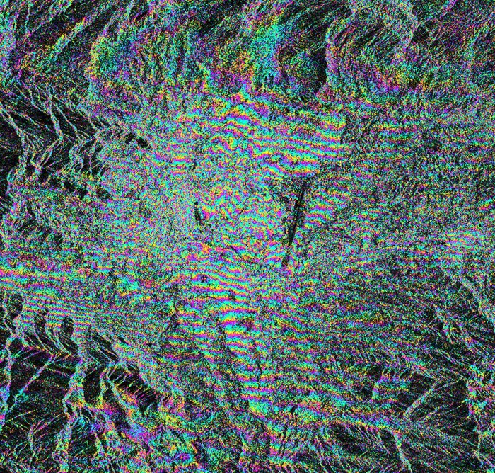
By analyzing the satellite images, the researchers found a swath of land measuring 75 miles long by 30 miles wide (120 kilometers by 50 kilometers) lifted upward by up to 3 feet during the magnitude-7.8 temblor that killed more than 4,000 people. (Image Credit: ESA SEOM InSARap Study – Norut/PPO.labs/Univ Leeds)
Mountains shift
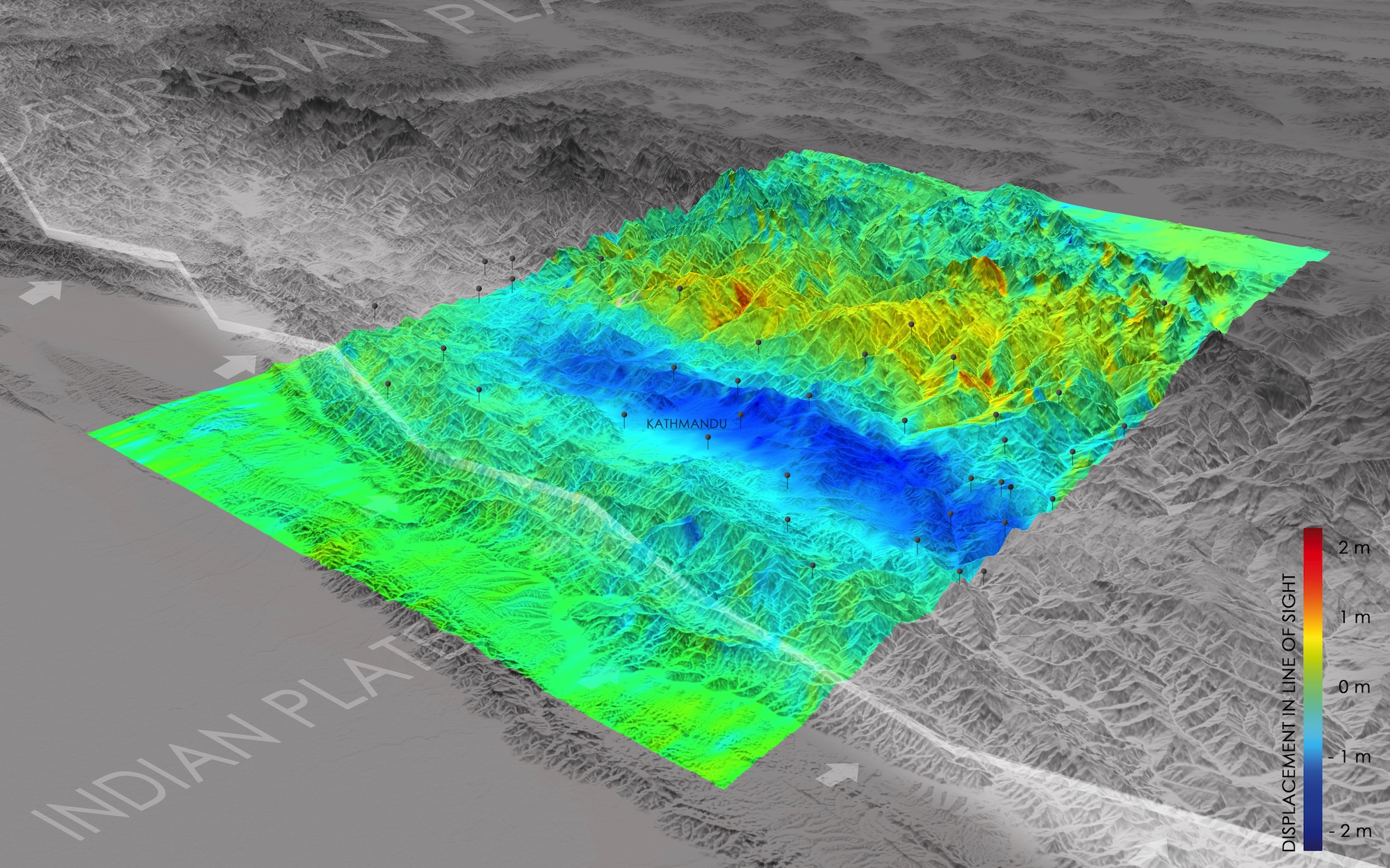
The German Aerospace Center (DLR) used the satellite radar data to create a regional aid map and calculate how the ground shifted during the earthquake. In the DLR map, areas that moved upwards are blue and regions that dropped down (away from the satellite) are coded yellow and red. In additional to vertical movements, the researchers also detected north-south horizontal shifts of nearly 7 feet (2 meters). (Image credit: DLR/EOC)
Get the world’s most fascinating discoveries delivered straight to your inbox.
Rainbow fringes
The Sentinel-1A interferogram (created by combining radar images taken on April 17 and April 29) over Kathmandu, Nepal. The colors show deformation in the earth caused by the 7.8-magnitude earthquake. The east–west "fringes" cross the city, with each colored fringe representing about an inch of ground displacement, from both uplift and subsidence. (Image Credit: Contains Copernicus data (2015)/R. Grandin/IPGP/CNRS)
Near the Tibetan Plateau
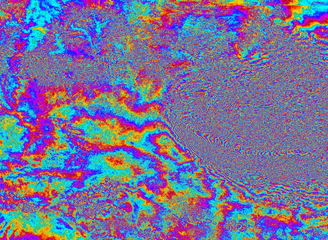
Combining two Sentinel-1A radar scans from 17 and 29 April 2015, this interferogram shows changes on the ground that occurred during the 25 April earthquake that struck Nepal. An overall area of 120x100 km has moved – half of that uplifted and the other half, north of Kathmandu subsided. Vertical accuracy is a few cm. (Image Credit: Contains Copernicus data (2015)/ESA/Norut/PPO.labs/COMET–ESA SEOM INSARAP study)
Grading map
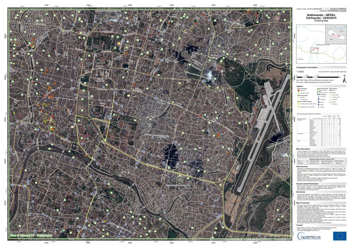
Based on imagery from the WorldView-3 satellite acquired on April 28, this "grading map" shows topographic features and crisis information around Kathmandu, Nepal, after the 7.8-magnitude earthquake struck on April 25.
Mount Everest shrinking
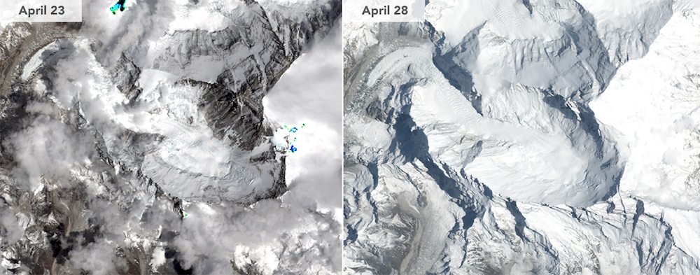
This side-by-side comparison shows Mount Everest before and after the earthquake. The 7.8-magnitude quake on April 25 shook Everest and triggered a terrifying avalanche. In the April 28 image (left), there are no major changes visible from the earthquake and avalanche due to fresh snow cover and clouds over Everest, according to NASA. The April 23 photo was captured by Landsat 8, which is operated by NASA and the United States Geological Society (USGS). The April 28 image was taken by NASA's Earth Observing-1 satellite. (Image Credit: NASA Earth Observatory)
Emitted light
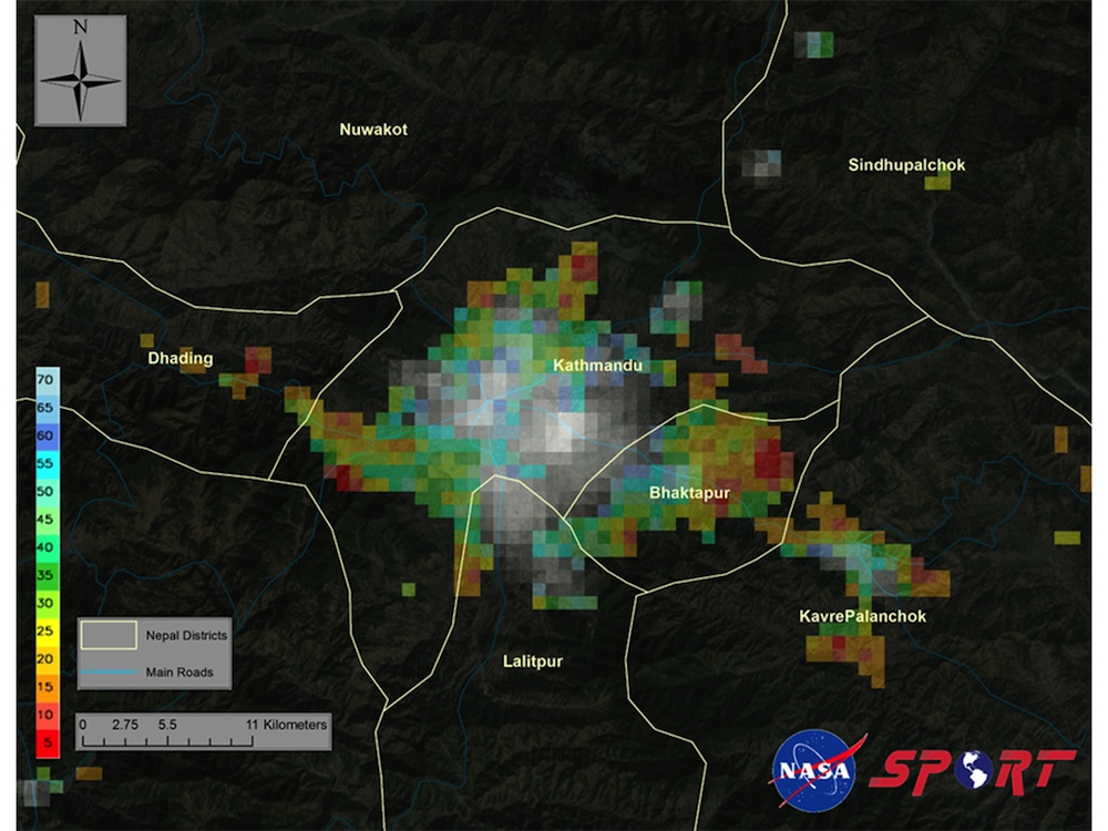
This satellite image shows the city of Kathmandu and its surrounding areas after the April 25 earthquake. The Suomi National Polar-Orbiting Partnership satellite, operated by NASA and the National Oceanic and Atmospheric Administration, detected a decrease in emitted light over Kathmandu, based on a comparison between images taken pre-earthquake, on April 22, 2015, and after the earthquake, on April 26, 2015. The red and yellow colors indicate areas with the largest decrease in emitted light — possibly because of electrical outages and damage to key infrastructure, according to NASA. (Image Credit: Short-term Prediction Research and Transition (SPoRT) team/Marshall Space Flight Center)
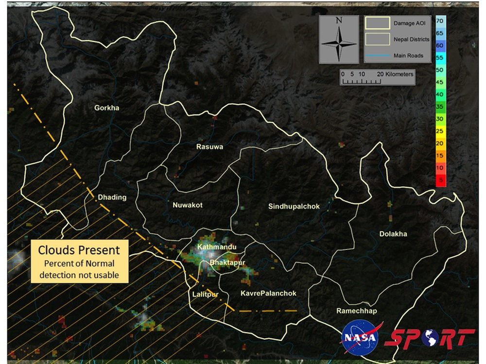
Nepal districts affected
This satellite image shows 11 districts in Nepal that were affected by the earthquake. The Suomi National Polar-Orbiting Partnership satellite was used to compare image of the region before and after the earthquake, and detected a decrease in emitted light over Kathmandu and its surrounding region. (Image Credit: Short-term Prediction Research and Transition (SPoRT) team/Marshall Space Flight Center)
Jeanna Bryner is managing editor of Scientific American. Previously she was editor in chief of Live Science and, prior to that, an editor at Scholastic's Science World magazine. Bryner has an English degree from Salisbury University, a master's degree in biogeochemistry and environmental sciences from the University of Maryland and a graduate science journalism degree from New York University. She has worked as a biologist in Florida, where she monitored wetlands and did field surveys for endangered species, including the gorgeous Florida Scrub Jay. She also received an ocean sciences journalism fellowship from the Woods Hole Oceanographic Institution. She is a firm believer that science is for everyone and that just about everything can be viewed through the lens of science.


