
 Live Science Plus


Remote Canadian Fires Seen from Space (Photo)

published
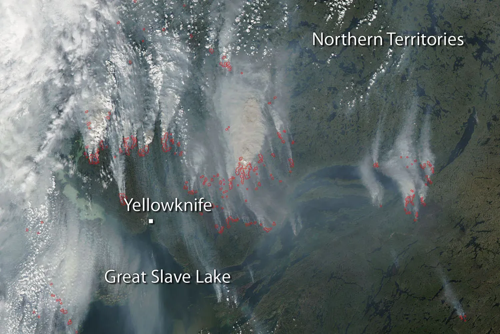
Wildfires in the Northern Territories of Canada near Yellowknife captured by NASA's Aqua satellite on July 26, 3014.
(Image credit: NASA image courtesy Jeff Schmaltz LANCE/EOSDIS MODIS Rapid Response Team, GSFC)
Heavy smoke obscures the region around Yellowknife, Canada, in a new satellite image of wildfires that have choked the air and confined residents indoors.
Yellowknife sits on the banks of the Great Slave Lake in Canada's Northwest Territories. The fire season in the Northwest Territories has been harsh this year, with 284 fires reported so far, according to the region's Environment and Natural Resources Forest Management Division. More than 2.6 million acres (1,065,410 hectares) have burned. (In January 1978, the Soviet nuclear-powered spacecraft called Cosmos 954 fell into the Northwest Territories, scattering radioactive material from the Great Slave Lake into northern Saskatchewan and Alberta.)

TOPICS
