













Astronaut Photo Reveals River's History

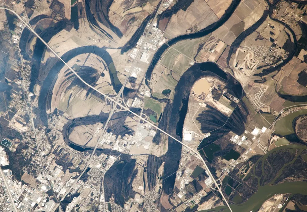
Twisty, turny lakes near Little Rock, Ark., show where the mighty Arkansas River once traveled. These meander lakes, as they're called, are the subject of a new astronaut photograph.
An astronaut on the International Space Station snapped the new picture from 250 miles (400 kilometers) above the Earth's surface on Feb. 21, according to NASA's Earth Observatory, which just released the photo. The image shows the curving neighborhood streets of Little Rock on the lower left, bounded by Interstate 40. The greenish Arkansas River of today is in the lower right corner of the photograph.
The rest of the image shows where the river flowed in the past. Little Rock is on the edge of the Mississippi River Flood Plain, a flat region smoothed by years of sediment deposits from the river. Here, the Arkansas was long free to meander, picking the easiest route down toward the Mississippi River. This route shifted with the sediments; when one path became blocked, the river simply changed course, leaving behind orphaned segments that became meander lakes.
Finer dark lines that look like scour surfaces in the curves of these lakes are the remnants of ancient riverbanks, the Earth Observatory reports.
The headwaters of the Arkansas River begin in the Sawatch Range of the Rockies in Colorado, where they compose the most commercially rafted river in the United States, according to Colorado Parks and Wildlife. The river continues more than 1,450 miles (2,334 km) through eastern Colorado, Kansas, Oklahoma and Arkansas, draining more than 160,000 square miles (414,398 square km) along its path, according to the Kansas-based Arkansas River Coalition.
Follow Stephanie Pappas on Twitter and Google+. Follow us @livescience, Facebook & Google+. Original article on Live Science.
Get the world’s most fascinating discoveries delivered straight to your inbox.

Stephanie Pappas is a contributing writer for Live Science, covering topics ranging from geoscience to archaeology to the human brain and behavior. She was previously a senior writer for Live Science but is now a freelancer based in Denver, Colorado, and regularly contributes to Scientific American and The Monitor, the monthly magazine of the American Psychological Association. Stephanie received a bachelor's degree in psychology from the University of South Carolina and a graduate certificate in science communication from the University of California, Santa Cruz.