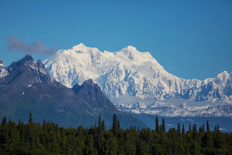
Reaching 20,320 feet (6,194 meters) above sea level in south-central Alaska, Mount McKinley is North America's tallest mountain and the third tallest mountain in the world after Mount Everest in Nepal and Aconcagua in Argentina (note this is based on the measurement from base to peak on land, and not based on elevation). The behemoth has long befuddled geologists because it stands far inland, more than 300 miles (500 kilometers) away from major mountain-building tectonic activity along Alaska's southern coast.
Researchers have assumed that this tectonic activity, driven by the Pacific Plate sinking beneath the North American Plate,somehow accounts for the Central Alaska Range, of which Mount McKinley is a part, but have not been able to fully explain how those coastal tectonics connect to the inland mountain range.
Now, geologists from Brown University and the University of California, Davis have created detailed 3D computer models of the various forces imposed on the mountain by surrounding tectonic activity, and have offered the first numerical explanation for the mountain's location: The models show that the combined effects of the remarkably low angle at which the Pacific Plate sinks under the North American Plate — called flat slab subduction — in addition to an unrelated bend in a geologic fault farther inland, together force land upward into the Central Alaska Range, far inland. The findings appeared earlier this month in the journal Earth and Planetary Science Letters. [In Images: How North America Grew As a Continent]
Latest Videos From
"Although the flat slab does generate deformation in south-central Alaska, the flatslab subduction alone is not enough to generate the Central Alaska Range or Mount McKinley," said Margarete Jadamec, a postdoctoral researcher at Brown University. "Both the flat slab and the Denali fault are required to form the mountain range." (Mount McKinley is known as Denali in a local aboriginal dialect.)
The models — which ran for a total of 17,000 supercomputer hours— not only help clarify the McKinley location question, but also demonstrate the complicated ways in which tectonic plates operate dynamically in three dimensions, rather than as simpler two-dimensional objects that geologists once regarded them as during the 20th century.
While the models do present a good case for why the mountain formed where it did, they do not explain why it is so large. Factors that were not considered in the model — such as glaciers and snow pack that protect the mountain from erosion — likely also contribute to the mountain's great height, Jadamec told LiveScience's OurAmazingPlanet.
Geologists who have worked on the McKinley location problem are pleased by these advancements, which have been in the works for nearly a decade.
"What [the group] has done is unique and absolutely represents a great advancement," said Andy Freed, a geologist at Purdue University in Indiana, who was not involved in the study."[They have] confirmed ideas that have been out there, sorted through existing and competing ideas to say this is the one that makes the most sense now. It's not so much new ideas, but helping us understand which of the prevailing theories is the correct one."
Next, the team behind the new study will use similar models to explain tectonic activity in the Andes, further exploring the dynamic ways in which tectonic plates operate in three dimensions.
Editor's Note: The location of the tectonic activity along Alaska's coast has been updated to state that it occurs along the southern coast.
Follow Laura Poppick on Twitter. Follow OurAmazingPlanet @OAPlanet, Facebook and Google+. Original article at LiveScience's OurAmazingPlanet.

 Live Science Plus