













GPS 'Junk' Data Reveals Volcanic Plumes
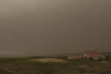
(ISNS) – Scientists may be able to track dangerous ash-filled clouds by using information similar to the bars showing signal strength on a cell phone.
The new technique analyzes the GPS’s “signal strength” -- the intensity of a GPS signal – as it attempts to cut through a volcanic plume. The research was published online in the journal Geophysical Research Letters.
The dangerous particles within these plumes can clog an airplane’s engines and send it plummeting from the sky.
Two years ago this month, Grímsvötn, a volcano in Iceland, erupted, leaving behind a thick column of ash that led to canceled flights all over Europe for days.
The new research uses GPS data to detect these hazardous clouds as they fill the sky. Such early hazard detection could help pilots to avoid areas loaded with deadly ash.
Signal-strength data is logged in the inner workings of the GPS machines. But since it has never been useful to scientists studying how the earth moves during volcanic eruptions, the data has been ignored. In fact, most scientists don’t even upload the information to their computers.
“When I learned GPS, you were supposed to use it to measure where you are,” said Kristine Larson, professor of aerospace engineering at the University of Colorado Boulder and author of the study. “These days, I look for weird things to do with GPS.”
Get the world’s most fascinating discoveries delivered straight to your inbox.
Larson was working with colleagues from the University of Alaska Fairbanks, who set up GPS antennae at Alaska’s Mount Redoubt to measure how terrain shifted during an eruption. Those measurements come from an array of satellites beaming down signals that indicate the exact position of a GPS antenna on earth.
Equipment on the ground automatically stores GPS data on the strength of the signals coming from those orbiting satellites. But Larson is the first to use the information to measure volcanic plumes.
Think of your cell phone, said Larson. “I always hear people talking about how many bars they have,” she said. “That’s basically what I’m using.”
She found that the plume, which was loaded with bits of volcanic ash, somehow blocked the GPS signal coming from satellites in space.
Knowing this, Larson could then track the plume in real time by observing the strength of the GPS signal in a certain area. Once the plume passed, the signal bumped back up to its normal level.
This once-overlooked information may help track plumes when other methods like radar or pictures taken from satellites fall short.
Images taken from space can monitor plumes but “if it’s cloudy you can’t see anything,” said Larson.
Since the GPS signal strength beamed down from orbiting satellites is largely unaffected by clouds and water vapor, Larson can detect only the dangerous ash within a plume.
Radar can spot plumes but the equipment is expensive. “We have many more volcanoes in the world than we have resources to monitor them,” said Larson. “The beauty of GPS is it’s so inexpensive.”
Many scientists already have GPS antennae dispatched at volcanoes all over the world that automatically collect signal strength data.
More research is needed to determine how dense a plume must be to cause a drop in signal strength, said Michael Lisowski, a geophysicist at the U.S. Geological Survey Cascades Volcano Observatory, in Vancouver, Wash.
Signal strength can only be measured if satellites are actively sending signals to the antennae on the ground. Since only about a couple of dozen GPS satellites are in orbit over the earth, there may be times when there is no satellite overhead to connect with an antenna on the ground and no data can be collected on signal strength.
But many countries already have plans to send new GPS satellites into space. “As more satellites systems get launched, it will become a better tool,” said Lisowski.
Larson’s study looked only at two volcanic plumes in Alaska. Plans are in place to test the technique on more volcanoes, she said. “GPS is not the only instrument that is helpful but it’s a new thing that we could add to the list of tools we’re using to make air travel safer.”
Ryder Diaz is a science writer based in Santa Cruz, Calif.
Inside Science News Service is supported by the American Institute of Physics.