It's quick and easy to access Live Science Plus, simply enter your email below. We'll send you a confirmation and sign you up for our daily newsletter, keeping you up to date with the latest science news.
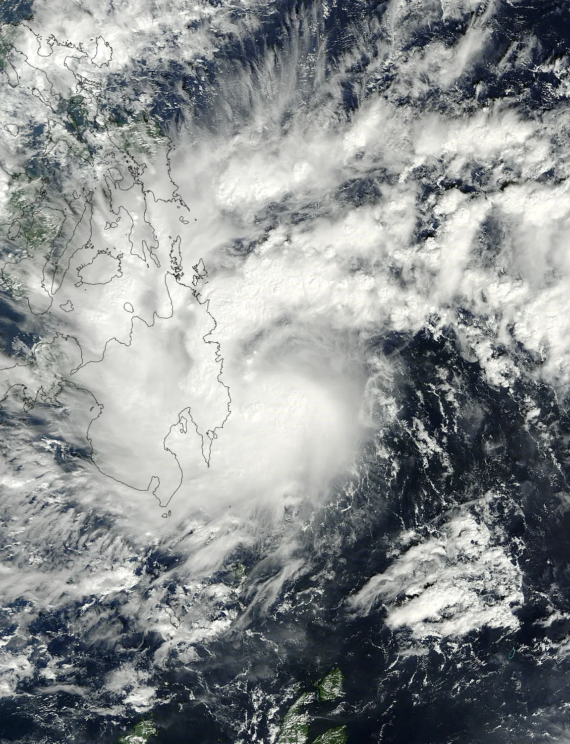
NASA's Terra satellite flew over Tropical Storm Washi on Dec. 16 at 01:45 UTC and captured this visible image of the storm. The western half of Washi was already over Minandao in the southern Philippines.
(Image credit: NASA Goddard MODIS Rapid Response Team.)
Tropical Storm Washi swamped the Philippines with torrential rain this weekend, causing flash floods that killed hundreds and have left hundreds more missing. NASA satellites detected and imaged the heavy rainfall before the storm came ashore.
Washi's tallest thunderstorms reached over 15 km (~9.3 miles) and were located on the northwest side of the storm.
(Image credit: NASA/SSAI, Hal Pierce)
Early Dec. 15 when NASA's Tropical Rainfall Measuring Mission (TRMM) satellite passed over the storm, it detected an area of heavy rainfall in the southwest portion of the storm. By the time the satellite circled back later that day, the heavy rainfall had become more widespread.
TRMM detected rain falling at rates of 2 inches (50 mm) per hour in the east, north and western quadrants of the storm. The rainfall analysis showed that Washi was much better organized than in previous days, with bands of thunderstorms spiraling into the center of the storm.
The typhoon dumped a month's worth of rain in just 12 hours, according to The Los Angeles Times.
TRMM data can be used to create flat, top-down images of storms, which use color coding to show areas of high rainfall. It can also be used to create 3D profiles of storms that show the heights of heavy thunderstorms. In Washi, the tallest thunderstorms reached heights of over-9 miles (15 km).
Light to moderate rainfall fell throughout the storm and there was more heavy rainfall than on the previous day.
(Image credit: SSAI/NASA, Hal Pierce.)
On Dec. 16, NASA's Terra satellite flew over Washi as the storm was already over Mindanao in the southern Philippines. Mindanao is the second-largest and easternmost island of the Philippines.
Mindanao was one of the hardest-hit parts of the country as the torrential rains created flash floods that washed away houses and people.
Sign up for the Live Science daily newsletter now
Get the world’s most fascinating discoveries delivered straight to your inbox.
Illegal logging and mining contributed to the damage, the LA Times quoted officials as saying, because it leaves soil more susceptible to being washed away by rains.
For the science geek in everyone, Live Science offers a fascinating window into the natural and technological world, delivering comprehensive and compelling news and analysis on everything from dinosaur discoveries, archaeological finds and amazing animals to health, innovation and wearable technology. We aim to empower and inspire our readers with the tools needed to understand the world and appreciate its everyday awe.