















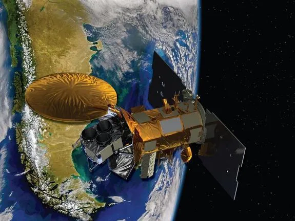
NASA launched a new international satellite mission today (June 10) will measure the ocean's saltiness from hundreds of miles above Earth.
The Aquarius/SAC-D satellite soared into space at 7:20 a.m. PDT (1420 GMT) from Vandenberg Air Force Base in California atop an unmanned Delta 2 rocket. The launch was originally scheduled for Thursday morning, but kinks in the rocket's flight software caused a one-day delay.
Once it settles into orbit, Aquarius will record salt levels in oceans around the world with unprecedented precision for the next three years. This information should help researchers better understand global patterns of precipitation, evaporation and ocean circulation key drivers of Earth's climate.
"In this mission, NASA is really ready to take an important science and technological leap forward," Gary Lagerloef, Aquarius principal investigator at Earth and Space Research in Seattle, said in a prelaunch briefing Tuesday (June 7). [Video: Sea Salt Changes Ripple Around the World]
Mapping the ocean's salt
The $400 million Aquarius mission will scan Earth's oceans continuously from 408 miles (657 kilometers) up, creating a global salinity map every seven days.
NASA has spent $287 million for its portion of the mission, which is a partnership between the U.S. and Argentina space agencies with the countries of Brazil, Canada, France and Italy also participating.
Get the world’s most fascinating discoveries delivered straight to your inbox.
Aquarius is one of eight scientific payloads aboard the SAC-D spacecraft. The other instruments will observe fires and volcanoes, map sea ice and collect a wide range of other environmental data.
The Aquarius instruments are sensitive that the satellite can detect saltiness differences of just two parts per 1,000 the equivalent of one-eighth teaspoon of salt in a gallon of water, researchers said. [Video: With Water Cycle Changes, So Goes Salinity]
Even subtle salinity differences can have a big impact on ocean temperature and circulation, which themselves influence Earth's climate. So mapping out ocean saltiness precisely should help scientists come up with better climate models, researchers said.
The Aquarius/SAC-D mission joins 13 other NASA satellite missions dedicated to studying Earth from above. The satellite is aimed for an orbit about 408 miles (657 kilometers) above Earth.
"The addition of Aquarius to this suite of instruments helps create a more complete picture of our oceans and the impact on the Earth's climate," said Eric Ianson, program executive with NASA's Science Mission Directorate in Washington, D.C.
Good news from the launch pad
Today's successful liftoff must have come as a relief for NASA, which recently lost two Earth-observing satellites to launch failures. In 2009, the $273 million Orbiting Carbon Observatory crashed into the ocean near Antarctica. And in March of this year, the $424 million Glory climate satellite plunged into the Pacific.
Both of those launches used Taurus rockets, provided by the Virginia-based Orbital Sciences Corp. In both cases, the rocket's nose-cone fairing a shell-like covering that protects its satellite payload failed to open as designed.
Those two failures played no part in going with United Launch Alliance for Aquarius/SAC-D. The decision to use a Delta 2 was made about nine years ago, researchers said.
The Aquarius/SAC-D mission is a collaboration between NASA and Argentina's space agency, Comision Nacional de Actividades Espaciales (CONAE). CONAE built SAC-D, which stands for Satélite de Aplicaciones Científicas-D.
Mike Wall is a senior writer for SPACE.com, a sister site of OurAmazingPlanet. You can folllow him on Twitter: @michaeldwall.Follow SPACE.com for the latest in space science and exploration news on Twitter @Spacedotcom and on Facebook.
