Earlier this month, the Panama Canal closed for the third time in its 96-year history, when two artificial lakes linked to the canal, Gatún and Alajuela, reached their highest-recorded water levels.
Authorities closed the canal for 17 hours.
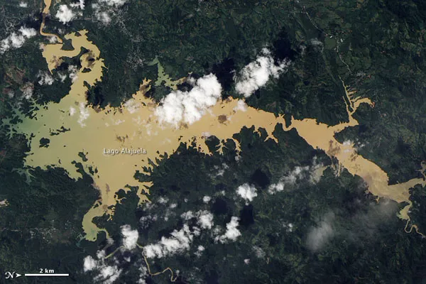
This image was taken on Dec. 17 by NASA's Earth Observing-1 satellite, several days after the canal's temporary closure. The image is of Lago Alajuela, the lake that serves as a reservoir for the Panama Canal , which lies to the southwest.
Latest Videos From
This image has been rotated so north is to the right. The canal lies off the top left corner of the image.
Ranging in color from dull green to tan, Lago Alajuela's waters appear choked with sediment, contrasting sharply with the surrounding green forest. This is most likely due to torrential rains, which can erode soils and deliver heavy sediment loads to streams, rivers and lakes. In Panama this is nothing unusual, as the rainy season lasts from May to January.
Usually the Panama Canal depends on huge quantities of water. Each trip through the canal requires roughly 52 million gallons (197 million liters) of water, but the heavy rains in early December proved to be too much for the region. The same rains that raised Lago Alajuela's water level and filled it with sediment also forced thousands of residents to evacuate, washed out roads, and caused deadly landslides .