














Before-And-After Picture of an Earthquake Zone
This Research in Action article was provided to LiveScience in partnership with the National Science Foundation.
Geologists gain insights into how earthquake faults behave, thanks to a sophisticated tool called LiDAR which stands for "light detection and ranging."
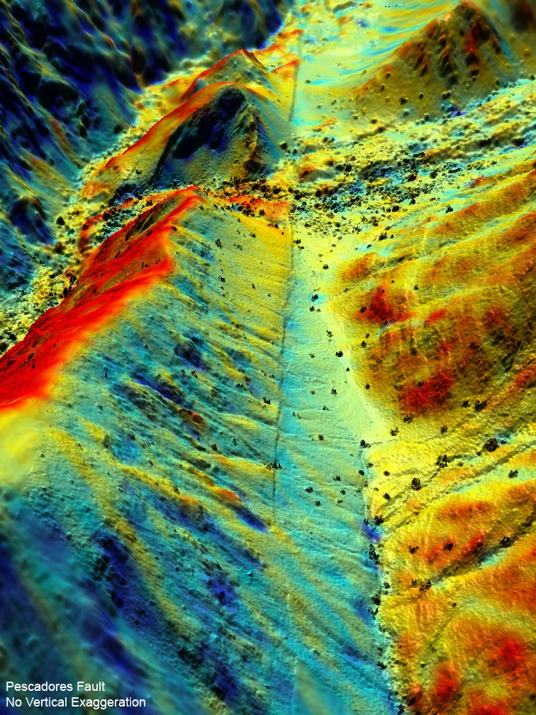
Using LiDAR and data from a magnitude 7.2 event that struck near Mexicali, Mexico, in April 2010, researchers from the United States, Mexico and China developed the most comprehensive pictures ever taken of a fault zone before and after an earthquake.
"We can learn so much about how earthquakes work by studying fresh fault ruptures," study researcher Michael Oskin, a geologist at the University of California, Davis, said.
The team flew over the area with LiDAR equipment, which bounces a stream of laser pulses off the ground. New airborne LiDAR equipment can measure surface features to within a few inches. The researchers were able to make a detailed scan over about 140 square miles in less than three days. Among the areas mapped was Mexico's Pescadores Fault.
In the image above, post-earthquake topography shows the fault making a deep cut along a ridge — a cut that wouldn't have been "visible" without LiDAR.
Read more in 3-D Laser Map Shows Earthquake Zone Before and After.
Get the world’s most fascinating discoveries delivered straight to your inbox.
Editor's Note: Any opinions, findings, and conclusions or recommendations expressed in this material are those of the author and do not necessarily reflect the views of the National Science Foundation. See the Research in Action archive.