In Pictures: Japan Earthquake & Tsunami
Get the world’s most fascinating discoveries delivered straight to your inbox.
You are now subscribed
Your newsletter sign-up was successful
Want to add more newsletters?

Delivered Daily
Daily Newsletter
Sign up for the latest discoveries, groundbreaking research and fascinating breakthroughs that impact you and the wider world direct to your inbox.

Once a week
Life's Little Mysteries
Feed your curiosity with an exclusive mystery every week, solved with science and delivered direct to your inbox before it's seen anywhere else.

Once a week
How It Works
Sign up to our free science & technology newsletter for your weekly fix of fascinating articles, quick quizzes, amazing images, and more

Delivered daily
Space.com Newsletter
Breaking space news, the latest updates on rocket launches, skywatching events and more!

Once a month
Watch This Space
Sign up to our monthly entertainment newsletter to keep up with all our coverage of the latest sci-fi and space movies, tv shows, games and books.

Once a week
Night Sky This Week
Discover this week's must-see night sky events, moon phases, and stunning astrophotos. Sign up for our skywatching newsletter and explore the universe with us!
Join the club
Get full access to premium articles, exclusive features and a growing list of member rewards.
After Tsunami: Ishinomaki
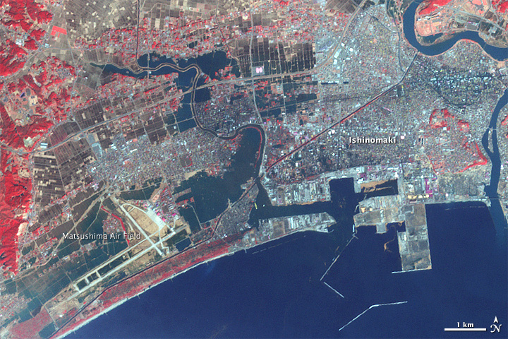
The Japanese city of Ishinomaki was one of the hardest hit when a powerful tsunami swept ashore on March 11, 2011. Here, an image taken from NASA's Terra satellite three days later, on March 14, shows water (dark blue) still inundates the city. (Red indicates plant cover.)
Before Tsunami: Ishinomaki
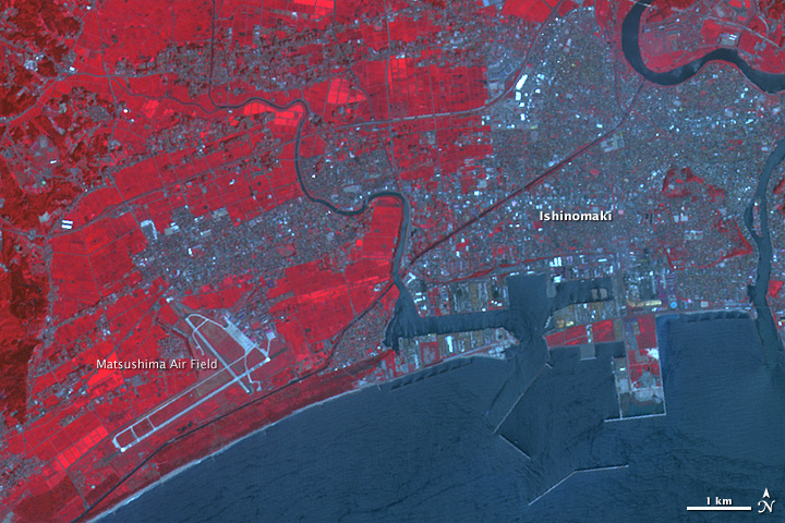
A NASA satellite image shows Ishinomaki, a Japanese city hit hard by the March 11 tsunami, before the disaster, on Aug. 8, 2008. Here, water levels (dark blue) are at their normal levels, and plant cover (red) is spread across large swaths of the city.
Tsunami Coastal Damage
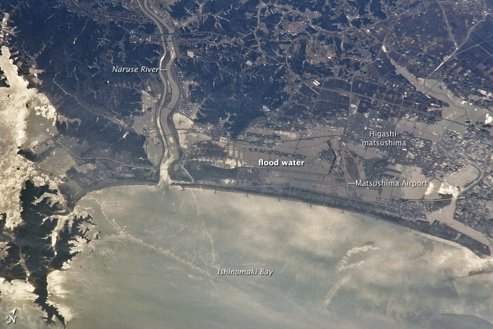
On March 13, 2011, floodwaters lingered along the Japanese coast near the city of Sendai, in the aftermath of a 9.0-magnitude earthquake. An Expedition 26 crew member took this photograph from an altitude of 220 miles (350 km) above ground.
Both agricultural fields and settled areas are shown submerged by muddy water. The earthquake caused severe damage to oil refineries, some of which caught fire. In the aftermath of the oil-refinery damage, oil floated on the surface of Ishinomaki Bay, with oil slicks highlighted here by the sunglint, or the mirror-like of the sun on the ocean surface.
Stuck Albatross
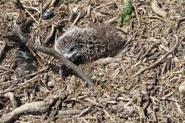
A Laysan albatross chick that was found stuck in tsunami debris.
Injured Albatross
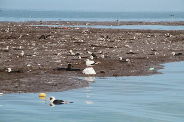
Injured birds rest on a floating island of debris in the lagoon at Midway Atoll, after the 9.0-magnitude earthquake and tsunami struck northeastern Japan.
Tsunami Cleanup
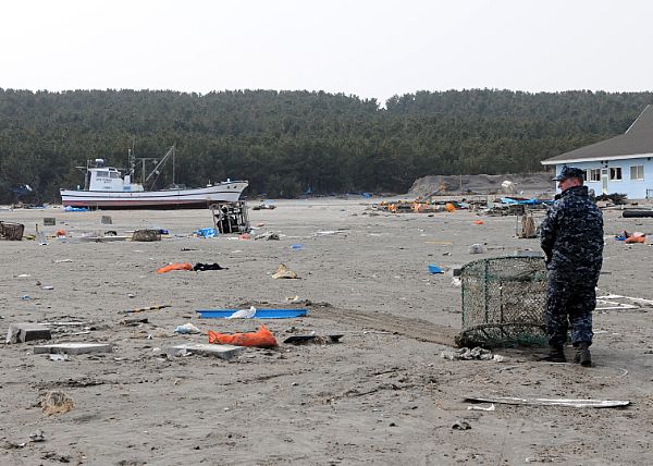
A sailor assigned to Naval Air Facility Misawa hauls debris during a cleanup effort at the Misawa Fishing Port, located in the eastern Aomori Prefecture in the T?hoku region of northeastern Japan. More than 90 sailors from Naval Air Facility Misawa volunteered to help Misawa City employees and members of the community begin to clean up after the 9.0-magnitude earthquake and tsunami struck the area.
Get the world’s most fascinating discoveries delivered straight to your inbox.
Dogs in Japan

Staff Sgt. Travis Lausier, right, and Spc. Jason Hayes, both assigned to the Japan District Veterinary Command, Misawa Branch,draw blood from "Lago," while his handler, Tim Dinges, comforts him. Dinges and Lago are with Virginia Task Force 1 of the Fairfax County Fire and Rescue Department, and arrived at Naval Air Facility Misawa to take part in search and rescue efforts in Sendai, Japan.
After: Kitakami River
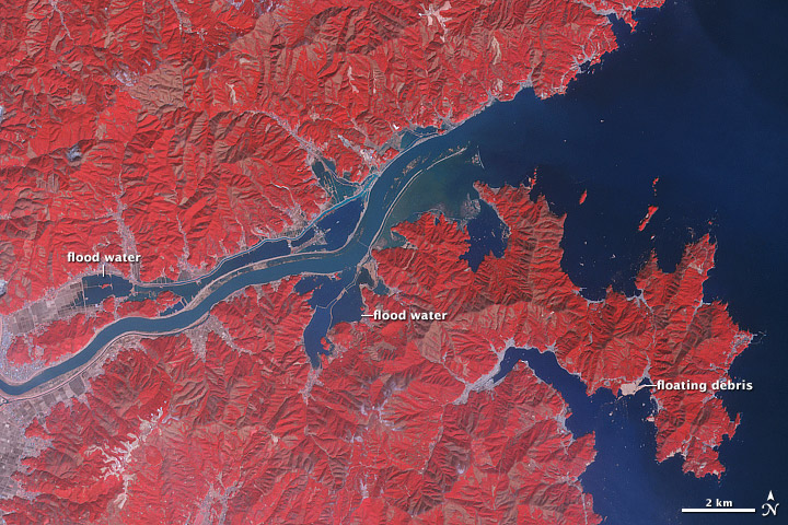
In the wake of the magnitude 9.0 earthquake and resulting tsunami that struck northeastern Japan in March 2011, ocean waters flooded croplands and settlements lining the Kitakami River. The Advanced Spaceborne Thermal Emission and Reflection Radiometer (ASTER) on NASA's Terra satellite captured false-color images before and after the tsunami.
In this image, captured on March 14, 2011, you can see water (blue) has spilled over the banks both north and south of the river. Although agricultural fields appear to have escaped the flooding farther inland (image left), some fields closer to the ocean have seemingly disappeared into the sea. North of the Kitakami, floodwaters extend far enough inland to create what looks like a parallel river. Near the coast, only the rugged peaks rising above the floodplains have escaped inundation. (Fallow fields appear in shades of beige and brown. Vegetation is red, and the brighter the red, the more robust the vegetation.)
Before: Kitakami River
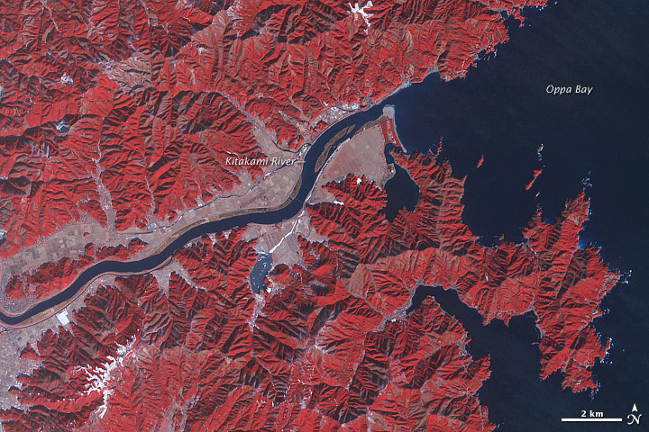
This satellite image taken from an instrument aboard NASA's Terra satellite captured the Kitakami River and surrounding area on Jan. 16, 2011, before the earthquake and tsunami struck northeastern Japan. (Blue represents water; vegetation in red; and beige and brown for fallow fields.)
Before and After: Torinoumi
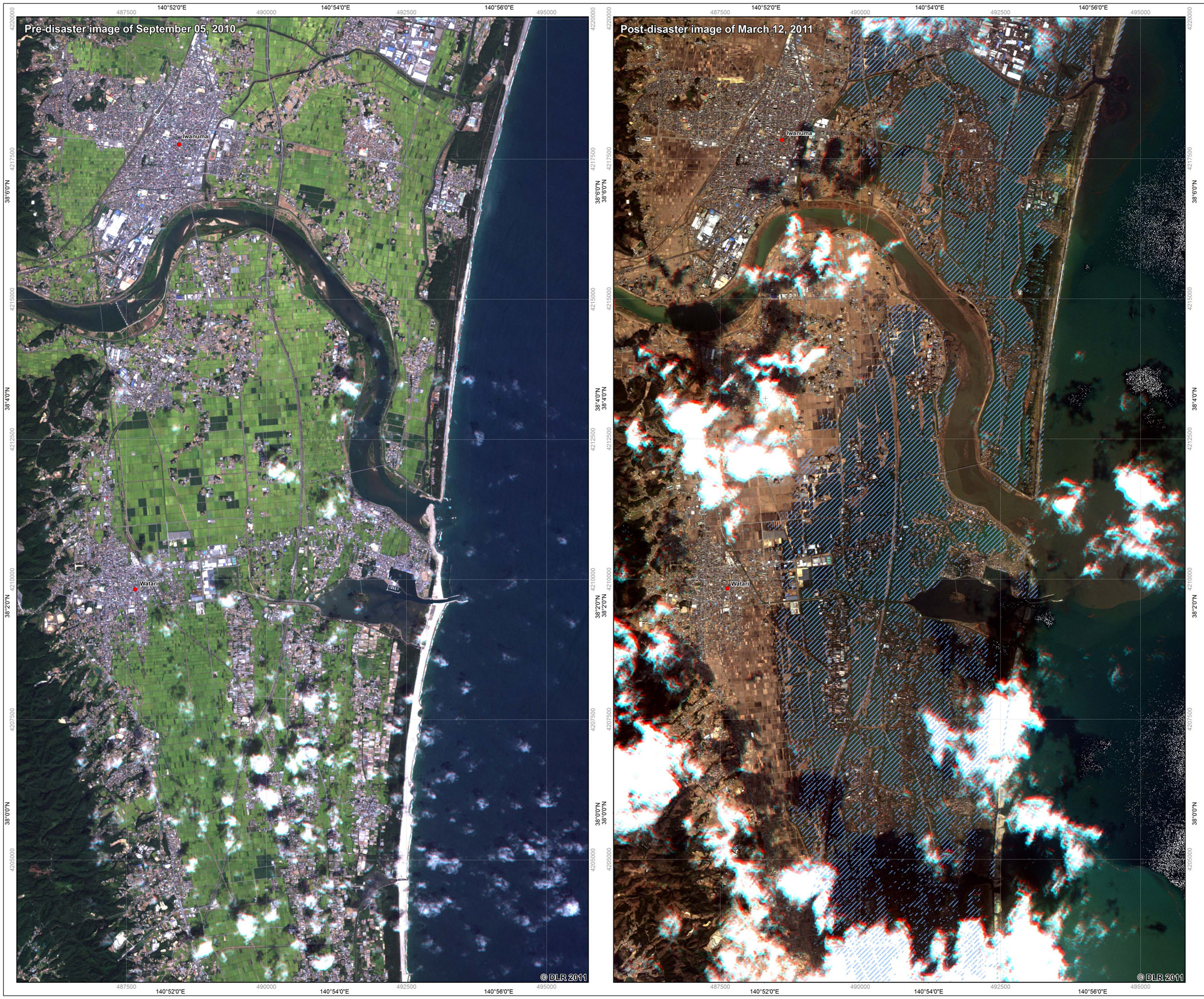
These images were acquired by the German Optical RapidEye and radar TerraSAR-X satellites. They show Torinoumi on the eastern coast of Japan before the disaster on Sept. 5 2010 and after the tsunami on March 12, 2011. The German Aerospace Center, DLR, is responding to the disaster through its Center for Satellite Based Crisis Information to provide information for the International Charter.
Jeanna Bryner is managing editor of Scientific American. Previously she was editor in chief of Live Science and, prior to that, an editor at Scholastic's Science World magazine. Bryner has an English degree from Salisbury University, a master's degree in biogeochemistry and environmental sciences from the University of Maryland and a graduate science journalism degree from New York University. She has worked as a biologist in Florida, where she monitored wetlands and did field surveys for endangered species, including the gorgeous Florida Scrub Jay. She also received an ocean sciences journalism fellowship from the Woods Hole Oceanographic Institution. She is a firm believer that science is for everyone and that just about everything can be viewed through the lens of science.
 Live Science Plus


