Iceland Volcano Plume Captured in Satellite Image

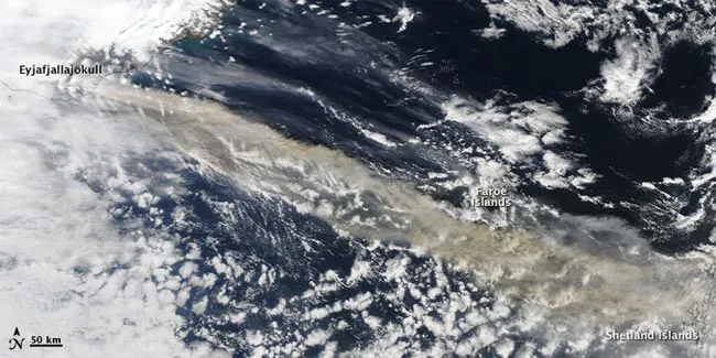
A NASA satellite captured this image of the plume from Iceland's Eyjafjallajökull Volcano on April 15, 2010. (Image credit: NASA image by Jeff Schmaltz, MODIS Rapid Response Team at NASA GSFC.)

As the huge plume of ash and steam from Iceland's Eyjafjallajökull volcano blew east-southeast, threatening to ground aircraft along its track, a NASA satellite captured the cloud in action.

The

Live Science Staff
For the science geek in everyone, Live Science offers a fascinating window into the natural and technological world, delivering comprehensive and compelling news and analysis on everything from dinosaur discoveries, archaeological finds and amazing animals to health, innovation and wearable technology. We aim to empower and inspire our readers with the tools needed to understand the world and appreciate its everyday awe.