
 Live Science Plus


Super Cyclonic Storm Phailin: The Strongest Cyclone Ever in the North Indian Ocean Basin (Op-Ed)
This article was originally published at The Conversation. The publication contributed the article to LiveScience's Expert Voices: Op-Ed & Insights.
Phailin (the Thai word for sapphire) is officially the strongest tropical cyclone ever recorded to make landfall over India.
Phailin had begun as a tropical storm with 105kph (65mph) winds, but rapidly intensified on October 10 2013 to 250kph (155mph). It was upgraded to a super cyclonic storm, which is equivalent to Category 5 in the Saffir-Simpson Scale for the North Western Atlantic Ocean (NWA) Basin.

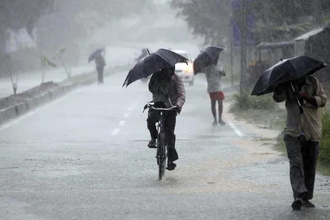
A combination of exceptionally warm water (28C) and low wind-shear (4-8kps/2.5-5mps) over the Bay of Bengal provided the ideal conditions for cyclone Phailin to maintain its strength. Moving north-westward, it made landfall over the coastal areas between Odisha and Andhra Pradesh on Saturday October 12.
Cyclone disaster management in India
Much of India’s current approach to preparation was developed during the 1999 cyclone in Odisha. Disaster preparations mainly include cyclone warning and evacuation.
To mitigate a potential disaster from Phailin, the Indian central and state governments have shown huge improvements in disaster preparation.
The Odisha chief minister Naveen Patnaik sought defence forces' help in preparing to tackle the cyclone. State disaster status was enacted, and the National Disaster Rapid Action Force (NDRAF) and Odisha Disaster Rapid Action Force (ODRAF) were put in force. Puja holiday celebrations were cancelled and a large scale evacuation undertaken. More than 260,000 people were moved to high ground and half a million to shelter.
Get the world’s most fascinating discoveries delivered straight to your inbox.
However there was some confusion during the process of early warning. India has no aircraft reconnaissance comparable to the “hurricane hunters” we have in the North Western Atlantic, so the Indian Meteorological Department (IMD) seemed to underestimate the cyclone wind speed at 80kph (50mph) and storm surge at 1m (3ft). These were far less than the Joint Warning Typhoon Center’s (JTWC) estimation of wind speeds at 177-185kph (110-115mph), meaning also that a 1m storm surge was unlikely to be true.
This discrepancy in predictions could cause distrust of the official forecast and delay in the process of evacuation.
Will Cyclone Phailin be a natural disaster?
Phailin made landfall about 160km southwest of where the 1999 Odisha cyclone hit. The storm surge was predicted to be 11 meters high.
Though the area where Phailin made landfall is not low-lying, the convergent coastline and the shallow offshore waters around Ganjam, Khurda, Puri and Jagatsinghpur can amplify the impounding water which could cause huge flooding.
These areas are particularly vulnerable to flooding due to poor drainage and soil already saturated by the active summer monsoon. At its landfall, Phailin brings in a rainfall depth of 200-400mm along the coastal areas.
The death toll should be lower than the approximately 10,000 killed by cyclone Odisha in 1999. However, the financial losses could be huge.
With high population density, the exposure to risk is high. The low- and mid-rise buildings in rural areas were traditionally built of bricks and other primitive materials, so their roofs and walls could be completely blown away or partially collapsed under the pressure difference caused by gale force winds on the windward and leeward sides of the buildings. Modern high rise buildings in urban areas use confined masonry and stricter building code enforcement.
The insured losses due to stopping cargo operations, train cancellation and loss of lives and property could be billions.
Are cyclones in the North Indian Ocean becoming more active?
On average only 7% of world’s cyclones are formed over the Indian Ocean Basin. It is the quietest ocean basin for spawning cyclones in the world.
But Phailin is the second tropical cyclone over North Indian Ocean in 2013, and 26 of the 35 deadliest cyclones in world history have been Bay of Bengal storms.
Super-cyclone Phailin was huge in diameter (about 500km), with a central pressure of 918mb and maximum sustained wind of 258kph: it is the strongest over the North Indian Ocean basin in recorded history.
Super-typhoon Usagi, the strongest typhoon over the North Western Pacific Ocean Basin during 2013, affected 3.5 million people, and killed at least 25. It caused more than $500 million losses in China alone.
Some will ask if global warming is causing more intense tropical cyclones. Recent research showed that severe cyclones have become more frequent in the North Indian Ocean during the intense cyclone period of the year (May, October and November). The rate of intensification of tropical disturbances to severe cyclone stage has shown an upward trend.
However there is a slight decline of annual cyclone numbers. Number of cyclones is related more to El Niño phenomena (2-5 year oscillation) than to global warming. The North Western Atlantic Ocean has had a relatively quiet hurricane season, so far, in 2013. Globally we still have roughly similar annual number of tropical cyclones to average.
Norman Cheung does not work for, consult to, own shares in or receive funding from any company or organisation that would benefit from this article, and has no relevant affiliations.
This article was originally published at The Conversation. Read the original article. The views expressed are those of the author and do not necessarily reflect the views of the publisher. This version of the article was originally published on LiveScience.