Colorado Flood Photos: 100-Year Storm
Get the world’s most fascinating discoveries delivered straight to your inbox.
You are now subscribed
Your newsletter sign-up was successful
Want to add more newsletters?
Delivered Daily
Daily Newsletter
Sign up for the latest discoveries, groundbreaking research and fascinating breakthroughs that impact you and the wider world direct to your inbox.
Once a week
Life's Little Mysteries
Feed your curiosity with an exclusive mystery every week, solved with science and delivered direct to your inbox before it's seen anywhere else.
Once a week
How It Works
Sign up to our free science & technology newsletter for your weekly fix of fascinating articles, quick quizzes, amazing images, and more
Delivered daily
Space.com Newsletter
Breaking space news, the latest updates on rocket launches, skywatching events and more!
Once a month
Watch This Space
Sign up to our monthly entertainment newsletter to keep up with all our coverage of the latest sci-fi and space movies, tv shows, games and books.
Once a week
Night Sky This Week
Discover this week's must-see night sky events, moon phases, and stunning astrophotos. Sign up for our skywatching newsletter and explore the universe with us!
Join the club
Get full access to premium articles, exclusive features and a growing list of member rewards.
Obvious flood path
Flood waters have been receding along the South Platte River near Greeley, Colo., after the 100-year flooding event in the area in mid-September 2013, but the muddy brown waters could still be seen beyond the normal banks of the waterway when the the Operational Land Imager (OLI) on the Landsat 8 satellite snapped an image of the region on Sept. 17. "The image shows that the flood has washed away roads, including sections of U.S. Highway 34," according to NASA's Earth Observatory.
Piles of debris
Mud and debris clog a pedestrian underpass near Boulder Creek in Colorado on Sept. 14, 2013, as photographed by local resident Bonnie Sizer.
No biking here
A bike/pedestrian path along Bear Creek in south Boulder — normally a placid thoroughfare — is engulfed by flood waters on Thursday afternoon, September 12.
Lots 'o rain
Rainfall amounts for the seven days ending at noon MDT on Friday, September 13, ranged from 5 to 10-plus inches across large swaths of the Colorado Front Range, with similar amounts eastward into northwest Kansas.
Not a day for bench sitting
Not the day for bench-sitting: a scene along swollen Boulder Creek on September 12.
Measuring the damages
Matt Kelsch, a hydrometeorologist in UCAR’s Community Programs who volunteers with NOAA’s cooperative weather observing program, measures the historic daily total of 9.08 inches at Boulder’s official station on September 12.
Flood warnings for Colorado
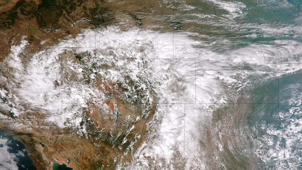
This image from the Suomi NPP satellite's VIIRS sensor from the evening of September 11, 2013, shows the storm system that has devastated towns in the foothills of the Rockies in central Colorado.
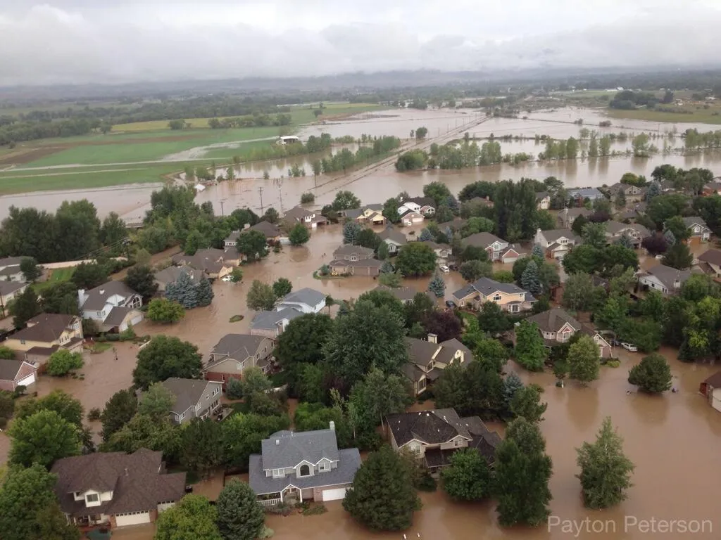
Get the world’s most fascinating discoveries delivered straight to your inbox.
Major flooding
An aerial picture taken flying over Mt. View in Longmont, Colo., after torrential rains caused major flooding in the area.
More flooding in Colorado
Another aerial photo taken over Longmont, Colo., which shows the area between 9th and Mt. View.
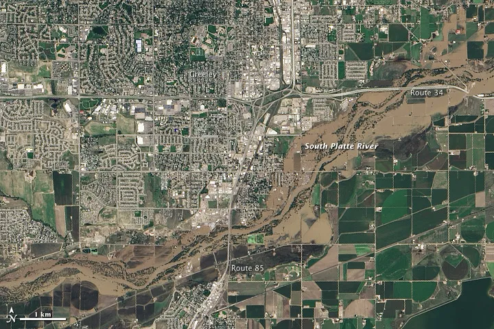
Flooding areas
A flooded picnic area in Longmont, CO.
Rising waters
The water was rising higher by the minute.

