
Tien Shan mountains, China

Almost half the world's population gets its water from glaciers and rainfall in Asia's highest mountains and deserts. Geologist Aaron Putnam of Columbia University's Lamont-Doherty Earth Observatory, his father David Putnam, an archaeologist at the University of Maine at Presque Isle, and their colleagues recently visited some of these areas on study expeditions, snapping these striking photos.Above: Looking north toward the high Tien Shan mountains of western China. At center is the highest peak in the Tien Shan: Tomur peak (or Jengish Chokusu in Khirgiz).
Mountains in Bhutan

Snow on high peaks above Thampe Chhu, Bhutan.
Boulder sampling

Tshewang Rigzin (Department of Hydromet Services, Royal Government of Bhutan) and guides sampling boulder on moraine.
Weather station

Tshewang Rigzin (Department of Hydromet Services, Royal Government of Bhutan) and Aaron Putnam (Columbia) tinkering with a weather station.
Glacier, Bhutan

Prof. Summer Rupper (Brigham Young University) and colleagues descending Drukso Gangri after emplacing stakes that would monitor melt over the following year.
Glacier, Bhutan

Drukso Gangri ('Dragon-Tooth Glacier'), Bhutan.
Himalayan plateau
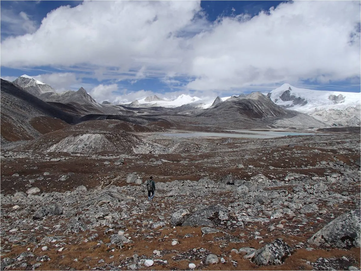
Rinchen Zoe plateau, Bhutan Himalaya.
Himalayan Blue Sheep

Himalayan Bharal ('Blue Sheep') on high cliffs near Tampe La.
Mountain camp

Camp beneath the high mountain pass of Tampe La.
Yak herders

Nomadic yak herders in the Nikka Chhu valley, Bhutan.
Himalayas

Looking north toward the spine of the Himalaya, featuring the high peaks of Makalu (right) and Everest (left).
Taklamakan Desert

Blowing sand in the Taklamakan.
Dry lake bed

Ancient lake bed of Lop Nor.
Tree cutting

Cookie cut from an ancient 'sub-fossil' poplar discovered deep in the Taklamakan Desert.
Desert poplars

David Putnam describing ancient poplars rooted in waterlain sediment surfaces in the Taklamakan Desert.
Desert sediments

Aaron Putnam investigating sediments that indicate the presence of water in the Taklamakan Desert.
Ancient shells

Shells associated with ancient, now-dry riverbeds in the Taklamakan Desert, south of the Tarim River.
Ancient sediments

Ancient waterlain sediments littered with wood being exposed from beneath migrating sand dunes.
Mud cracks

Ancient mud cracks on the surface of waterlain sediments in the Taklamakan Desert show that wet conditions prevailed in the past.
Desert dunes

Sand dunes in the Taklamakan Desert.
Map of the world

Red dots indicate the locations of our field sites where Putnam and colleagues are investigating past climate and glaciers.

