Lost city, a real-life 'Helm's Deep,' possibly discovered in Iraq
The ancient stronghold is believed to be part of the lost city of Natounia.
Get the world’s most fascinating discoveries delivered straight to your inbox.
You are now subscribed
Your newsletter sign-up was successful
Want to add more newsletters?

Delivered Daily
Daily Newsletter
Sign up for the latest discoveries, groundbreaking research and fascinating breakthroughs that impact you and the wider world direct to your inbox.

Once a week
Life's Little Mysteries
Feed your curiosity with an exclusive mystery every week, solved with science and delivered direct to your inbox before it's seen anywhere else.

Once a week
How It Works
Sign up to our free science & technology newsletter for your weekly fix of fascinating articles, quick quizzes, amazing images, and more

Delivered daily
Space.com Newsletter
Breaking space news, the latest updates on rocket launches, skywatching events and more!

Once a month
Watch This Space
Sign up to our monthly entertainment newsletter to keep up with all our coverage of the latest sci-fi and space movies, tv shows, games and books.

Once a week
Night Sky This Week
Discover this week's must-see night sky events, moon phases, and stunning astrophotos. Sign up for our skywatching newsletter and explore the universe with us!
Join the club
Get full access to premium articles, exclusive features and a growing list of member rewards.
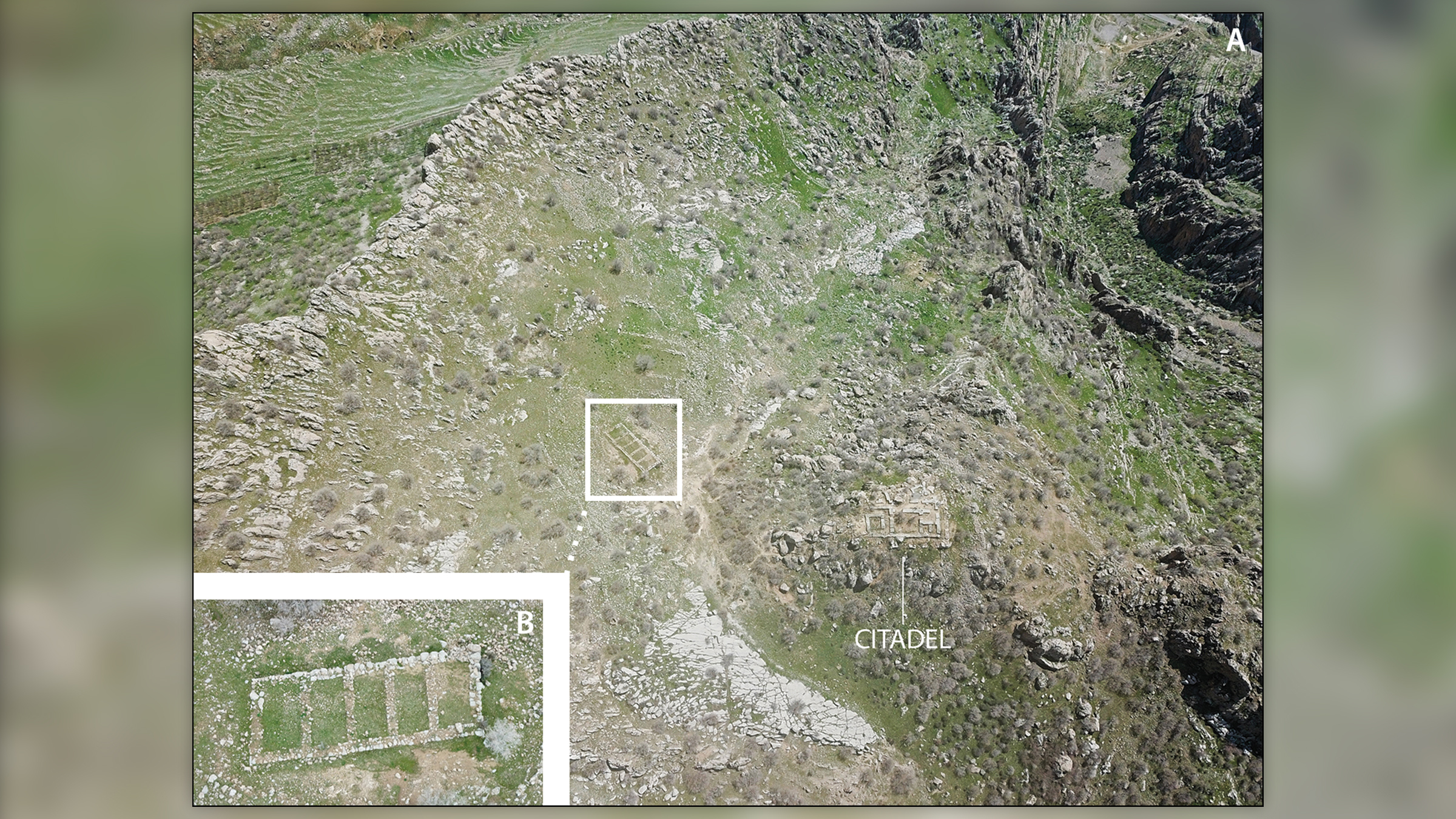
Nestled in a valley shadowed by mountains in Iraqi Kurdistan sits an ancient fortress that archeologists think may be the lost, royal city of Natounia, based on the discovery of intricately carved rock reliefs depicting an ancient leader, a new study finds.
The stronghold, known as Rabana-Merquly, was once part of the Parthian Empire (also known as the Arsacid Empire), which reigned between 247 B.C. and A.D. 224. The Parthians were bitter enemies of the Roman Empire, and fought various battles against them for over 250 years. Now, new research at this 2,000-year-old fortress suggests that it served as one of the empire's regional centers.
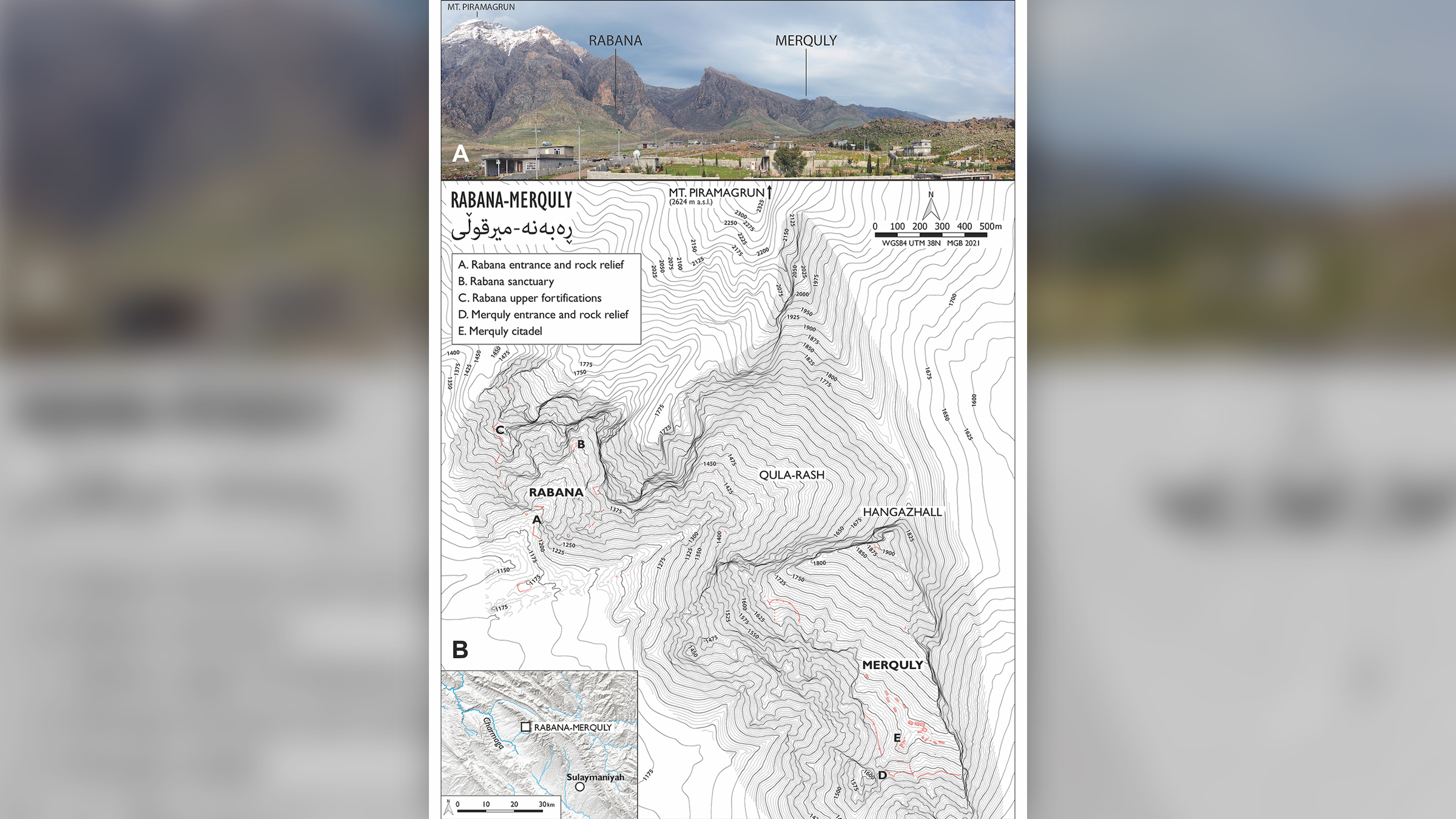
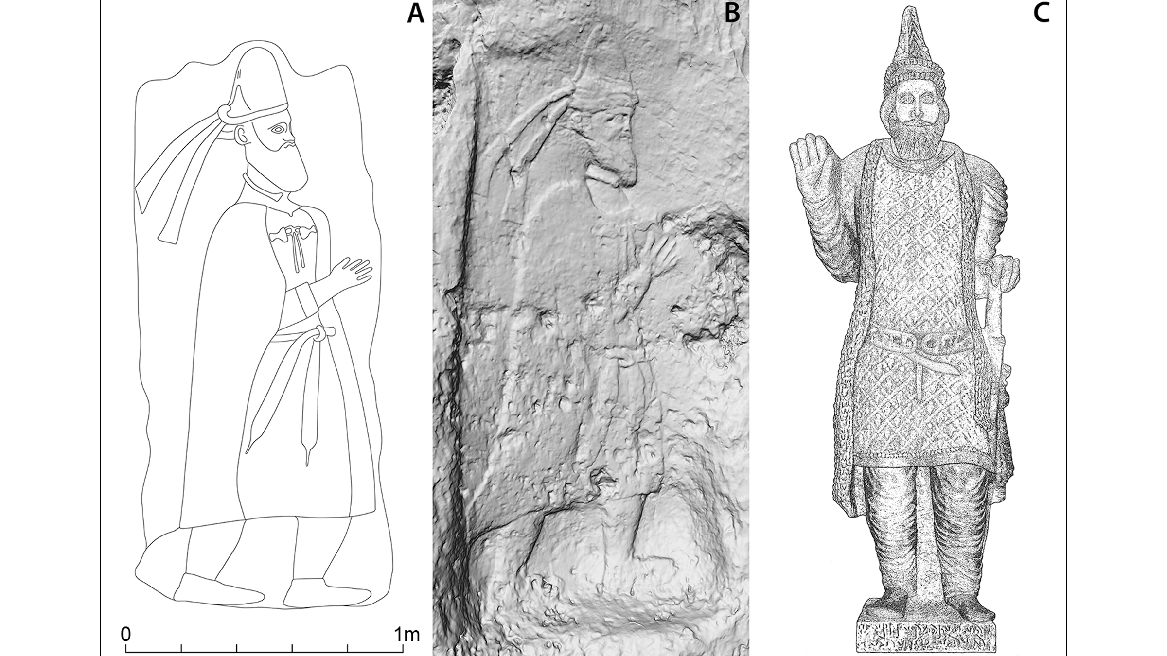
During a recent expedition, an international team of archeologists discovered twin rock reliefs at the two entrances to the settlement, which is situated at the base of Mount Piramagrun in the Zagros Mountains. The matching reliefs are said to depict a king of Adiabene, a kingdom that was part of the Parthian Empire, according to researchers.
"Based on the dress of the figure, in particular his hat, we think that the fortress was built by the ruling dynasty of Adiabene close to the kingdom's eastern border," study lead researcher Michael Brown, a researcher at the Institute of Prehistory, Protohistory and Near-Eastern Archaeology of Heidelberg University in Germany, told Live Science in an email. "The twin rock reliefs are rare examples of near life-size monuments of rulers from the Parthian period, and they allow us to link the fortress with those who built it."
He added, "Both reliefs are located immediately next to the two gated entrances and were clearly designed to make a political statement — they can be characterized as ancient propaganda."
Related: Lost palace of a once-mighty empire unearthed in Iraq
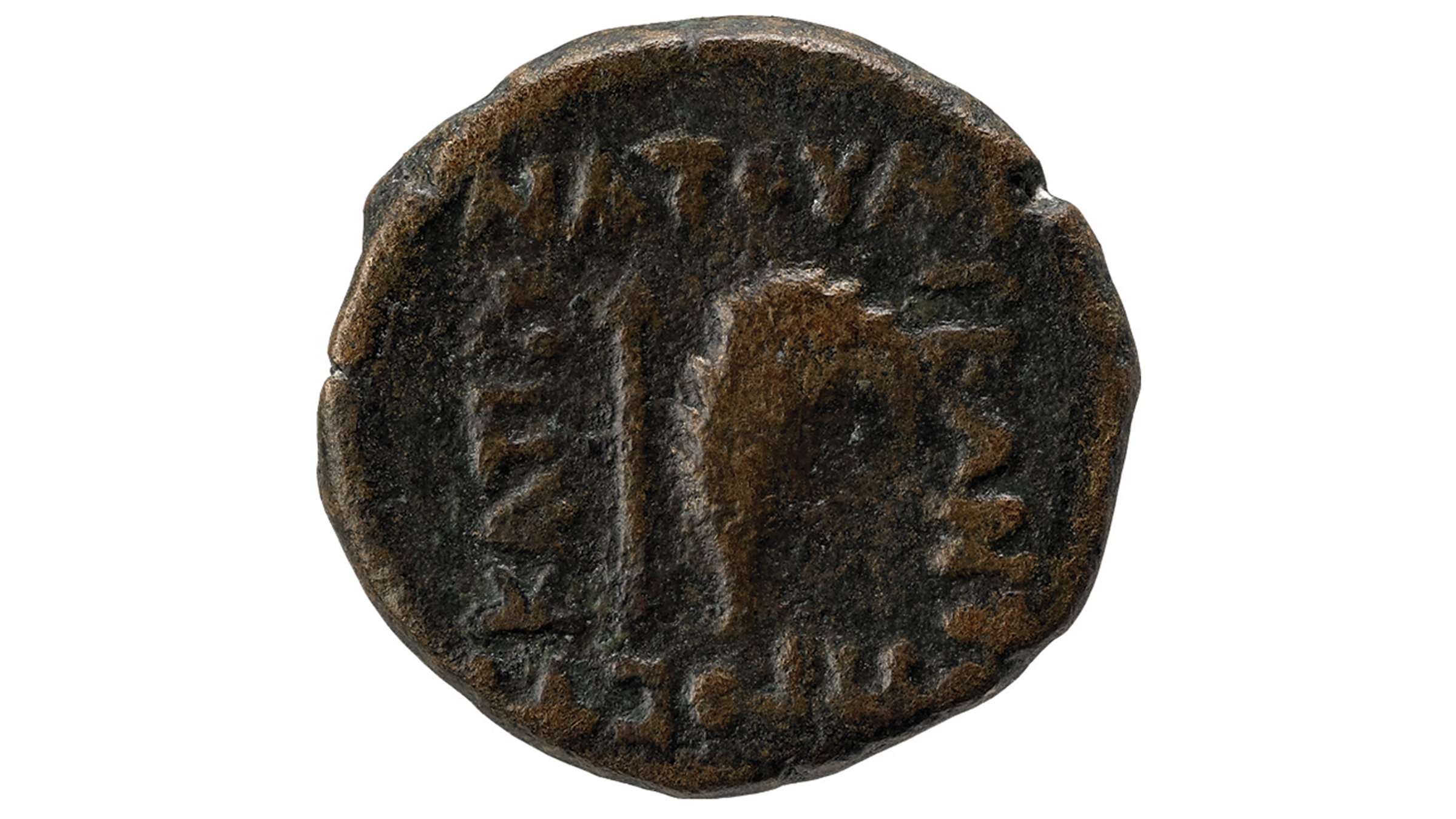
Prior to this find, the only known depictions of the existence of Natounia (also known as Natounissarokerta), have been documented on several coins dating from the first century B.C., according to a statement.
Get the world’s most fascinating discoveries delivered straight to your inbox.
"The more specific association with the city of Natounia comes from the inscription on that city's rare coins found elsewhere, which locate it 'on the Kapros,' which is the modern Lower Zab River," Brown said. For this reason, the city was sometimes called Natounia on the Kapros.
In addition to the reliefs, which possibly depict Natounissar, the city's founder, or a direct descendant, researchers used drones to explore fortifications that measure approximately 2.5 miles (4 kilometers) along with two nearby settlements, Rabana and Merquly, of which the site is named.
"Rabana-Merquly is by far the largest and most impressive site of the Parthian era in the region, and the only one with royal iconography, so it's by far the best candidate [for being Natounia]," Brown said. "Its fortifications enclose naturally defensible terrain and can be viewed as an extension of the surrounding highland landscape. If you're familiar with Lord of the Rings, it's basically a real-life Helm's Deep."
During its reign, the Parthian Empire played a formative role in the development of Eurasian globalization through its complex relations with Rome, India and Han China. "The fortress very likely played an important role in managing these relations through trade and diplomacy, as well as through military force," he said.
However, it appears that the Parthians abandoned the fortress relatively soon after it was built. "Most of the architecture is single phase (i.e. not much rebuilding) so we think the fortress wasn't used for very long during its main Parthian era occupation. Probably a span of no more than 100 years," Brown said.
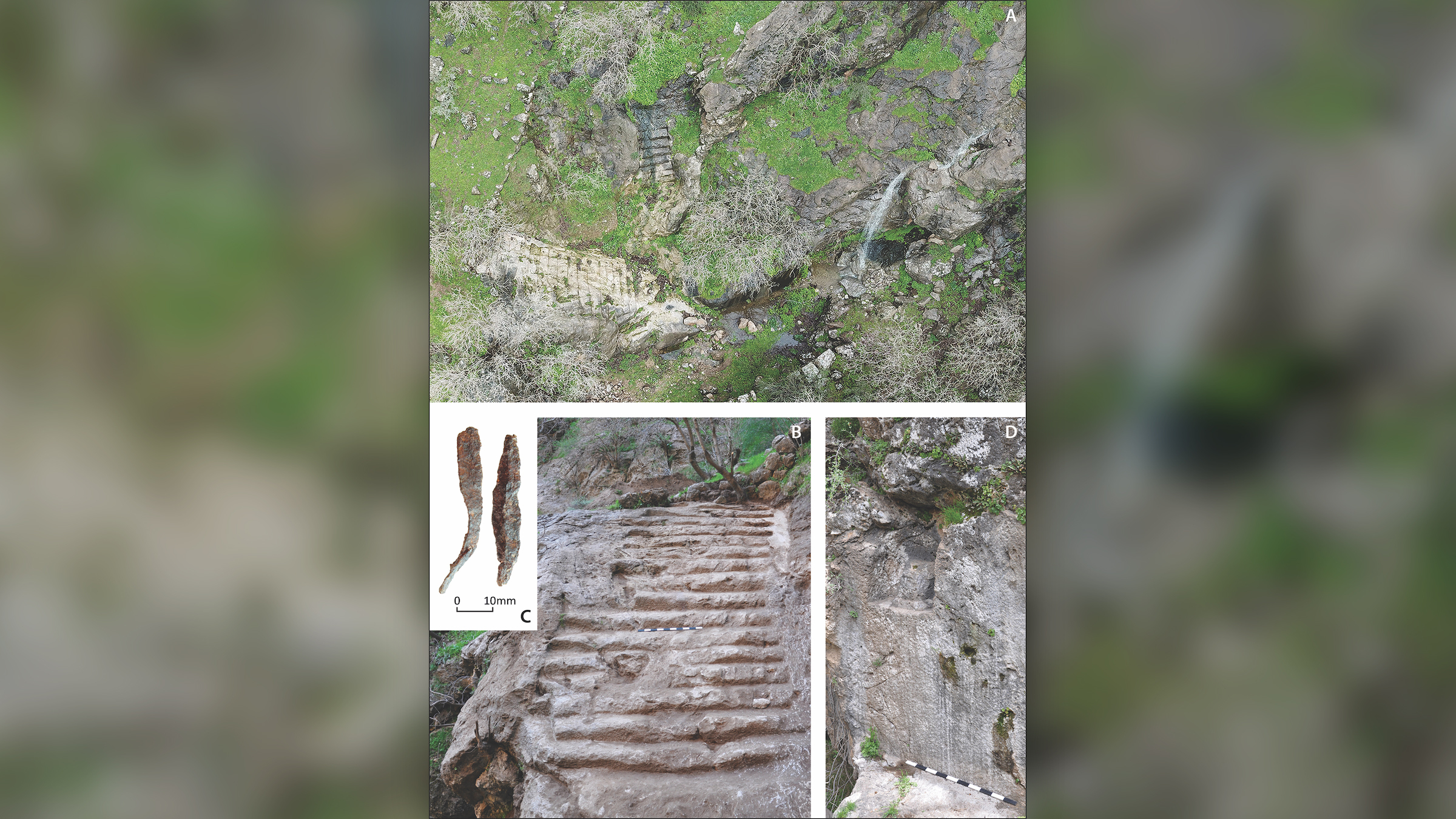
While on site, Brown and his team also found a large waterfall in the valley, which he calls a "seasonal phenomena," since it appears only following a heavy rain.
"It could have held religious significance to Rabana's Parthian-era occupants," he said. "A plausible association can be made in this regard with the Iranian water-goddess Anahita. A small rock-cut altar nearby, most probably for fire, supports the religious interpretation."
The findings will be published online Wednesday (July 20) in the journal Antiquity.
Originally published on Live Science.
Jennifer Nalewicki is former Live Science staff writer and Salt Lake City-based journalist whose work has been featured in The New York Times, Smithsonian Magazine, Scientific American, Popular Mechanics and more. She covers several science topics from planet Earth to paleontology and archaeology to health and culture. Prior to freelancing, Jennifer held an Editor role at Time Inc. Jennifer has a bachelor's degree in Journalism from The University of Texas at Austin.
 Live Science Plus


