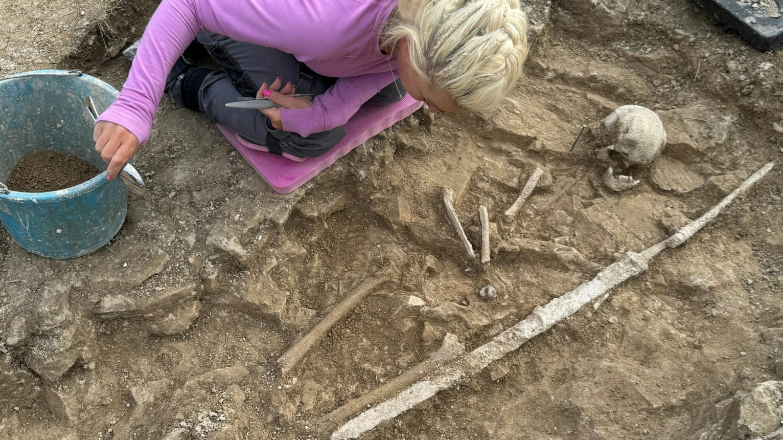
Photos: Circular Geoglyphs Discovered in Peru's Sihuas Valley
Get the world’s most fascinating discoveries delivered straight to your inbox.
You are now subscribed
Your newsletter sign-up was successful
Want to add more newsletters?

Delivered Daily
Daily Newsletter
Sign up for the latest discoveries, groundbreaking research and fascinating breakthroughs that impact you and the wider world direct to your inbox.

Once a week
Life's Little Mysteries
Feed your curiosity with an exclusive mystery every week, solved with science and delivered direct to your inbox before it's seen anywhere else.

Once a week
How It Works
Sign up to our free science & technology newsletter for your weekly fix of fascinating articles, quick quizzes, amazing images, and more

Delivered daily
Space.com Newsletter
Breaking space news, the latest updates on rocket launches, skywatching events and more!

Once a month
Watch This Space
Sign up to our monthly entertainment newsletter to keep up with all our coverage of the latest sci-fi and space movies, tv shows, games and books.

Once a week
Night Sky This Week
Discover this week's must-see night sky events, moon phases, and stunning astrophotos. Sign up for our skywatching newsletter and explore the universe with us!
Join the club
Get full access to premium articles, exclusive features and a growing list of member rewards.
Mystery Circles

These mysterious circles are etched into the desert of southern Peru. Dating back to between A.D. 200 and 1400, the circles are closely associated with walking paths used to carry goods around the region, researchers report Oct. 26 in the journal Antiquity. [Read more about the Peru geoglyphs]
Southern Peru
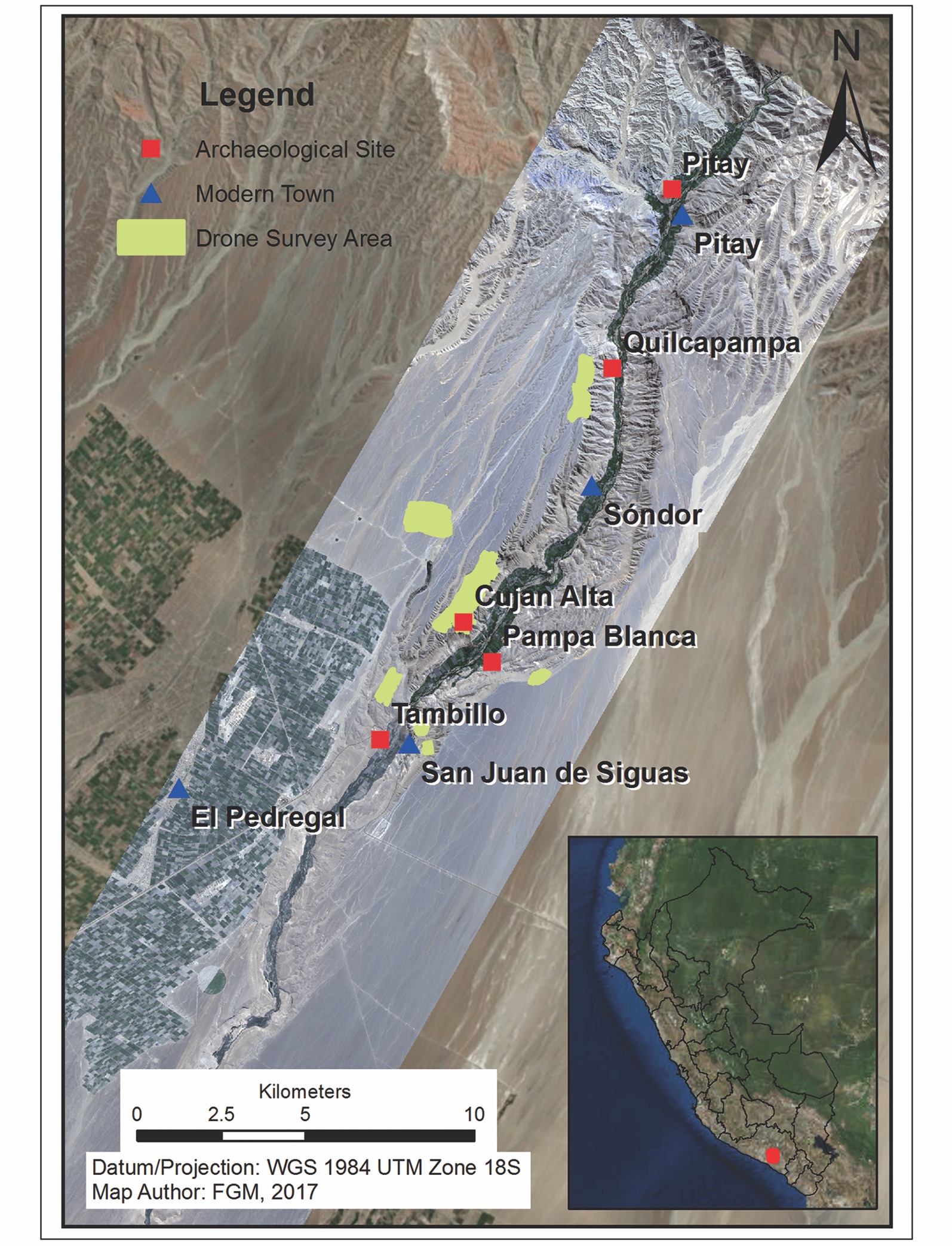
A map showing the Sihuas Valley in southern Peru. Here, modern villages (blue triangles) abut archaeological sites (red squares) dating back to before the Spanish arrived in the New World. To map the subtle ancient footpaths and geoglyphs of this pre-Colonial world, researchers used fieldwork, satellites and aerial drone surveys.
Cujan Alta
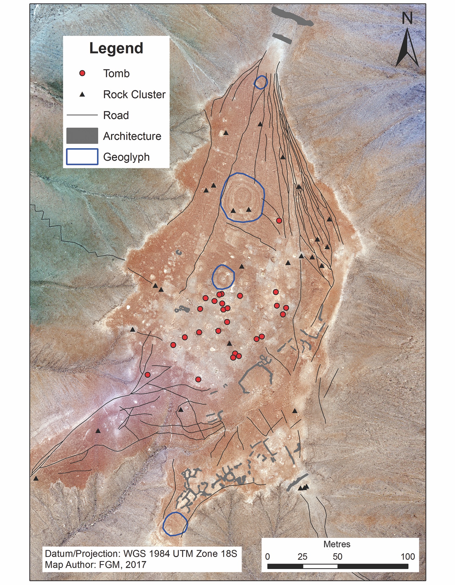
The site of Cujan Alta in southern Peru. This area bears the marks of human activity going back centuries, including tombs, roads, rock cairns and the remains of buildings. Circled in blue are three large circular geoglyphs, made by scraping the reddish rock and top layer of soil from the ground to expose a lighter layer beneath.
Complex Geoglyphs
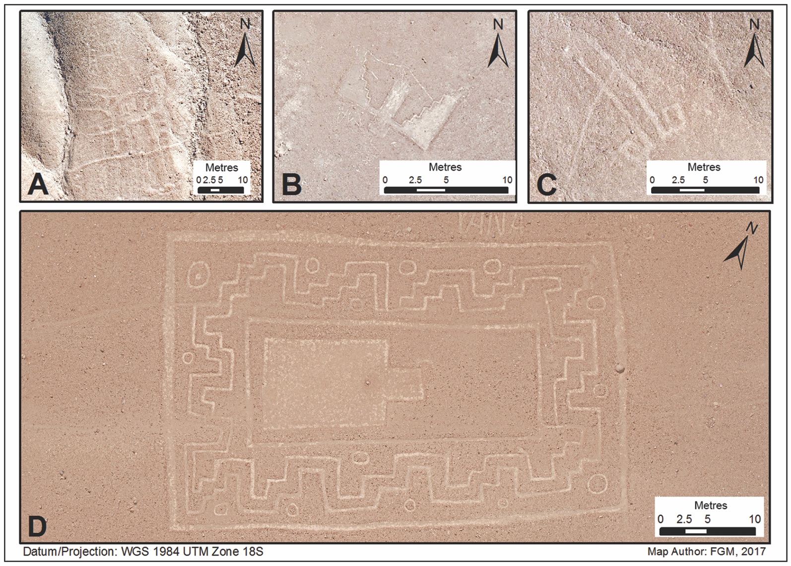
Geoglyphs of various figures and patterns in southern Peru. The more complex glyphs depict a llama (A), "bat man" (B), hooks (C) and an angular design known as "Gross Munsa." Alongside these complex geoglyphs are at least 92 circular geoglyphs, ranging in size from 9.8 feet to 180 feet (3 to 55 meters).
Paths and glyphs
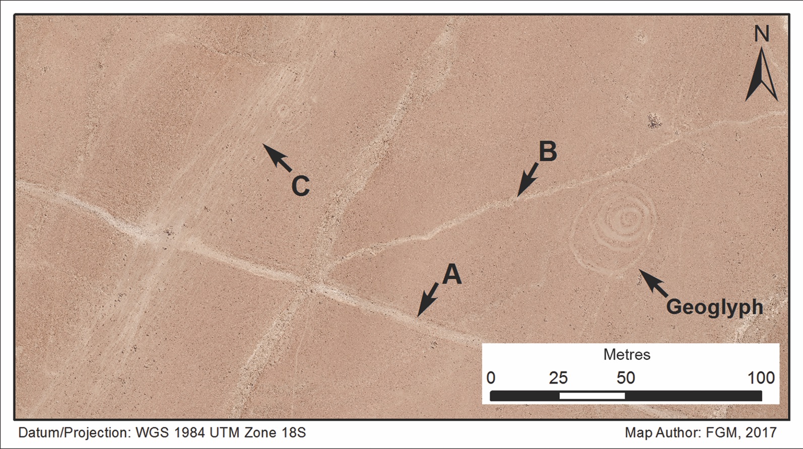
An overhead view of a circular geoglyph alongside a secondary "feeder" roadway that connects to a larger primary road. Pre-Columbian peoples in Peru used llamas to carry goods long distances. Their caravans may have built hasty geoglyphs during pit stops as a way to make offerings to gods or spirits.
Mapping the connections
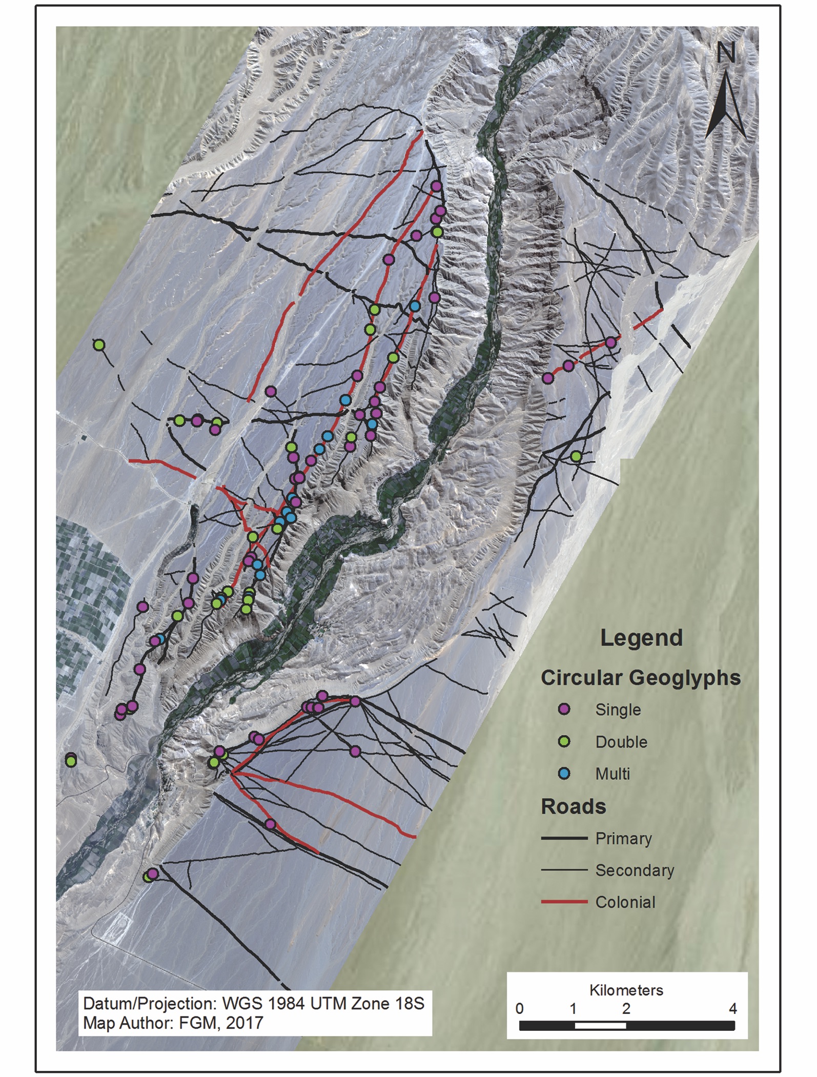
A map of roads and circular geoglyphs in the Sihuas Valley of Peru. Some geoglyphs were a single circle (purple), while others were double (green) or multiple concentric circles (blue). The geoglyphs were often found at "inflection points," such as right after the road crested a valley wall, the researchers reported.
Get the world’s most fascinating discoveries delivered straight to your inbox.

Stephanie Pappas is a contributing writer for Live Science, covering topics ranging from geoscience to archaeology to the human brain and behavior. She was previously a senior writer for Live Science but is now a freelancer based in Denver, Colorado, and regularly contributes to Scientific American and The Monitor, the monthly magazine of the American Psychological Association. Stephanie received a bachelor's degree in psychology from the University of South Carolina and a graduate certificate in science communication from the University of California, Santa Cruz.
 Live Science Plus


