Honanki Ruins: Photos Reveal Sprawling, Ancient Pueblos
Get the world’s most fascinating discoveries delivered straight to your inbox.
You are now subscribed
Your newsletter sign-up was successful
Want to add more newsletters?

Delivered Daily
Daily Newsletter
Sign up for the latest discoveries, groundbreaking research and fascinating breakthroughs that impact you and the wider world direct to your inbox.

Once a week
Life's Little Mysteries
Feed your curiosity with an exclusive mystery every week, solved with science and delivered direct to your inbox before it's seen anywhere else.

Once a week
How It Works
Sign up to our free science & technology newsletter for your weekly fix of fascinating articles, quick quizzes, amazing images, and more

Delivered daily
Space.com Newsletter
Breaking space news, the latest updates on rocket launches, skywatching events and more!

Once a month
Watch This Space
Sign up to our monthly entertainment newsletter to keep up with all our coverage of the latest sci-fi and space movies, tv shows, games and books.

Once a week
Night Sky This Week
Discover this week's must-see night sky events, moon phases, and stunning astrophotos. Sign up for our skywatching newsletter and explore the universe with us!
Join the club
Get full access to premium articles, exclusive features and a growing list of member rewards.
Many inhabitants
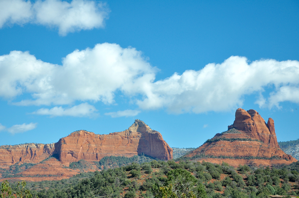
Early native people have long made their homes in the east-central region of today's Arizona. The Clovis People (11,500 B.C. to 9000 B.C.) once hunted mammoths, giant sloths, bison and camels here in what was a savanna-like climate. When the big-game animals disappeared around 9000 B.C., so too did the Clovis people. Yet, the land was still rich in natural resources, and soon groups of archaic people with their hunting-gathering nomadic lifestyles moved into and across the land.
Changing habitat
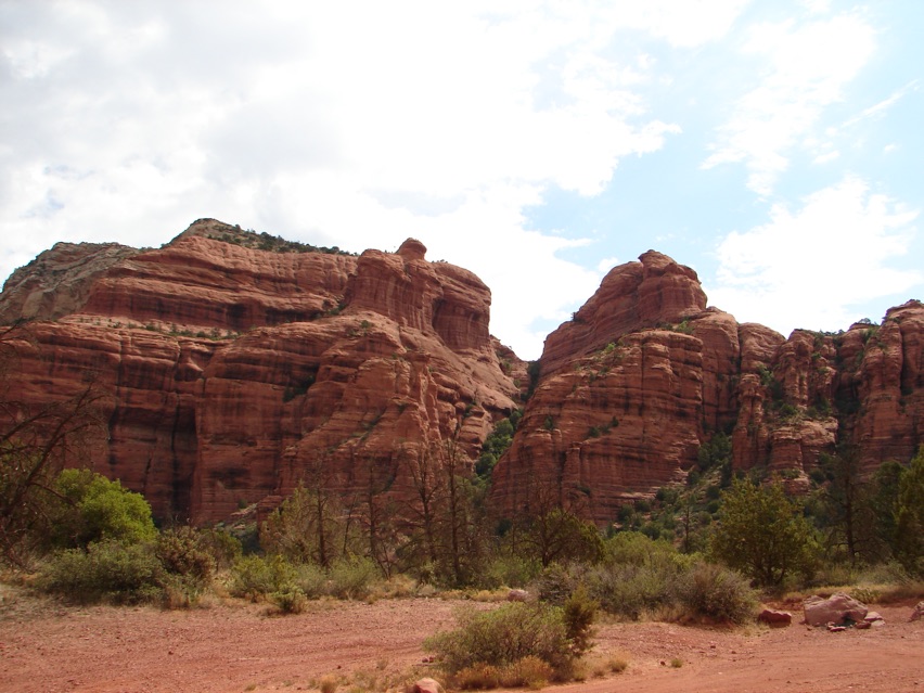
By A.D. 650, another more sedentary group of prehistoric people had arrived into what was a more arid region, and they began to develop a rich culture that was located throughout the Verde River Valley to the south and northward to the Sunset Crater region near modern-day Flagstaff, Arizona. In 1583, when a group of Spanish conquistadors led by Antonio de Espejo passed through the region in search of gold, they found only ruins and non-perishable items from these prehistoric people. Espejo noted the aridness of the region and spoke of these people as the Sinagua — "those without water."
Amazing ruins
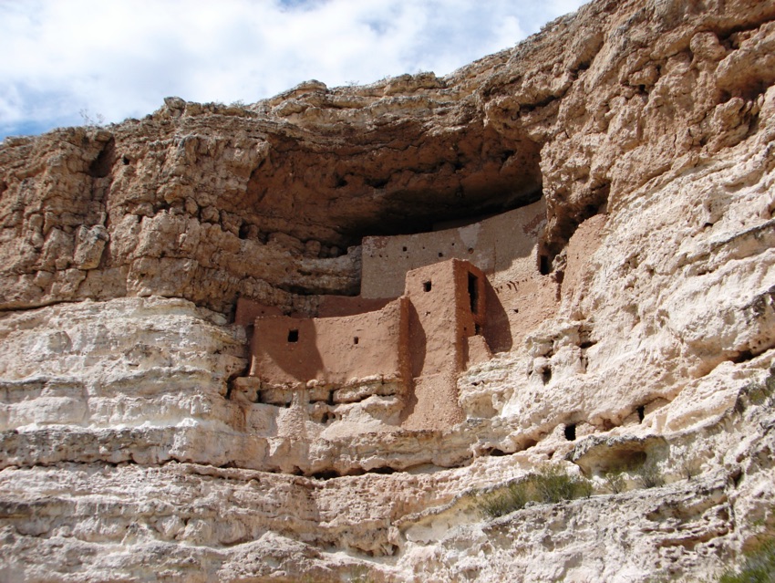
Espejo and his conquistadors came across and documented the ruins of large Sinagua pueblos throughout the Verde River Valley. Many are today under the stewardship of the National Parks Service, such as Montezuma Castle, shown here, Walnut Canyon and Wupatki. Hundreds if not thousands of smaller villages are scattered throughout this region and are under the jurisdiction of the U.S. Forest Service. One, just to the south of modern-day Sedona, is known as Honanki, and is truly worth the effort to visit and explore.
The road less traveled
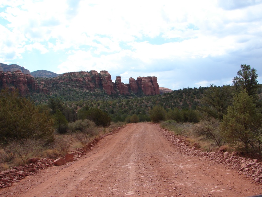
The road to Honanki and its nearby sister pueblo called Palatki, is a well-maintained dirt road that leads for some 4.5 miles from AZ Route 89A into the Loy Butte region. It passes through the typical Upper Sonoran Desert life zone dominated by conifer trees such as the Arizona Cypress, Cupressus arizonica, several varieties of Pinon Pines and a variety of juniper trees. Scrub oaks, desert holly, Atriplex hymenelytra, along with various species of agave and prickly pear cacti dot the vast local chaparral. Some 15 to 18 inches (38 to 46 cm) of precipitation falls upon this land each year, and the region has an average elevation of 4,500 feet (1,371 m).
Erosion made useful
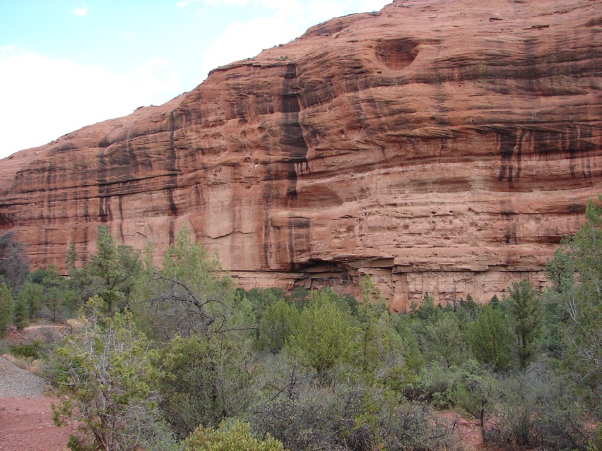
The road to Honanki ends near a high red sandstone butte — typical of the geological formations found in the beautiful Sedona area. Near the base of this sandstone butte, a small west-facing alcove has been carved over the centuries by the common blowing wind. Around the year 1130, a group of local native people, the Sinagua people, came to this alcove and began to build their multi-story pueblo within the alcove's protection.
House of the bears
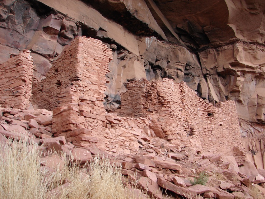
Honanki is one of the largest prehistoric pueblos in the Verde River Valley of Central Arizona. The best dendrochronological dating suggests that the pueblo was built and in use from A.D. 1130 to 1280. The pueblo was first visited by Smithsonian Institute anthropologist Jesse Fewkes in 1895 and first excavated by Fewkes and his team in 1913. The modern Hopi people claim the Sinagua people to be their ancestors, and Fewkes named the site "Honanki" which is a Hopi word that means "Bear House."
Impressive construction
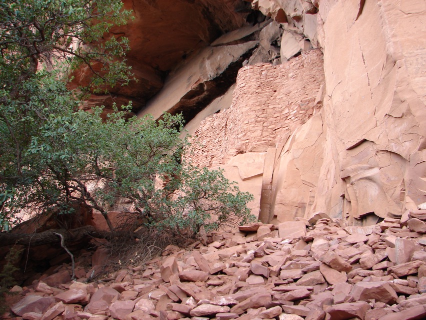
Under the alcove, Honanki once stood two stories tall with upwards of 60 ground-floor rooms running along the base of the butte for a total of 72 rooms at various points of construction and abandonment. Fewkes was so impressed with these ruins that he wrote that "this place, I have no doubt, will sooner or later become popular with the sightseer, and I regard the discovery of these cliffs as one of the most interesting of my summer's field work."
Get the world’s most fascinating discoveries delivered straight to your inbox.
Comfortable lives
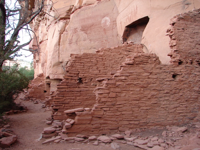
The ruins of the many ground floor rooms along the edge of the butte show evidence of the rich and varied lifestyle of the Sinagua people who hunted deer and rabbit, made stone tools, tended their crops and gathered edible wild plants. A remarkable collection of perishable artifacts, such as cordage, weaving textiles and basketry have been recovered in the internal floors of these Honanki rock chambers. Evidence suggests that some rooms were used for food storage, others as family-group living spaces and one special room is believed to be a highly spiritual birthing room.
Precious cache
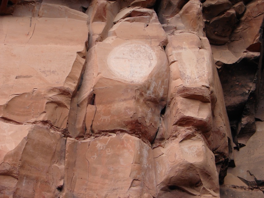
Honanki is a treasure trove of ancient petroglyphs and pictographs. The ancient rock art found here specifically records almost every period of human occupation of the Verde River Valley from possibly as early as 5000 B.C. Over 2,000 pictographs and petroglyphs have been documented at Honanki; they were created by early Archaic people, the prehistoric Sinagua people and even the historic Yavapai people (1400 - 1875). Big-horned sheep, mountain lions, bow hunters, ghostly figures and the sun are all seen on these rock wall panels of Honanki.
Remaining decor
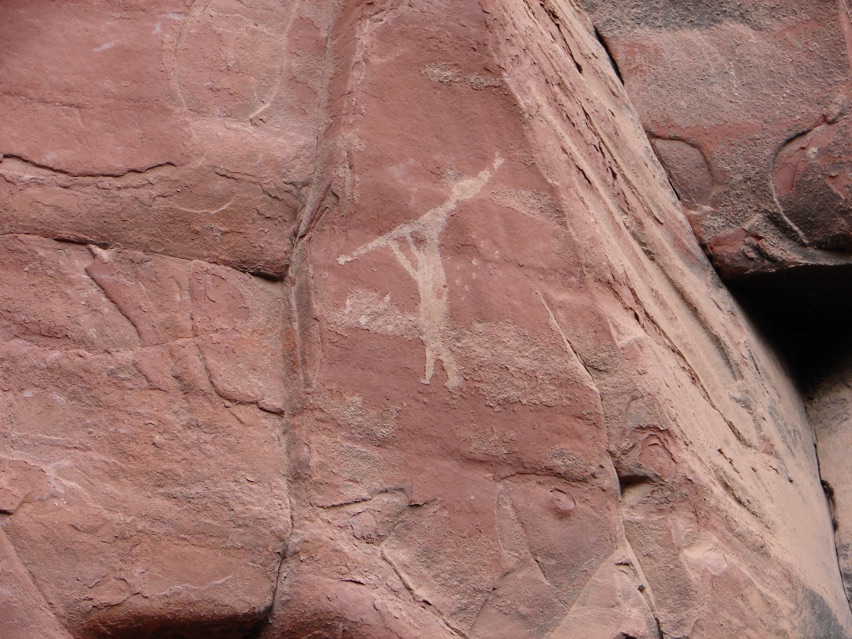
One of the more spectacular pictographs of Honanki is that of Kokopelli. Kokopelli has been a part of multiple American Southwest Native American cultures for over 3,000 years. At different times and in different traditions, Kokopelli has been called a fertility god, a healer, a storyteller and a prankster. This flute player was a source of music making and dancing while spreading joy to all those around him. Kokopelli was always welcome in the homes of Honanki.
Unique marks
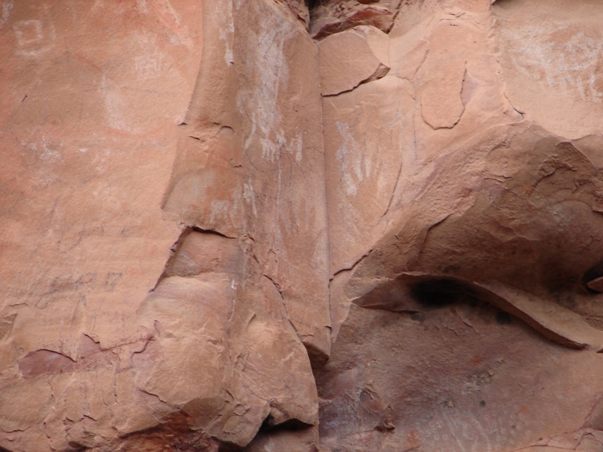
One of the more unique pictographs of Honanki is of two human hands along a crevice of the red rock walls. One can only imagine the early human who climbed this rock wall, blew paint over his right and left hands to form the negative image shown here. Why did he do it? When did he do it? All answers of this rock art are lost in the rock walls of Honanki.
 Live Science Plus


