













Intracoastal Waterway Seen from Edge of Space (Photo)

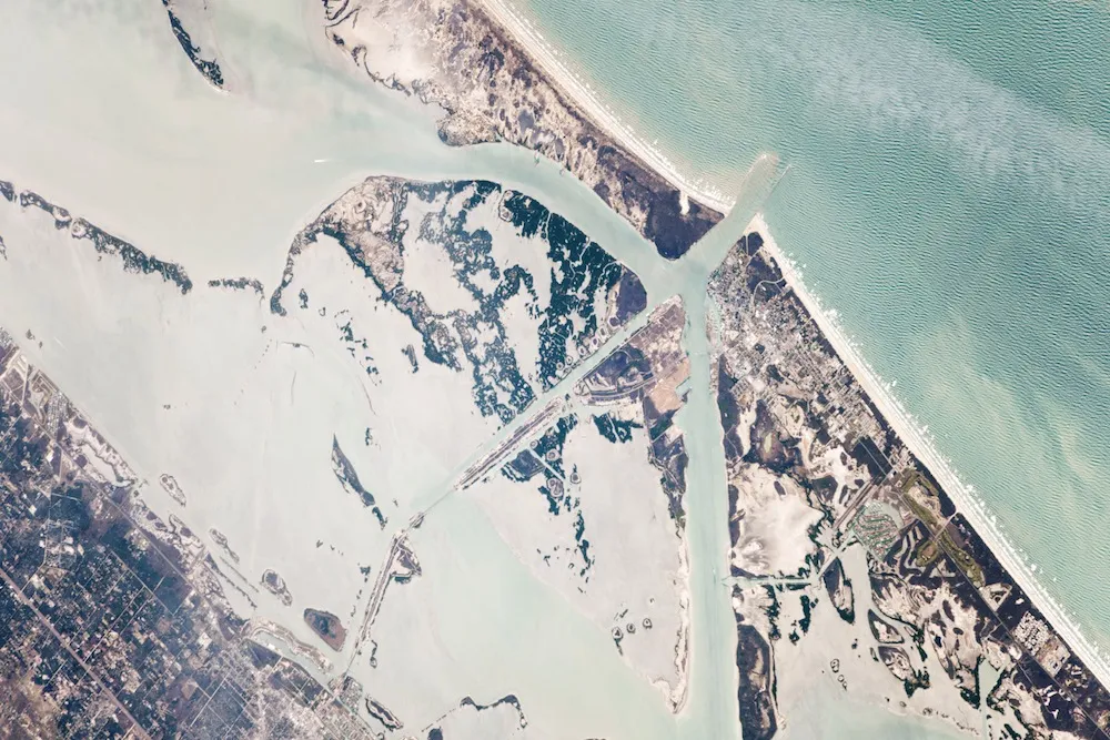
The Intracoastal Waterway is a route stitched together from natural and man-made channels, as seen in this view from the edge of space.
The 3,000-mile-long (4,800 kilometer) waterway runs along the southeastern United States; barrier islands protect it from the wider Atlantic. At Port Aransas, shown in this astronaut photograph from the International Space Station, the waterway is partially man-made, as evidenced by the unnaturally straight lines visible in this 11.2 mile (18 km) stretch.
The Intracoastal Waterway connects the sea to the inland, according to NASA's Earth Observatory. Barges can slip between barrier islands and float from the waterway into the mouths of the United States' largest rivers, including the Mississippi. Petroleum is frequently shipping this way, according to the Earth Observatory, with petroleum products making up 30 percent of the total tonnage shipped by barge along the waterway in the Gulf of Mexico region.
Sometimes, however, this method of shipping causes problems. Up the coast from Port Aransas, at the Houston Ship Channel, a ship collision on March 22, 2014, caused 4,000 barrels (126,000 gallons) of fuel oil to spill into the water. Two dozen vessels and 90,000 feet (27,400 meters) of floating boom were deployed to clean up the spill, the Coast Guard reported.
The Houston Ship Channel reopened fully on March 26, with shipping limited to daylight hours only. As of 2012, the Channel was the second-busiest port in the United States after the Port of South Louisiana, according to U.S. Coast Guard data. On average, 38 tankers, 22 freighter transits, 297 ferry transits and one cruise ship travel through the port each day, among other vessels. There were six collisions and 30 vessel groundings in 2013.
Follow Stephanie Pappas on Twitter and Google+. Follow us @livescience, Facebook & Google+. Original article on Live Science.
Get the world’s most fascinating discoveries delivered straight to your inbox.

Stephanie Pappas is a contributing writer for Live Science, covering topics ranging from geoscience to archaeology to the human brain and behavior. She was previously a senior writer for Live Science but is now a freelancer based in Denver, Colorado, and regularly contributes to Scientific American and The Monitor, the monthly magazine of the American Psychological Association. Stephanie received a bachelor's degree in psychology from the University of South Carolina and a graduate certificate in science communication from the University of California, Santa Cruz.