Images: 'Lost' New England Archaeology Sites Revealed in LiDAR Photos
Stone Walls Come into View
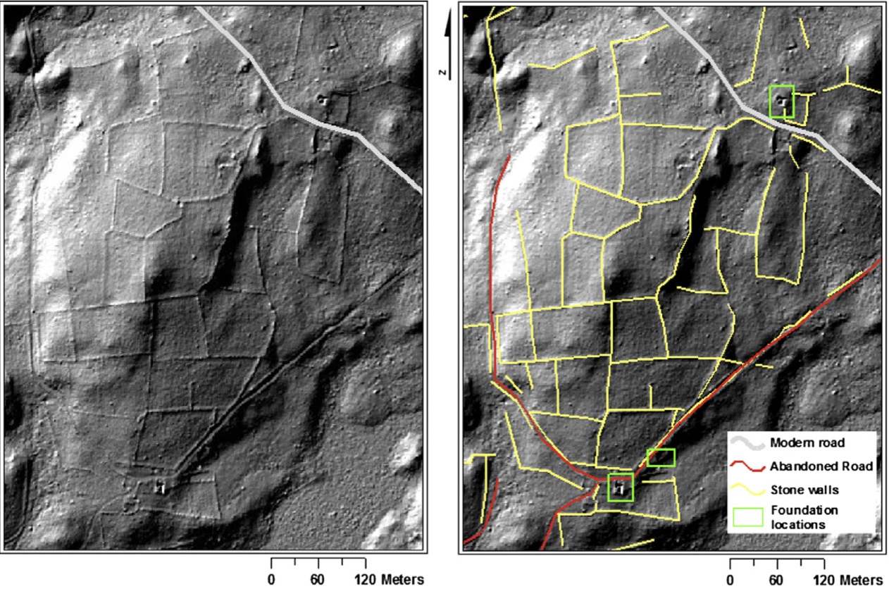
Examinations of airborne scans, using light detection and ranging (LiDAR), of three New England towns have revealed networks of old stone walls, building foundations, old roads, dams and other features, many of which long were forgotten. Here, stone walls are yellow, abandoned roads are red, and building foundations are outlined by green squares.
Shady Landscape
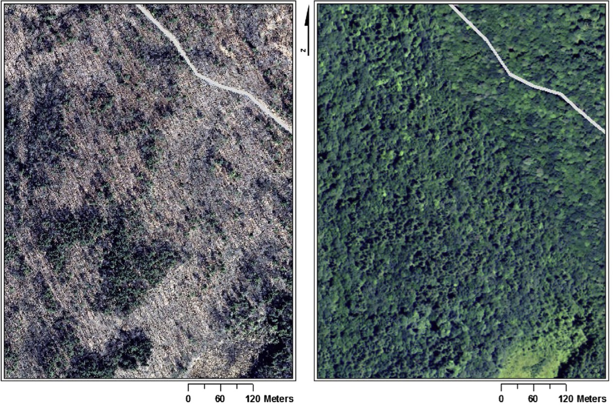
These stone walls and other archaeological features could not be seen with traditional aerial photographs shown here. This figure illustrates the advantage of LiDAR data with a point spacing of 1 meter or better over traditional map views of the landscape for archaeological purposes. The images here show leaf-off (left) and leaf-on (right) aerial photographs with a modern road superimposed through the northeast corner of the image for reference (National Agricultural Imagery Program, 2012).

In addition to building foundations, LiDAR allows scientists to see other archaeological features such as dams, mills, stone walls and old roads. Here, a dam and walls in Ashford, Conn., that were once part of a mill complex.
Sawmill

This race for an 18th-century sawmill in Tiverton, R.I., shows up in the LiDAR image (right).
Stone Walls

Here, a stone wall showing different initial construction heights, with the LiDAR image on the right.
Preservation Stage

Here, a stone wall at various stages of preservation, with the LiDAR image on the right.
Power of LiDAR
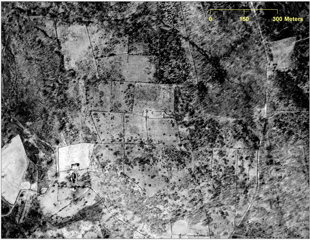
"LiDAR is not only a powerful tool on its own; it can also be used in conjunction with the many types of historical documents available to those performing research in this geographic area," Johnson and Ouimet write in the Journal of Archaeological Science. As an example, this 1934 aerial photograph taken of an area in Preston, Conn., shows a farmstead -- cleared fields, forest, stone walls or fences, a house, a barn and other outbuildings, and a road running through the farm. Check out the next slide with the 2012 aerial image.
Get the world’s most fascinating discoveries delivered straight to your inbox.
Hidden from View
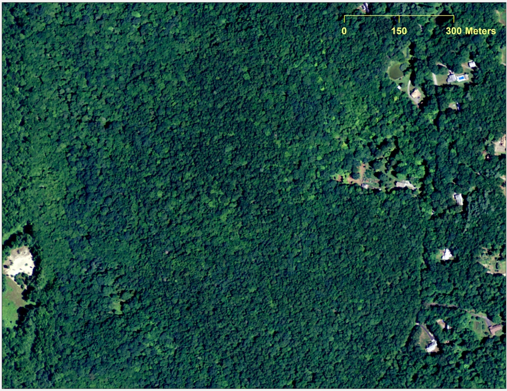
Here, an aerial photograph of the area from 2012 shows the farmstead has been completely abandoned and overgrown by forest. Check out the next slide showing the LiDAR image taken of this overgrown forest.
Farm Abandonment
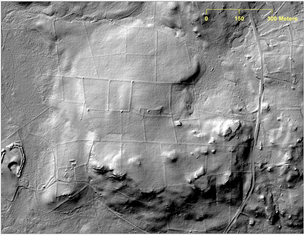
In a LiDAR image of the long-lost farmstead in Preston, Conn., reveals features such as building foundations, stone walls and an old road. "Ongoing research suggests preliminarily that individual abandoned fields might impact the modern vegetation patterns. This is just one example of farm abandonment, a process that took place on a much smaller scale in Ashford, where entire portions of the town that were once cleared are now completely forested," Johnson and Ouimet write in the Journal of Archaeological Science.
Jeanna Bryner is managing editor of Scientific American. Previously she was editor in chief of Live Science and, prior to that, an editor at Scholastic's Science World magazine. Bryner has an English degree from Salisbury University, a master's degree in biogeochemistry and environmental sciences from the University of Maryland and a graduate science journalism degree from New York University. She has worked as a biologist in Florida, where she monitored wetlands and did field surveys for endangered species, including the gorgeous Florida Scrub Jay. She also received an ocean sciences journalism fellowship from the Woods Hole Oceanographic Institution. She is a firm believer that science is for everyone and that just about everything can be viewed through the lens of science.
 Live Science Plus


