


Best Earth Images of the Week - May 4, 2012
A Dazzling View

A stunning new video shows Earth through an astronaut's eyes, letting the rest of us see just how beautiful our planet is from 240 miles up.
The four-minute video combines several sequences of time-lapse imagery snapped recently by astronauts aboard the International Space Station. It takes viewers around the world, above dramatic lightning storms and through dazzling displays of the northern lights, also known as the aurora borealis.
[View the Video: Earth's Beauty from Space Dazzles in Astronaut Video]
A Frozen River

Arctic ice is undergoing rapid changes, and for the fourth year running, NASA scientists are flying missions above the region's forbidding landscapes to monitor the changes taking place there.
Some glaciers are speeding up, dumping more water from Greenland's massive ice sheet into the ocean which raises global sea levels while other glaciers have barely budged. And it now appears that changes in Arctic sea ice affect everything from weather in Europe to the amount of sunlight the Earth absorbs.
[Full Story: Stunning Ice Views Captured by Airborne NASA Mission]
A Land of Extremes
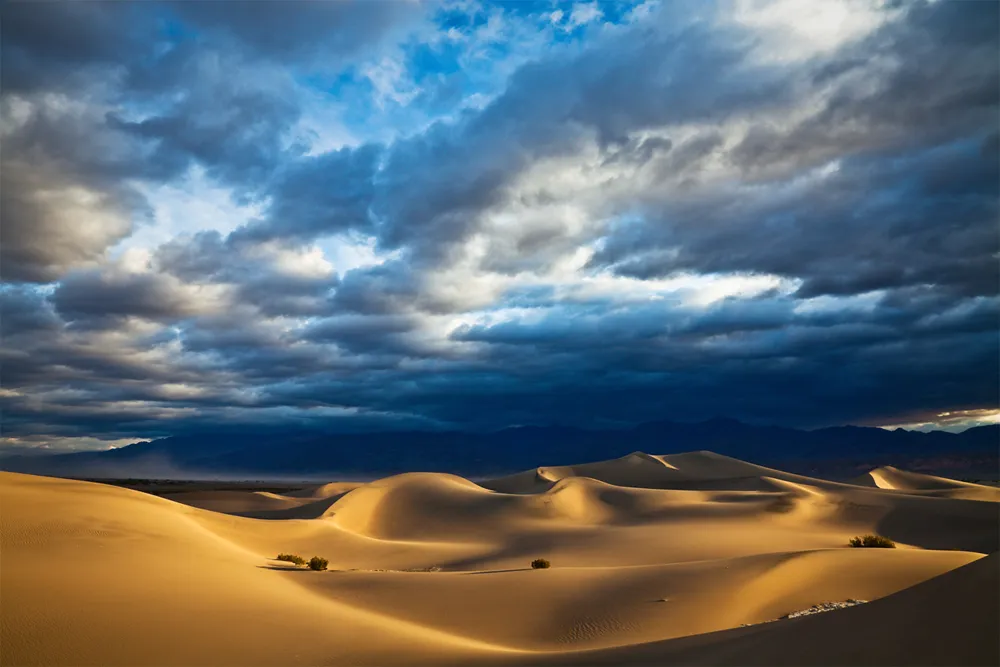
This recently released dramatic photo of Death Valley reveals the area's largely barren sand dunes in a land of extremes, but there are signs of life, too.
Within Death Valley National Park, an area called Badwater Basin is the lowest point in the United Sates, at 282 feet below sea level.
Rain is rare in Death Valley. The average rainfall is less than 2 inches a year. Some years it doesn't rain at all. Rains bring a bloom of wildflowers, and in fact there are more than 1,000 types of plants in the valley, some with roots more than 50 feet deep.
[Full Story: Death Valley National Park: Land of Extremes]

Evidence of Change
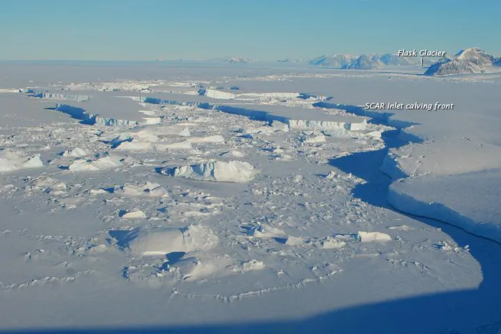
Photographs snapped last week of the Antarctic Peninsula reveal a glittering landscape of ice and snow, crowned by rugged mountains rising majestically in the distance. Yet no human captured the stunning view it was the work of machines.
Thanks to the combined technological powers of satellites and weather stations scattered around the Antarctic Peninsula, researchers can now keep tabs on the region's shifting ice which in recent years has undergone dramatic changes from the comfort of their offices.
[Full Story: Stunning Antarctic Images Reveal Changes in Continent's Ice ]
Lava Flows on Mount Etna
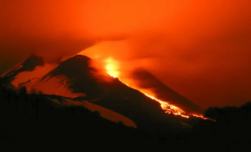
Sicily's Mount Etna wowed onlookers and researchers with yet another spectacular show last week. It was the restive peak's 25th dramatic lava display since the volcano ramped up activity in January 2011, and the seventh so far this year.
Signs the mountain was primed for yet another paroxysm first appeared on the morning of April 21, when Mount Etna sent out small plumes of ash.
[Full Story: Italian Volcano Erupts for 7th Time This Year]
Blowing in the Wind
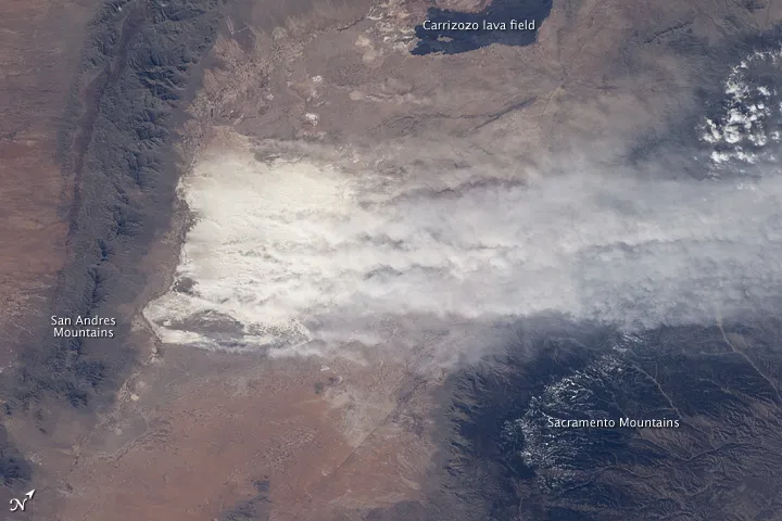
New Mexico's glistening white gypsum dunes, which cover 275 square miles (712 square kilometers), are the largest gypsum dune fields on the planet.
The snow-white sands are easily spotted from space; astronauts could see the dune fields on their way to the moon. This photograph was snapped by an astronaut aboard the International Space Station on Feb. 28, 2012.
[Full Story: Winds Blowing White Sands Spotted from Space]
Newly Discovered Lizards

A suite of lizards called skinks have just crawled into the science books, with researchers discovering 24 new species of the reptiles from the Caribbean islands.
Many of the skink species were identified from museum specimens, and now, the researchers say half of the newbies may be extinct or close to extinction, with the others threatened with extinction, said lead study researcher Blair Hedges, a professor of biology at Penn State University.
[Full Story: 24 New Lizard Species Identified from Caribbean]
Get the world’s most fascinating discoveries delivered straight to your inbox.
Secrets Revealed

Thanks to 16 'hidden' cameras planted around Antarctica, researchers have captured images of penguin colonies going about their business during the frozen continent's harsh winter months rare images indeed, since the brutal conditions makes it impossible for humans to work there in the winter.
Researchers from the Zoological Society of London set up time-lapse cameras on the continent and on sub-Antarctic South Georgia Island to capture aspects of the penguin life cycle that typically go unseen.
[Full Story: Secret Lives of Penguins Revealed by 'Hidden' Cameras]
