


Winter Brings Ice to Great Lakes
By
Live Science Staff
Published
In
News
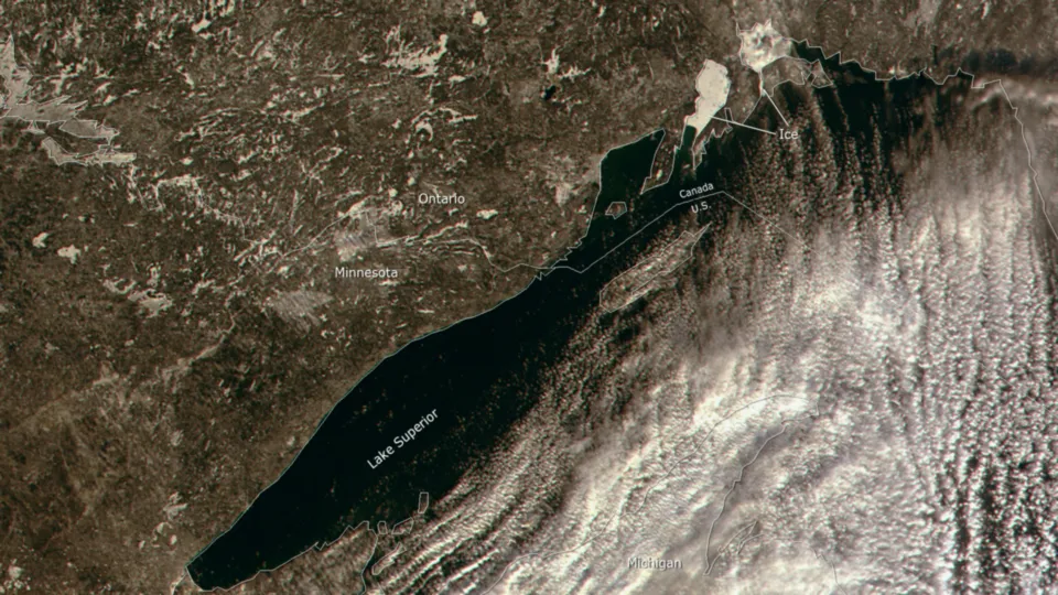
This 250 meter resolution image shows ice forming in the upper bays of Lake Superior.
(Image credit: NOAA)
Follow us
Add us as a preferred source on Google
Subscribe to our newsletter
From NOAA's Environmental Visualization Laboratory:
Winter has come to the Great Lakes, and with it, the National Ice Center has begun its daily analysis of the ice extent to help ensure safe transportation and accurate weather prediction. This 250 meter resolution image, taken by the NASA MODIS satellite sensor on January 2, 2012, shows ice forming in the upper bays of Lake Superior. From December until late May of each year, the National Ice Center produces daily analyses of Great Lakes ice coverage using high resolution satellite data.
Sign up for the Live Science daily newsletter now
Get the world’s most fascinating discoveries delivered straight to your inbox.
TOPICS

For the science geek in everyone, Live Science offers a fascinating window into the natural and technological world, delivering comprehensive and compelling news and analysis on everything from dinosaur discoveries, archaeological finds and amazing animals to health, innovation and wearable technology. We aim to empower and inspire our readers with the tools needed to understand the world and appreciate its everyday awe.