Hell on Earth: Image Tour of Death Valley
Nps Cloud Shadow
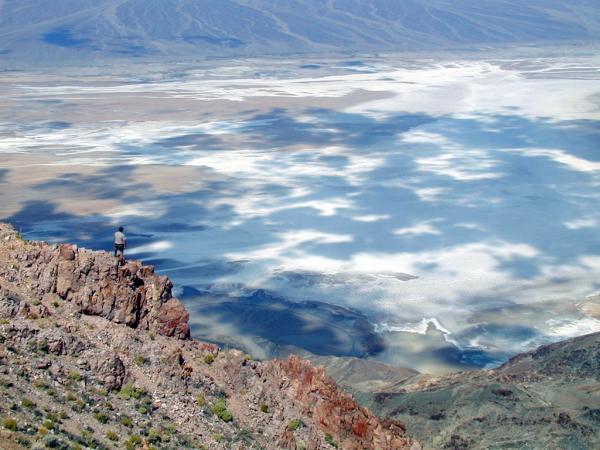
Death Valley has been described by some as the "path to hell" for its extreme temperatures, droughts and otherworldly salt flats which lie some 282 feet (86 meters) below sea level the second lowest point in the western hemisphere. Yet this unique desert place of bizarre, rugged vistas and 2-mile-high mountaintops is a sensual feast of ever-changing colors at sunrises and sunsets. It beckons the human spirit to come, to see and to experience one of Earth's truly special places.
Nps January Morning
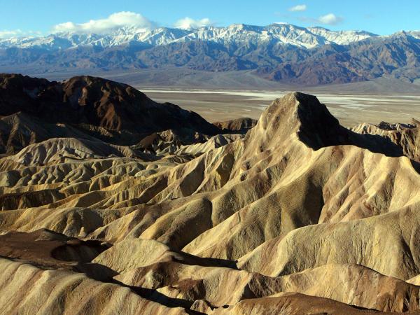
Death Valley is one of many basins located between towering mountain ranges in the American West . It is part of the Basin and Range Province of the Great Basin Desert with an ecological diversity representative of the Mojave Desert. Yet, what makes this basin so unique is that over 550 square miles (1,400 square kilometers) of its land area lies below sea level, as well as claiming the current scientific records for the hottest and driest place in the Western Hemisphere.
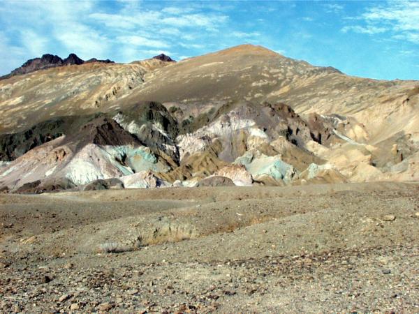
Nps Artists Drive
Death Valley is geologically young, reflecting the recent geological movement that uplifted the nearby mountain ranges. Known as a rift valley, or graben, Death Valley was formed by the sinking of the bedrock valley between the Amargosa and Panamint Mountain Ranges. As these tilt-block faulted mountains began their vertical rise some 30 million years ago, Death Valley began to form. Those same ancient crust-changing forces are still at work here even today.
Nps Artists Drive
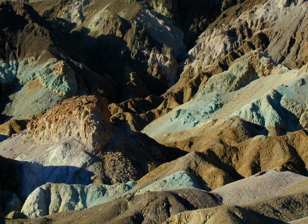
Here, at a place known as Artist's Drive, beautiful evidence of the ever-present forces of erosion becomes a delight for photographers and for anyone who loves the raw beauty of nature. As this valley sank, sediment from such nearby mountains washed onto the desert floor, forming great alluvial fans as they buried the bedrock with as much as 9,000 feet (2,700 m) of sediment.
Nps Mesquite Flat Sand Dunes
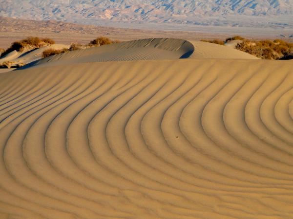
Nature's intense beauty, such as that found at the Mesquite Flat Sand Dune, became the driving force for Death Valley to become a National Monument on Feb. 11, 1933. That protective designation was upgraded on Oct. 31, 1994, when Death Valley National Park was created. The national park encompasses 5,262 square miles (13,629 square km) making it the largest national park outside of Alaska.
Nps Mesquite Flat Sd
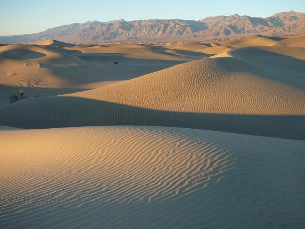
Sand dunes are a common site in Death Valley, especially here at Mesquite Flat, along Salt Creek and the southern part of the Amargosa River. Many a Hollywood movie director has chosen these dunes for that special desert scene. The depth of the dunes at their crests of Mesquite Flat is 130 to140 feet (40 to 43 m). Tiny grains of quartz and feldspar from the Cottonwood Mountains are the most common earthly particles found in these dunes, while occasional stands of mesquite trees and creosote bushes somehow grow on the leeward slopes.
Nps Salt Flats From Dantes View
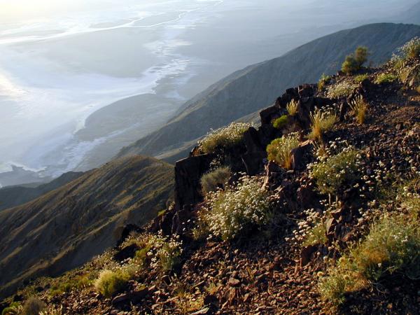
From the summit of Dante's View, the incredible Death Valley Saltpan comes into view. Covering more than 200 square miles (520 square km), the saltpan of Death Valley is one of the largest in the world. Events of the Pleistocene Ice Age resulted in the formation in this valley of an 81-mile-long, 600-foot-deep (130 km, 183 m) lake, called today by geologists, Lake Manly.
Get the world’s most fascinating discoveries delivered straight to your inbox.
Nps Salt Pool
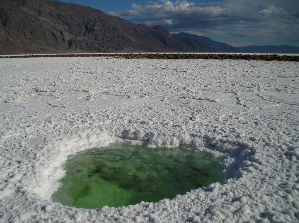
For the past 10,000 years the floor of Death Valley has been an enormous natural evaporation dish as climatic changes slowly dried up Lake Manly. Such drying has resulted in a saltpan averaging 2 to 3 feet (0.6 to 1 m) thick, resting on top of a 25 to 50-foot-deep (8 to 15 m) silt-and-clay ancient lakebed. And in one of the national park's greatest mysteries, this amazing saltpan seems to change itself on a daily basis, almost as if it were a living, breathing salt organism thriving in one of the Earth's harshest environments .
Nps Salt Detail
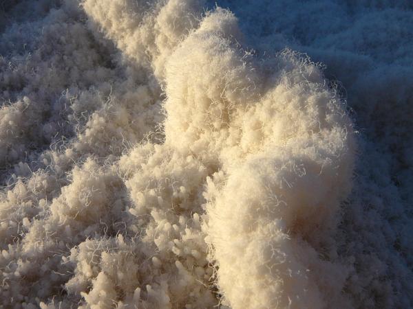
There are about a dozen borate, nitrate, sulfate, carbonate and chloride salts found in the ancient salt playa of Death Valley. Historically, the borates have caused the most economic interests for modern man. From 1907 to 1925, Death Valley was the principal source for borax and boric acid in the United States. Before their discovery here, the world's source for these minerals was Tibet, Italy and Chile.
Nps Salt Creek Pool
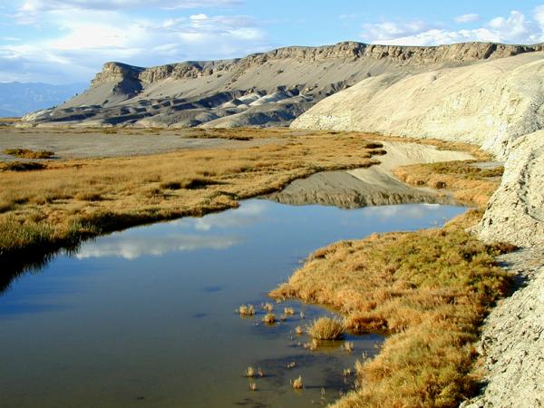
Salt Creek enters the saltpan of Death Valley from the north and at an elevation of 210 feet (64 m) below sea level. Parts of this unusual creek run with brackish water all year long. In the 2 miles (3 km) just below McLean Spring, the water has formed an extensive network of marshes and pools, some with a depth of several feet. As the name suggests, Salt Creek's water contains dissolved salts two to three times higher than the salinity of seawater.
Nps Salt Creek Pupfish
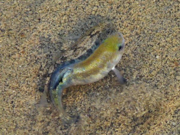
It is in these perennial salt waters of Salt Creek that the last surviving creature of the ancient Lake Manly can still be found. The Death Valley pupfish (Cyprinodon salinus salinus) are among the most heat tolerant fish on Earth, surviving water temperatures as high as 112 degrees Fahrenheit (44 degrees Celsius). These fish have become so adapted to the warm, briny waters of Death Valley that during the "cool" winter months, the pupfish burrow in to the muddy creek bottom and become dormant.
 Live Science Plus


