 Live Science Plus


Arctic Sea Ice Hits Yearly Max, But Still Dwindling
It may be time to retire the groundhog and start tracking Arctic sea ice for a better prediction of late-winter weather.
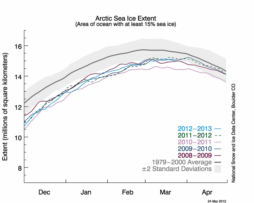
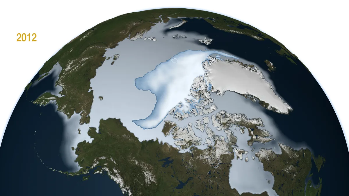
On March 15, the Arctic sea ice reached its maximum extent ― the most ice the frigid North would see this year, according to the National Snow & Ice Data Center (NSIDC) in Boulder, Colo. Changes in Arctic ice, and its total extent, may be affecting weather further south, scientists think.
Article continues belowDuring the 2012 to 2013 winter season, the sea ice grew a record 4.53 million square miles (11.72 million square km). This massive growth was primarily due to last year's missing ice: A record-low ice minimum in September 2012 meant more ocean was exposed, leaving a greater area uncovered to refreeze this winter, the NSIDC said in a statement.
The big swings between summer and winter ice indicate a shift toward a more pronounced seasonal cycle in the Arctic, according to the NSIDC.
The shift is changing the ratio of thin, first-year ice to thick, multiyear ice, which is more resistant to summer melting and winter storms. First-year ice increasingly dominates the Arctic ice pack, the NSIDC said.

This year, the relatively fragile first-year ice was buffeted by a powerful Arctic storm in February, extensively fracturing the ice. Cracking from storms happens every year. This year, however, the rifts extended from Canada to Alaska ― although they quickly refroze.
Less Arctic ice also means more of the ocean and atmosphere can warm from the sun. Scientists think this warming shifts the jet stream, steering cold storm systems further south. March brought freezing temperatures and strong winter storms to the United States, Europe and Russia.
Email Becky Oskin or follow her @beckyoskin. Follow us @OAPlanet, Facebook or Google+. Original article on LiveScience's OurAmazingPlanet.

