It's quick and easy to access Live Science Plus, simply enter your email below. We'll send you a confirmation and sign you up for our daily newsletter, keeping you up to date with the latest science news.
The East Coast of the United States isn't the first place that comes to mind as being at risk of tsunamis, but new sonar maps are now helping to show that these risks do exist.
For about the past five years, researchers at the U.S. Geological Survey, along with other governmental and academic partners, have been gauging the potential for tsunamis generated by landslides in submarine canyons in the mid-Atlantic to strike the U.S. Atlantic and Gulf of Mexico coasts. The investigation was requested by the U.S. Nuclear Regulatory Commission, which is concerned about the potential impact tsunamis might have on new and existing nuclear power plants, especially in light of the devastating tsunami in Japan in March that sparked the greatest nuclear disaster in years.
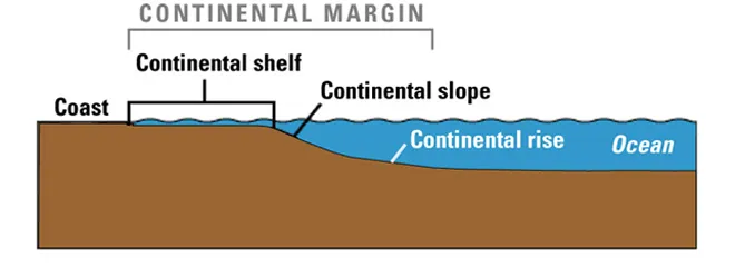
The research identified landslides along the submerged margin of the North American continent as the leading potential source of dangerous tsunamis to the East Coast. These landslides either originate in submarine canyons or on the continental slope.
Multibeam bathymetric data collected during the June 2011 Nancy Foster cruise (except for area around upper Norfolk Canyon, surrounded by dashed red line, where data are courtesy of Rod Mather, University of Rhode Island). The gray shaded-relief data were compiled from existing bathymetric datasets produced by the USGS Woods Hole Coastal and Marine Science Center.
Mapping mission
Investigators set out to map key areas of the Atlantic continental margin in high resolution, work that could uncover more about these hazards. Although this is one of the best-mapped continental margins in the world, significant gaps still remain along the upper slope and shelf where potentially dangerous submarine landslides might occur. [Natural Disasters: Top 10 U.S. Threats]
"Given the immense size of the regions in which we are working, it has taken many years of data collection and integration of existing data sets in order to produce seafloor maps with the resolution needed to identify all the features we are interested in," said U.S. Geological Survey research marine geologist Jason Chaytor.
A sonar mapping cruise taken in June to the Baltimore, Washington and Norfolk Canyons and selected regions of the continental shelf between the canyons marked the first field effort of the multiyear Deep-Water Mid-Atlantic Canyons Project. Using echosounders installed on the hull of the National Oceanic and Atmospheric Administration (NOAA) ship Nancy Foster, the science team mapped canyons and shelf regions at high resolution over more than 380 square miles (1,000 square kilometers) of seafloor from south of Cape Hatteras to Baltimore Canyon, which runs from offshore North Carolina to the eastern tip of Long Island.
Sign up for the Live Science daily newsletter now
Get the world’s most fascinating discoveries delivered straight to your inbox.
"Probably the biggest challenge we faced was avoiding the ever-present fishing gear deployed around the canyons while still collecting enough data to not leave any gaps in the final maps," Chaytor told OurAmazingPlanet.
High-resolution multibeam bathymetry collected in and between Baltimore and Accomac Canyons during the June 2011 cruise. Color key at left shows depths (in meters).
Submarine canyons and landslides
The science team's preliminary analysis of these new data revealed the presence of steep, sharp, stepped escarpments, or slopes, rimming the upper parts of each of the mapped canyons. These may be submerged ancient shorelines cut during times of lower sea level, "the most recent of which occurred during the last glacial period, which ended about 19,000 years ago," Chaytor said. Although the researchers do not at this time feel there is any connection between these features and tsunami hazards, "they may provide important insights into the development of the canyons and help us understand the role of changing sea level in the evolution of the Atlantic coast," he said.
A number of submarine landslides, some previously unknown, were either partly or completely mapped.
"Having accurate information on the number of submarine landslides, in addition to their characteristics such as their size and the water depth they occur in, the style in which they fail, and the properties of the soil and rock involved in the landslide, are important in determining whether or not they might have generated a tsunami," Chaytor said. "This information is often used in numerical modeling of landslide-generated tsunami waves."
The scientists have recently begun the difficult task of collecting long core samples of sediment from the sites of large landslides, a critical step in determining when they happened and how often they and their associated tsunamis are likely to occur.
"The evaluation of submarine landslides as potential tsunami sources along the U.S. East Coast and the Gulf of Mexico and the investigation of submarine canyon systems in the Atlantic are ongoing projects," Chaytor said.
The scientists detailed their findings in the September/October issue of the U.S. Geological Survey newsletter Sound Waves. They will present additional information at the American Geophysical Union fall meeting in San Francisco in December.
This story was provided by OurAmazingPlanet, a sister site to LiveScience.
Charles Q. Choi is a contributing writer for Live Science and Space.com. He covers all things human origins and astronomy as well as physics, animals and general science topics. Charles has a Master of Arts degree from the University of Missouri-Columbia, School of Journalism and a Bachelor of Arts degree from the University of South Florida. Charles has visited every continent on Earth, drinking rancid yak butter tea in Lhasa, snorkeling with sea lions in the Galapagos and even climbing an iceberg in Antarctica.