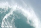
NASA Maps Ocean's Monster Waves

Scientists could soon predict when and where monster waves generated by hurricanes will strike, thanks to new computer models and data from a seven-year study that involved researchers flying into the center of the violent tempests.
From 1998 to 2005, NASA flew a device called a Scanning Radar Altimeter (SRA) into hurricanes and tropical storms aboard a manned National Oceanic and Atmospheric Administration (NOAA) airplane.
The SRA measured the height of waves by pinging radar pulses at the ocean surface and then recording how long it takes the echoes to bounce back. The technique is similar to that used by geographers to map mountainous terrain on land, except the ocean surface is constantly changing.
"Waves endanger ships and they damage structures, so you want to know what the characteristics of the wave field are and how they vary with the characteristics of the hurricane," said Edward Walsh, an electroengineer at NASA Wallops Flight Facility in Virginia and the lead investigator of the project. "Until the SRA began flying, they really didn't have information on that."
The NASA SRA instrument was a prototype to test whether the idea would work and is no longer in service. However, NOAA is designing its own SRA-type instrument, which should be ready for the 2007 hurricane season, Walsh said.
Data from future SRA flights will help researchers develop and improve ocean wave computer models that simulate ocean wave properties during hurricanes, such as height, direction and dominant wavelength.
The SRA data will provide a check for the model predictions, Walsh explained.
Get the world’s most fascinating discoveries delivered straight to your inbox.
"The models will tell you what's going on everywhere all the time, but you use the measurements whenever the aircraft is out there to verify the performance of the model," he told LiveScience.
How high ocean waves get during hurricanes depend on numerous factors, including the storm's wind speed, how far the reach of its winds extend and how fast the hurricane is moving.
Hurricane Katrina in August 2005 generated waves up to 40 feet tall. In September 2004, scientists with the Naval Research Laboratory in Mississippi measured a record-sized 91-foot wave when the eye wall of Hurricane Ivan passed over sensors in open water over the Gulf of Mexico.
- Images: Monster Waves
- Images: Hurricanes at Eye Level
- Images: Hurricanes from Above
- Hurricane Guide: 2006 Forecast Downgraded
- Natural Disasters: Top 10 U.S. Threats
- New Method Predicts Monster Waves


