
 Live Science Plus


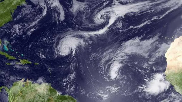
Hurricane Danielle won't be alone as it barrels toward Mexico's Gulf coast this week. Beginning Friday, planes will harry the storm, repeatedly piercing, poking and prodding its enormous eye.
These aircraft, the "Hurricane Hunters" of the U.S. Air Force's 53rd Weather Reconnaissance Squadron (WRS), will be taking Danielle's measure. The planes are kitted out with all sorts of fancy gear, equipment that gauges wind speed and direction, pressure, temperature and humidity multiple times per second. Forecasters will use this information, along with satellite imagery and sophisticated computer models, to predict a storm's path and intensity.
Such advanced hurricane tech saves lives and millions of dollars every year. And it's more than 100 years in the making; meteorologists have been trying hard to predict and track hurricanes since the 19th century.

[See also "Hurricane Katrina History and Numbers."]
The early years: weather stations and ships
In 1898, in the middle of the Spanish-American War, President McKinley declared that he feared tropical storms more than he feared the Spanish navy. That year, the U.S. started setting up its first true hurricane warning system: manned weather stations throughout the West Indies.
These stations' wind and pressure observations helped alert the mainland that a nasty storm might be on the way. But the news didn't travel very fast at first.
Get the world’s most fascinating discoveries delivered straight to your inbox.
"Initially, there was no wireless telegraph," said hurricane historian Lew Fincher. "Information had to be transmitted by fast cruisers."
These ships, stationed in Havana and Key West, were only useful if they could beat the storm to shore.
By 1910 or so, telegraphs were carrying the news, which came from the weather stations and, increasingly, boats that ventured into rough seas. But as radio technology became more developed from the 1920s on, it shouldered the communications load.
A few decades later, meteorologists got their hands on a new type of data: measurements taken from high up, from the heart of a storm. And it all started with a dare.
[Read also "A History of Destruction: 8 Great Hurricanes."]
The Hurricane Hunters take to the air
On July 27, 1943, U.S. Army Air Force Col. Joe Duckworth was helping train some British pilots at Bryan Field near Galveston, Tx. A big storm approached, and the Americans considered moving their planes out of harm's way. The Brits teased them and disparaged the sturdiness of U.S. planes. Duckworth responded by claiming he could fly directly into the hurricane, which he and his navigator proceeded to do.
"When they got back, the weather officer came running out and said, 'Hey, how come you didn't take me?'" Fincher said. So Duckworth grabbed the weather officer and flew back into the maelstrom.
By the mid to late 1940s, the Air Force had started flying into storms regularly, and the Hurricane Hunters were born.
"They'd fly over the ocean in huge sweeps, looking for places where a storm might be forming," said Lt. Col. Jon Talbot, chief meteorologist for the 53rd WRS, of those early days. "It was a real seat-of-the-pants sort of thing."
The Hurricane Hunters gathered data from a storm's innards, including pressure readings and measurements of wind speed and direction. Since the planes could cover so much area, they opened up vast stretches of ocean to meteorological research. Forecasters could get information about many more storms than had been possible before.
Over the years, the gear aboard the Hurricane Hunters' planes, and others operated by the National Oceanic and Atmospheric Administration (NOAA) and NASA, got more and more advanced. These days, radiometers on the wings of the Hurricane Hunters' WC-130Js gauge wind speed at the ocean's surface once every second. Crewmen also heave parachute-equipped dropsondes directly into storms. On their way down to the water, these cylindrical instrument packages measure wind speed and direction, temperature, pressure and various other storm characteristics. They do this twice every second.
All this data streams immediately to the planes' computer system. From there, it's beamed by satellite to NOAA's National Hurricane Center (NHC) in Miami.
Of course, in hurricane-monitoring technology, the sky is no longer the limit.
Satellites: A view from above
In 1959, the U.S. launched Vanguard 2, the nation's first weather satellite. Vanguard 2 didn't do much, but it heralded bigger things to come. A year later, TIROS-1 took television footage of Earth, and suddenly forecasters could see hurricanes from space.
Another milestone came with the 1975 launch of the Geostationary Operational Environmental Satellite 1. GOES 1 sported a visible infrared scanning radiometer, which provided good cloud-cover pictures both day and night. And since it was geostationary (rather than polar-orbiting), GOES 1 could keep continuous watch over troublesome patches of sea.
"They could park it over the Caribbean and pick up anything from Africa to the United States," Fincher said.
GOES 1 was retired in 1985, but dozens of other weather satellites, with increasingly advanced instruments, have carried the ball since. In addition to monitoring cloud formations, some use scatterometry—basically, microwave radar—to gauge wind speed and direction on the ocean's surface, thousands of miles below.
All of this imagery has been a great help to meteorologists.
"We do rely heavily on satellites," said Dan Brown, a senior hurricane specialist at the NHC. And satellites aren't just for monitoring. "They also provide lots of data that go into our forecasting models."
These models are getting better and better, partly because computers are getting more and more powerful. And as a result, according to Brown, track forecasting – predicting where a hurricane is headed – has improved dramatically over the past 20 years.
"We've cut our error in half," Brown said. And he sees more improvement on the horizon, including an extension of the current 5-day hurricane-warning lead time. "Within five to 10 years, I envision we'll be issuing 7-day forecasts."
The future
While track forecasting has advanced greatly recently, intensity forecasting – predicting how strong a storm will be – has lagged. But that may change, and soon, as new technology gets deployed.
On August 17, NASA began a series of flights into and around hurricanes to investigate how storms form and strengthen. The Genesis and Rapid Intensification Processes mission will use three different types of planes; one of these, the Global Hawk, is unmanned.
The Global Hawk may represent the next step in hurricane-hunting tech: heavily instrumented unmanned aerial vehicles that cruise through or around hurricanes for long stretches at a time. (The Global Hawk's flights may last around 20 hours, while the Hurricane Hunters' WC-130Js must head home to refuel after about 11 hours.)
The Hurricane Hunters' Talbot recognizes the potential of craft like the Global Hawk. At some point, he said, autonomous aerial vehicles will probably be making the most daring and dangerous hurricane flights. But experience tells him that the human touch will be needed for a while longer.
"When I first got to this unit in 1985, the first thing I heard was, 'You guys are going to be replaced by satellites,'" he said. "Here we are in 2010, and it hasn't happened yet."
