


Explosive Images: Hawaii's Kilauea Erupts for 30 Years
Eruption begins

Hawaii's Kilauea volcano began erupting in January 1983 with a spectacular arching lava fountain. This photo was taken on Feb. 25, 1983.
Braving spatter

Geologists preparing to collect samples near an active vent erupting in the background at Kilauea's east rift zone on Jan. 7, 1983.
Pu'u O'o Crater at dusk
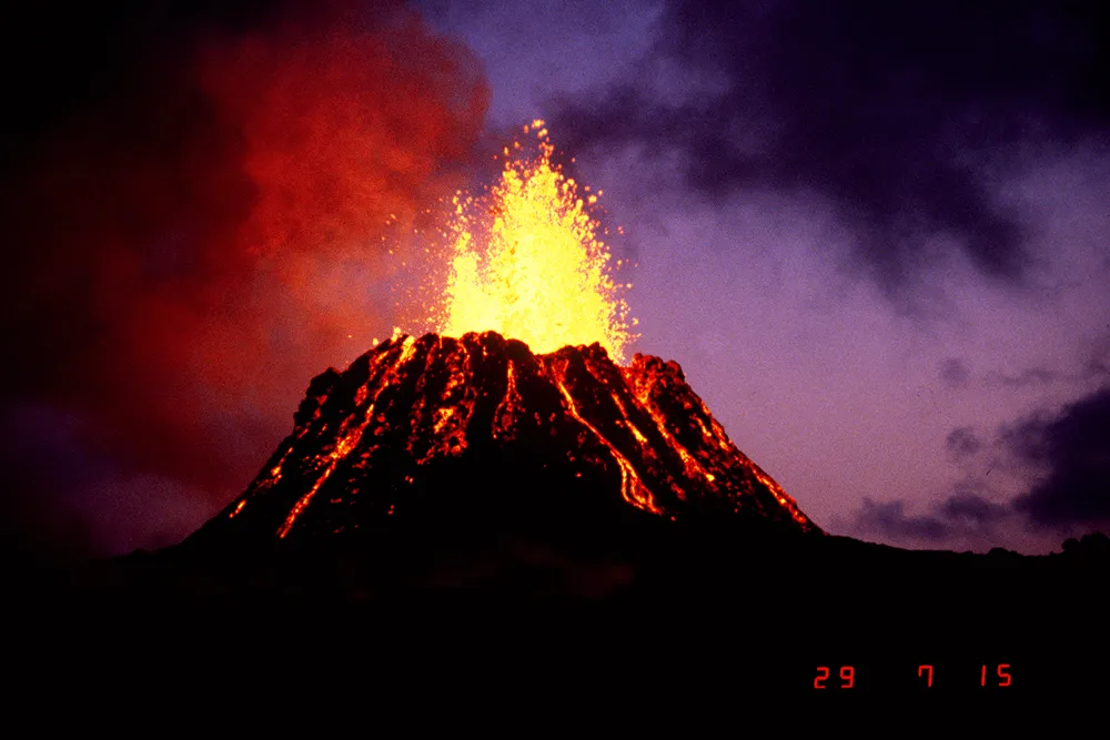
An aerial view of Pu'u O'o crater, where the eruption has been occurring, at dusk, soon after the eruption began. Photo taken June 29, 1983.

Pu'u O'o Crater in 1988

An aerial view of Pu'u O'o crater from the southeast on April 21, 1988.
Lava destroys visitor center

Kilauea volcano's eruption destroyed Hawaii Volcanoes National Park's Wahaula Visitor Center, shown on the top in 1987. The building was set aflame by molten lava on June 22, 1989.
Lava hose

Lava from Kilauea volcano flows from a tube into the sea near Kupapau Point in Hawaii. Photo taken Nov. 27, 1989.
Lava consumes Kalapana Village

Two aerial views show lava from Kilauea's east rift zone advancing through the Kalapana community between April and June 1990. By the end of summer, Kalapana was buried beneath lava. Total losses at the time were estimated at $61 million.
Get the world’s most fascinating discoveries delivered straight to your inbox.
Pu'u O'o Crater lava lake

An aerial view of the lava lake in Pu'u O'o crater, taken Aug. 30, 1990. The crater was about 800 feet (250 meters) in diameter.
Glowing vents

Spots at incandescent cones in Pu'u O'O crater contrast with the broad glow from a new vent and lava flow at the southeast base of the cone. A new fissure opened at the crater's southeast base in January 2004.
Cookie Monster hornito

Looking up at the last incarnation of the so-called Cookie Monster hornito on the inactive Mother's Day flow lave tube. Hornitos are steep-sided spatter cones that form on the surface of lava flows. The Mother's Day flow was so named becaue it began on Mother's Day (May 12) in 2002. The photo was taken Aug. 5, 2005.
Littoral explosion at Kupapau Point

When lava from the Pu'u O'o crater eruption, meets the ocean, large littoral explosions from steam can result. Photo taken July 16, 2008.
