
 Live Science Plus


Red River Flooding Seen From Space

published
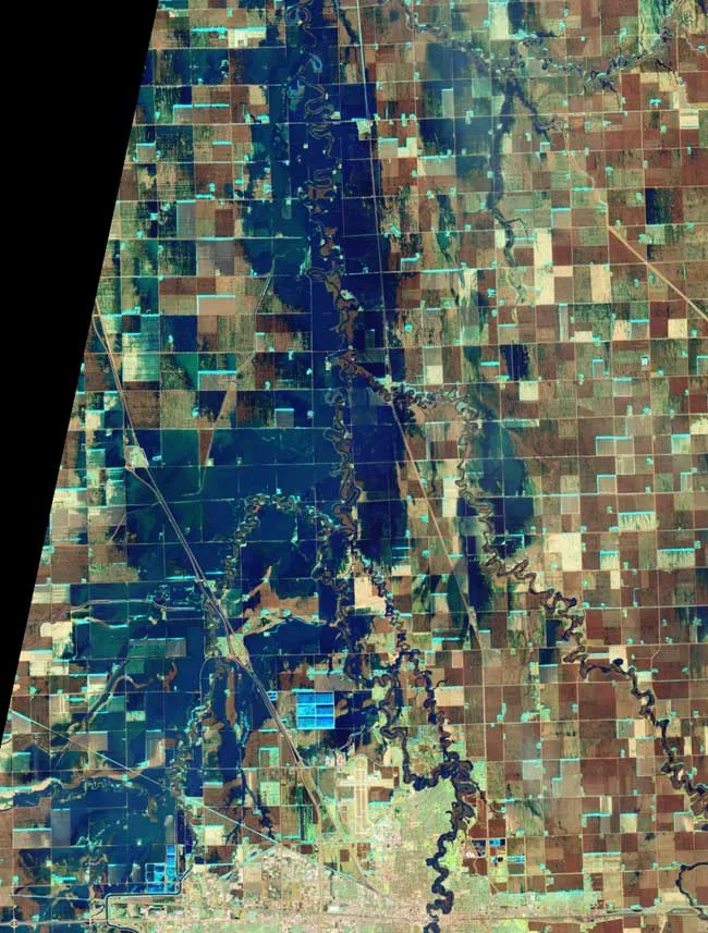
Flooding in North Dakota is seen in this false-color image taken March 21, 2010. It shows water as blue and vegetation as green. Fallow fields, bare ground, and paved surfaces appear in shades of brown.
(Image credit: NASA/Earth Observing-1 satellite)
On March 21, the Red River crested at 36.99 feet (11.27 meters), according to the National Weather Service. NASA has looked down on the flooding from space.
It was not the worst flooding ever. The river's crest was about 4 feet (1 meter) below 2009’s record crest, according to news reports. Dykes and sandbags spared Fargo, North Dakota. But north of the town, the fields were flooded.

TOPICS
