Zoom in on the waters off the coast of Edinburgh on Google Earth, and your eye may catch something strange. Is that a plane? Underwater?
There does seem to be an airliner at the bottom of the sea off Scotland's coast. But this isn't the case of a mysterious plane crash cover-up. Rather, it's the result of Google's system of stitching together satellite imagery to create continuous cover of most of the globe.
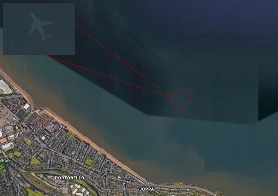
The ghost plane, which sits at the coordinates 55 degrees 57 minutes 26 seconds north latitude and 3 degrees 05 minutes 35 seconds west longitude, was first reported by the Mirror Online, which was alerted to the weird artifact by Robert Morton, a mechanical fitter from South Yorkshire, England. Morton told the tabloid that he was exploring Google Earth on Monday (Nov. 5) when he stumbled across the plane. [15 Secretive Places You Can Now See on Google Earth (And 3 You Can't)]
A Google spokesperson told the Mirror that the find was the result of a process the company uses to create a seemingly seamless view of Earth using a mosaic of satellite and aerial imagery. The images used in any given area are often a composite of several shots, a method that allows Google Earth's developers to get the sharpest possible picture, unobscured by clouds or shadows. When an object (like a fast-moving plane) happens to be in one of those shots, it can end up in the final picture as a ghostly, washed-out version of the original image.
That image of a plane near Edinburgh isn't the first time an artifact like this has appeared on Google Earth or Google Maps. Last year, redditors noticed an airplane caught midflight including a capsized vessel in Iraq and the USS Utah, lost in the Pearl Harbor attack of 1941.
Ghost images can also appear anywhere Google Earth and Google Maps have three-dimensional imagery. Because these 3D views are created by stitching together multiple photographs from different angles, anything that moves between photos can appear as a translucent blur. The Google Earth Blog has examples, including two more "sunken" ghost planes from lakes in Minnesota, which look exactly like the one off Scotland's coast.
Originally published on Live Science.

