
 Live Science Plus


Baltic Sea Turned into 'Mirror' in Photo from Space

published
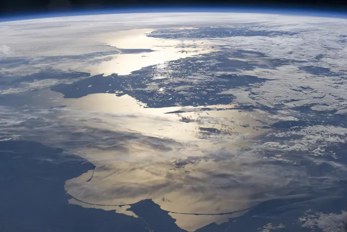
An astronaut snapped this sunset view of the southern Baltic Sea and Scandinavia on June 15, 2014.
(Image credit: ISS Crew Earth Observations Facility and the Earth Science and Remote Sensing Unit, Johnson Space Center. The image was taken by the Expedition 40 crew.)
The setting sun turns the southern Baltic Sea into a mirror in a new photograph taken from the International Space Station (ISS).
Snapped by a member of the Expedition 40 crew on June 15, this picture shows Poland, Russia and Lithuania along its lower border. A string of barrier islands loops along the coast of the southern Baltic Sea. Sweden is visible as the large, protruding land mass in the center of the photograph; across the Øresund Strait — known as the Sound in English — is Denmark, visible on the left edge of the photograph. Beyond Sweden, closer to the horizon, is Norway. Moving north from the Øresund Strait, the water widens into the Kattegat Sea and Skagerrak Strait, which connect the Baltic Sea to the North Sea.

