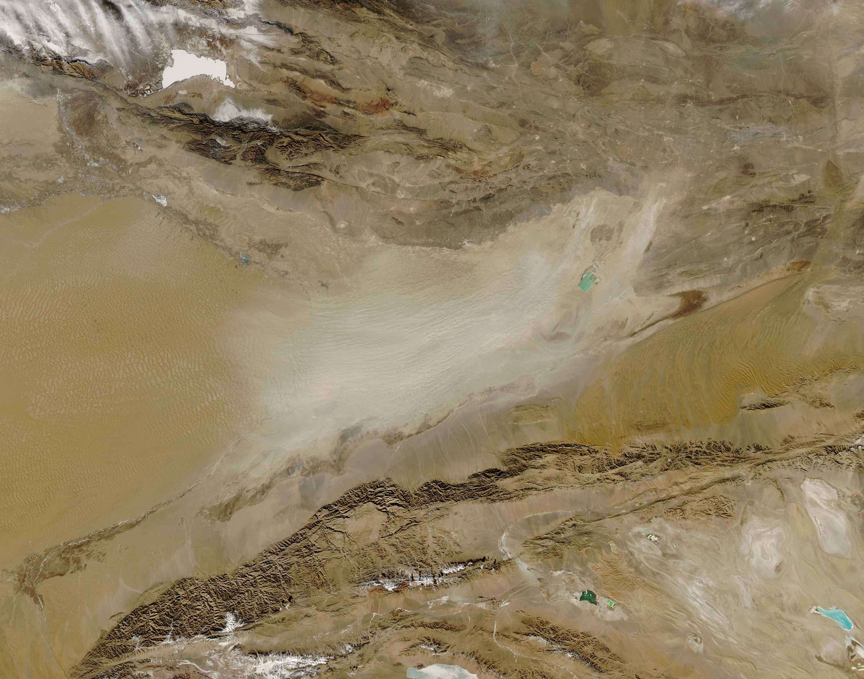
Impressive Desert Dust Storm Spotted from Space


When NASA's Aqua satellite was passing over Asia's Taklimakan Desert on Feb. 1, 2014, and snapped a picture of the ground, a dust storm covered the area, obstructing the view of the barren yet beautifully sculpted landscape.
The source of all that view-obscuring dust? Ephemeral desert ponds.
The Taklimakan is the largest desert in China and one of the largest deserts in the world. It is located far away from the ocean, and it only gets less than 0.4 inches (10 millimeters) of rain in the center of the basin that forms it, according to NASA's Earth Observatory. As a result, hardly anything grows there.
While it might seem easy for a satellite to see the intricate details of the landscape, such as shifting sand dunes, contrastingly dark mountains and channels formed by melting snow, this isn't the case when a frequent dust storm blows through. When seasonal lakes dry out a residue of fine mineral soil is left behind. Once winds sweep the residue up into the air, it spreads towards the west. As the lakes continue to evaporate and refill, mineral salts build up.
And it turns out that the Taklimakan is not as desolate as it looks at first sight. The turquoise spot in the photo is likely a man-made evaporation pond created to extract the same mineral salts that other lakes draw out naturally, the Earth Observatory said.
The pond is not the only sign of human presence. The photo also shows irrigated croplands seen in the form of green and brown spots along the rivers. Since rainfall in the area is extremely scarce, the water used for irrigation comes solely from snowmelt.
Follow OurAmazingPlanet @OAPlanet, Facebook and Google+. Original article at LiveScience's OurAmazingPlanet.
Get the world’s most fascinating discoveries delivered straight to your inbox.


