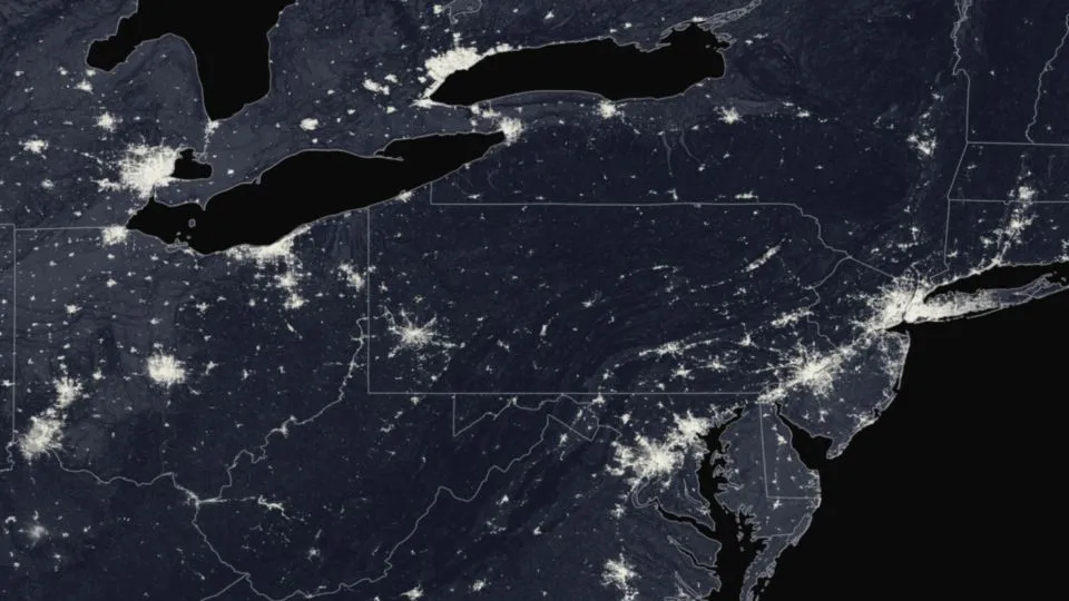
This stunning view of the nighttime lights of the northeast U.S. was captured by the Suomi NPP satellite on May 20, 2012.
The picture was taken using the Visible Infrared Imaging Radiometer Suite (VIIRS), which is more sensitive than other imaging systems to light emitted from the surface, such as reflected moonlight or surface generated photons like those beamed skyward by humans and raging wildfires.
Most satellite-based cameras require daylight to reflect off Earth's surface and into the detector, forming an image much like a camera, or rely on thermal detection of features, such as cold cloud tops.
Latest Videos From
Differing amounts of moonlight will affect the VIIRS sensor sensitivity, so the features that can be seen in an image change from night to night. You can't see clouds in this image because the moon was in a "new" phase, so moonlight was available to reflect off of clouds.
The day-night capability of VIIRS is primarily intended to capture detailed data about cloud, snow and ice formations during nighttime hours. Before 1973, pictures of the country's nighttime lights were classified by the military, but since then the National Oceanic and Atmospheric Administration's National Geophysical Data Center has been processing the images to examine population and urbanization changes around the planet, along with helping to pinpoint electrical power blackouts in the United States.
Follow OurAmazingPlanet for the latest in Earth science and exploration news on Twitter @OAPlanet. We're also on Facebook andGoogle+.