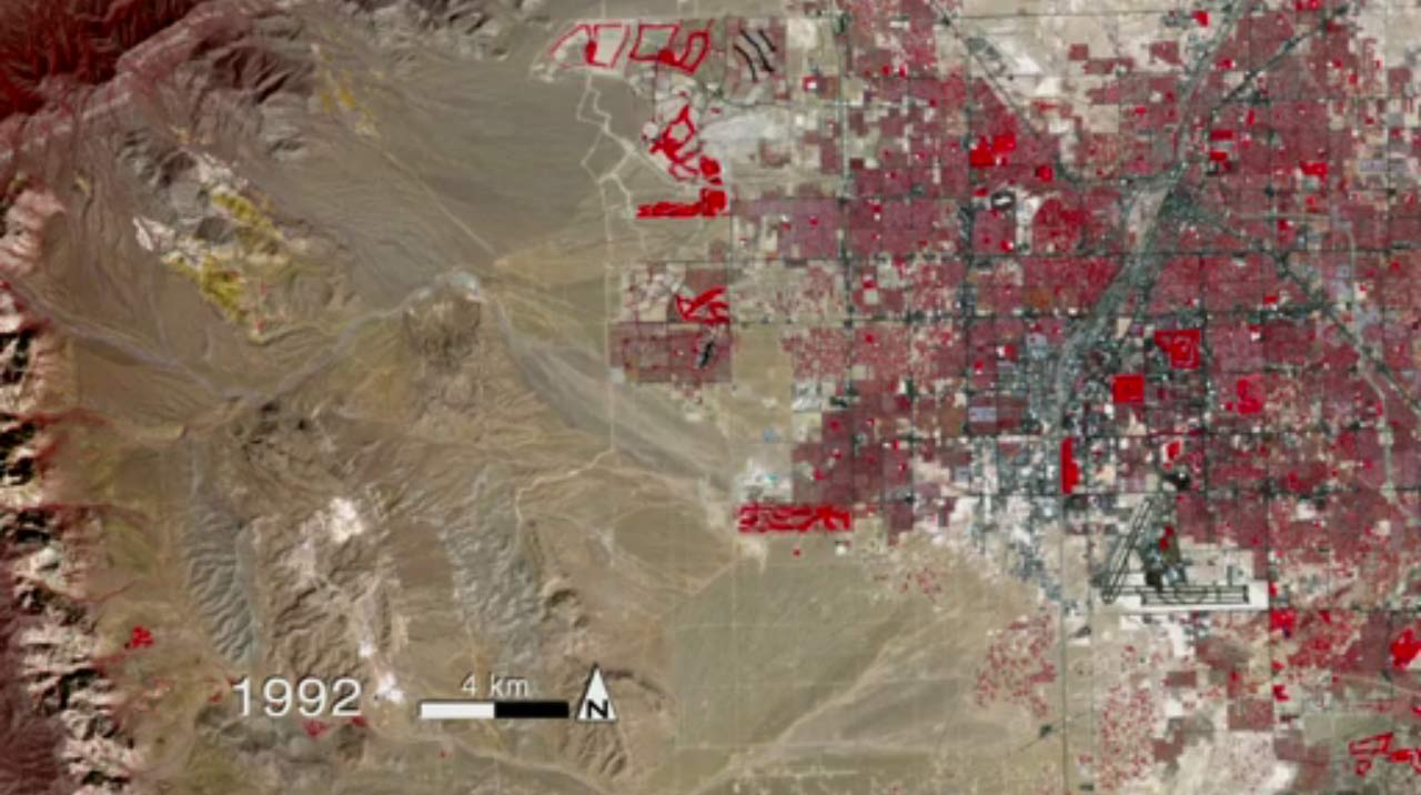
Las Vegas' Sprawling Growth Seen from Space

Get the world’s most fascinating discoveries delivered straight to your inbox.
You are now subscribed
Your newsletter sign-up was successful
Want to add more newsletters?

Delivered Daily
Daily Newsletter
Sign up for the latest discoveries, groundbreaking research and fascinating breakthroughs that impact you and the wider world direct to your inbox.

Once a week
Life's Little Mysteries
Feed your curiosity with an exclusive mystery every week, solved with science and delivered direct to your inbox before it's seen anywhere else.

Once a week
How It Works
Sign up to our free science & technology newsletter for your weekly fix of fascinating articles, quick quizzes, amazing images, and more

Delivered daily
Space.com Newsletter
Breaking space news, the latest updates on rocket launches, skywatching events and more!

Once a month
Watch This Space
Sign up to our monthly entertainment newsletter to keep up with all our coverage of the latest sci-fi and space movies, tv shows, games and books.

Once a week
Night Sky This Week
Discover this week's must-see night sky events, moon phases, and stunning astrophotos. Sign up for our skywatching newsletter and explore the universe with us!
Join the club
Get full access to premium articles, exclusive features and a growing list of member rewards.
What happens in Las Vegas might stay in Vegas, but the Nevada city itself has been anything but static over the years. In a series of images, a fleet of Earth-watching satellites captured the gambling hub's incredible 40-year growth spurt from space.
The series of satellite images were compiled into a video by scientists at NASA's Goddard Space Flight Center in Greenbelt, Md., to show how Las Vegas has sprawled across the desertover the course of four decades. The time-lapse view offers an intriguing glimpse into what urban sprawl looks like from space.
The false-color images represent 40 years of data from the Landsat satellites. The large red areas in the images actually represent green space — primarily golf courses and city parks.
The quality of the images also becomes significantly sharper beginning in 1984, when newly designed instruments improved the satellites' ability to make detailed observations of smaller parcels of land, NASA officials said in a statement.
The images were created using reflected light from specific portions of the electromagnetic spectrum, including red, green and near-infrared.
The video sequence was put together to mark the 28th anniversary of the launch of Landsat 5 on March 1, 1984.
The Landsat program is the longest running program that provides continuous observations of the Earth's surface. A total of seven Landsat satellites have been launched into space since 1978, but only two (Landsat 5 and Landsat 7) are still operating today.
Get the world’s most fascinating discoveries delivered straight to your inbox.
Data from the Landsat fleet have been used to help scientists better understand forest health, storm damage, agricultural trends, urban growth and many other ongoing changes on our planet, agency officials have said.
The Landsat satellites are jointly managed by NASA and the U.S. Geological Survey. The next planned launch of a Landsat satellite, as part of the Landsat Data Continuity Mission, is slated to occur in January 2013.
Follow SPACE.com for the latest in space science and exploration news on Twitter @Spacedotcom and on Facebook.
 Live Science Plus


