Last week 30 U.S. states were affected by a massive winter storm that plowed over the country. NASA satellites have captured the aftermath of the whopper storm with a panorama of snow on the ground across the country.
The Geostationary Operational Environmental Satellites (GOES) cover the U.S. weather. A Feb. 3 GOES-13 image provided a snowy panorama of the U.S. and showed the snowfall on the ground in many of those 30 U.S. states from last week's giant storm. Last week's storm brought snow, sleet, freezing rain and rain from Texas and the Rockies to the New England states.
In satellite imagery, snow visibility depends on snow depth, terrain, and civilization.
Latest Videos From
"Wooded regions like the Appalachians and Midwest river valleys can remain dark even with a foot of snow on the ground," Dennis Chesters, a NASA GOES Project scientist at Goddard Space Flight Center in Greenbelt, Md., said in a NASA statement. "Metropolitan areas like Chicago are dark due to urban development like cleared highways and parking lots."
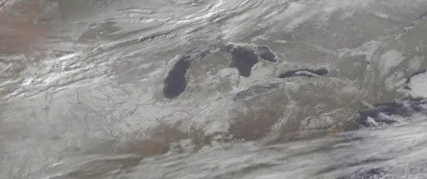
Usually in mid-winter, Lake Erie is lightly frozen over as it appeared in the February 3 GOES-13 image.
"Lake Erie is more easily chilled than the other Great Lakes because it is the shallowest -- waters along the northern shore are open because prevailing northwest winds push the lake ice away from the Canadian shore," Chesters said.