


Divers to Get 3D Images of Sunken Civil War Ship
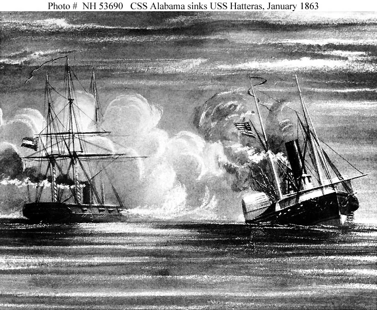
The USS Hatteras, an iron-hulled steamship that was converted into a gunboat by the U.S. Navy during the Civil War, was lost to the sea on Jan. 11, 1863, during one of the many battles for the strategic Confederate port of Galveston, Texas.
The Hatteras was sunk by the famous commerce raider CSS Alabama during the battle. It was the only Union warship sunk in combat in the Gulf of Mexico during the Civil War, according to a statement from the National Oceanic and Atmospheric Administration (NOAA).
Today, the wreck of the ship sits on the Gulf floor, some 57 feet underwater, stuck in the sand and silt. Recent storms have removed some of the sediment that had previous encased the wreck, providing NOAA scientists with an opportunity to study the wreck before shifting sands potentially rebury it.
During a two-day mission this week, a team of archaeologists and technicians assembled by NOAA will be using sonar to create a 3D map of the exposed remains of the ship.
"This will create a detailed visual representation of a long buried wreck in murky waters that we can share with the public while also using it to plan for USS Hatteras' long term protection as an archaeological site and war grave," said James Delgado, director of maritime heritage for NOAA's Office of National Marine Sanctuaries, in a statement.
Sunken Union and Confederate warships have also been examined around other parts of the East Coast, including two that sank at the bottom of a river in Virginia and were investigated during an expedition last year.
Two of the Hatteras crew went down with the ship, and their bodies never were recovered. They are presumed to lie inside the buried hull, the NOAA statement said.
Get the world’s most fascinating discoveries delivered straight to your inbox.
The Hatteras' mission was to help block the passage of goods, supplies, and arms to and from the Confederacy on the Atlantic and Gulf coasts.
NOAA plans to present results from the mapping mission in Galveston next January during local events marking the 150th anniversary of the sinking of the Hatteras, the agency said.
This story was provided by OurAmazingPlanet, a sister site to LiveScience.
