
 Live Science Plus


10 Modern Tools for Indiana Jones

Indiana Jones

This isn't your dad's archaeology, Indiana Jones. It's not even your breathless brand of chasing down wondrous relics and brawling with Nazi stooges. Today's archaeologists can search for buried ancient cities from space, fly laser-toting airplanes over the sites to map them in 3-D, and see what lies beneath the ground by using radar and other special instruments.
That's all before a single trowel begins excavating. Once the digging has uncovered samples from artifacts or bones, it's off to the lab for some radiocarbon dating, perhaps some CT imaging scans and possibly even DNA testing of biological remains.
But don't worry, Indy, you don't belong in a museum just yet. Read on to see the new tools in the archaeologist's arsenal.
This story was provided by InnovationNewsDaily, sister site to LiveScience. Follow InnovationNewsDaily on twitter @News_Innovation, or on Facebook.
Get the world’s most fascinating discoveries delivered straight to your inbox.
Metal Detectors

Nothing beats a metal detector when searching for musket balls, bullets and belt buckles below the ground of an old battlefield. The technology first came into its own during World War II following Indiana Jones' main adventures, but has since become a staple tool of the subfield known as battlefield archaeology. That's not surprising when considering how much metal ends up on battlefields ranging from Little Big Horn to Agincourt.
Still, many archaeologists often have a love-hate relationship with metal detectors. That's because of hobbyists or amateur treasure hunters who use the device to find and dig up artifacts as historical keepsakes, or even to sell them on eBay.
Crafty archaeologists such as Tony Pollard, director of the Centre for Battlefield Archaeology at the University of Glasgow in Scotland, have reached out to cooperate with hobbyists. Metal detectors have become incredibly sophisticated since the originals designed for detecting battlefield mines, and some hobbyists can even tell what an object is before a trowel is put in the ground.
"If they're collecting bullets from a Civil War battlefield or buttons and sticking them in a jam jar in the garage, it's lost to us," Pollard said. "But if the location is recorded and we can match them to certain sites, we can understand the historical significance."
Digital Archaeology
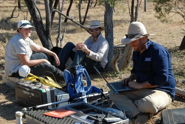
Computers may seem like an obvious tool for any science nowadays, but archaeologists such as David Hurst Thomas at the American Museum of Natural History in New York remember when computers had not yet ushered in the Digital Age. For his doctoral thesis in 1971, he wrote a program that represented a computer simulation capable of predicting artifact deposits from Shoshone Indians who had lived in Nevada.
Much has changed since Thomas wrote his computer simulation on punch cards that stored digital information for early computers. Archaeological labs use computers to process the latest 3-D scans or radar surveys of ancient sites, and archaeologists carry laptops or tablets into the field on digs. Virtual modeling has begun to digitally recreate ancient cities such as Pompeii in Italy.
Even the computing power and extra features packed into smartphones could help, said Tony Pollard, director of the Centre for Battlefield Archaeology at the University of Glasgow in Scotland.
"You've got mobile phones with camera and video and GPS and access to Internet," he said. "I'm pretty sure the mobile phone will become a tool for archaeologists."
Radiocarbon Dating

New technologies have revolutionized how archaeologists look at time. Indiana Jones of the 1930s never enjoyed the luxury of radiocarbon dating; a technique developed in 1949 that can estimate the age of carbon-containing objects to within about 200 years. Its pioneer, Willard Libby, won the 1960 Nobel Prize in Chemistry for developing the method that allows archaeologists to pin a rough date on biological artifacts.
The dating method looks for traces of naturally occurring carbon 14, which is an unstable form of carbon that decays by half its amount every 5,730 years. It doesn't work for objects more than 50,000 or 60,000 years old, but can give rough estimates of age within a 200-year range. Archaeologists rely upon it heavily, and can fine-tune the date by using methods such as counting tree rings.
"By giving us the ability to see the dating, it has really changed our view of deep time," said David Hurst Thomas, a curator in anthropology at the American Museum of Natural History in New York.
GPS Devices

The location-finding services of GPS have become standard kit for archaeologists who want to pinpoint artifacts, buildings or features at an excavation site. That has allowed archaeologists from Australia, New Zealand and Turkey to begin surveying World War I trenches at the Gallipoli battlefield in Turkey.
GPS figures out locations on Earth by comparing time differences between signals sent from satellites that make up the Global Positioning Service network. But the precision of the typical GPS used in cars and smartphones can be off by as much as 66 feet (20 meters) in some cases. Archaeologists at Gallipoli have boosted the accuracy by installing fixed ground stations that can help correct any satellite signal inaccuracies.
"Differential GPS is much more expensive than normal GPS, going from a few hundred dollars to tens of thousands of dollars," said Tony Pollard, director of the Centre for Battlefield Archaeology at the University of Glasgow in Scotland. "But it's increasingly replacing the more old-fashioned GPS for doing archaeology."
Medical Scans & DNA Tests

Even a 3,500 year-old Egyptian princess or an Italian Renaissance woman can still get medical scans and DNA testing in the name of archaeology. Technologies that originated in the hands of medical technicians now help analyze the lifestyles and even identities of individuals found at archaeological digs.
Researchers used computerized tomography (CT) scans to spot hardened arteries that may have led to heart disease in ancient Egyptian mummies. The evidence even showed blocked arteries in the heart of the princess Ahmose-Meryet-Amon, who lived in Thebes between 1580 B.C. and 1550 B.C.
Another team of archaeologists aims to extract DNA from the skeletal remains of a woman found at a Florence convent in Italy. That may allow the group to identify the bones as belonging to Lisa Gherardini Del Giocondo, a woman who historians say could have served as the model for Leonardo da Vinci's "Mona Lisa."
Isotope Geochemistry

Bones can tell much about the lives of past humans when archaeologists apply the right chemical analysis. The ratio of isotopes — different versions of elements such as nitrogen and carbon — can reveal the diets of ancient peoples. But such chemical balances can also provide unique markers that reveal where a person grew up.
"When you're raised on a piece of land, you absorb the chemical signatures of where you were raised from groundwater and plants that grew in the soil," said David Hurst Thomas, a curator in anthropology at the American Museum of Natural History in New York.
That means the level of a certain strontium isotope can tell archaeologists about whether humans buried at Spanish missions were born in Florida or in Spain. Similarly, archaeologists found soldiers from places as diverse as Finland and Scotland who ended up buried in the same German mass grave dating back to 1636, after they presumably died at the Battle of Wittstock during the Thirty Years' War.
Satellite Imaging from Space

Nobody from Indiana Jones' day could have imagined satellites high above the Earth helping archaeologists pinpoint the locations of buried ruins. But now, archaeologists regularly look to the visual images compiled by Google Earth to scan for their next big dig, and use radar imagery from NASA or commercial satellites to unearth hidden treasures.
Infrared satellite images have revealed pyramids, streets and palaces that lie buried in Egypt, as well as ancient rivers hidden beneath the Sahara. Such radar imagery has steadily improved over the years until it can now resolve buried features as small as 1.3 feet (0.4 meters), and as deep as 33 feet (10 meters), said Sarah Parcak, an Egyptologist at the University of Alabama in Birmingham.
Archaeologists may even someday face a time when remote-sensing technology can create detailed images of even the smallest buried objects. That could create a mild professional dilemma.
"What happens when satellite radar images have a resolution of a couple inches, and can go deeper?" Parcak said. "Will we ever have to stop digging? I hope not."
Radar, Magnetometers & Soil Resistivity Tests

Before excavation begins, archaeologists can get a peek beneath the surface with a wide array of technologies. Such instruments create a 3-D image of what lies beneath and give archaeologists a huge edge in knowing where to dig without bringing in a backhoe to tear up everything.
Ground-penetrating radar transmits pulses into the ground that reflect off buried materials, buildings and soil changes. Magnetometers detect buried artifacts based on the changes they create in the Earth's magnetic field. And soil resistivity instruments can pick up on similar buried features based on abrupt changes in electric current as it runs through the soil moisture.
Occasionally, the magnetometer or another instrument may detect an artifact or building that almost seems like a ghost signal, because archaeologists fail to find it despite digging. That points to the limits of human perception in following up on the technological leads, said David Hurst Thomas, a curator in anthropology at the American Museum of Natural History in New York.
"If we open up the site and decide to excavate, sometimes the instruments see things that we can't see as archaeologists," Thomas said.
LIDAR

Above the jungles of Central America, a device aboard an aircraft used millions of laser pulses to penetrate the thick forest canopy and map ancient Mayan settlements in 3-D. That demonstrated the power of LIDAR (Light Detection and Ranging), a technology that has transformed archaeology over the past five years.
LIDAR's ability to image everything down to 1.2 inches (3 centimeters) means that archaeologists can create detailed reconstructions of everything from the siege works outside old U.S. forts to underground tunnels from World War I in France.
Thirty years ago, using photographs and plain old pen and pencil to survey would take weeks," said Tony Pollard, director of the Centre for Battlefield Archaeology at the University of Glasgow in Scotland. "Now, LIDAR can do it in minutes."
The technology can even measure subtle differences in crop height that may reveal buried features in everything from ditches to buildings, said Sarah Parcak, an Egyptologist at the University of Alabama in Birmingham. She added that using such 3-D mapping power with satellite imaging could give archaeologists a powerful combination of tools for the future.
Robot Explorers

Indiana Jones may wish he had a robot that could have endured the dangers he faced over his fictional career. Modern archaeologists have increasingly deployed such robotic explorers to check out ancient Roman shipwrecks beneath the Mediterranean waves, or to crawl into claustrophobic shafts leading deep into the Great Pyramid of Giza in Egypt.
The uncomplaining nature of robots that can go where no human has gone before makes them ideal for scoping out virtually inaccessible archaeological sites. That has mostly meant underwater archaeology so far, with the notable exception of the Djedi Project robot helping archaeologists in Egypt. In another case, a team needed a submersible robot to investigate a World War I underground headquarters in Belgium that had flooded.
"We actually used a remote vehicle which would normally be used on oil platforms," said Tony Pollard, director of the Centre for Battlefield Archaeology at the University of Glasgow in Scotland.
Archaeologists can expect smarter and even more flexible robotic assistants in the future. Carnegie Mellon University is developing a snake robot that can wriggle into man-made caves containing ancient ship pieces in Hurghada, Egypt.
Sorry it had to be snakes, Indiana Jones.
