


In Photos: The Colossal Eruption of Mount Pinatubo
Pre-eruption Pinatubo
Before a cataclysmic 1991 eruption, Pinatubo was an unassuming mountain peak in the Philippines.
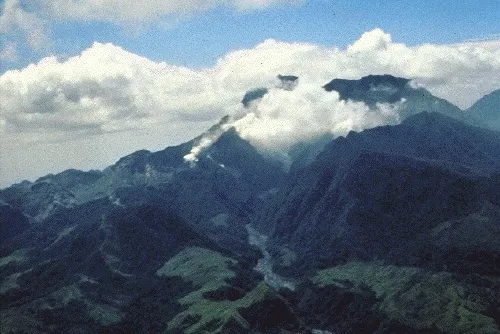
Pre-eruption Pinatubo
Mount Pinatubo shows early signs of activity in April 1991. The volcano, located on the Philippine island of Luzon, had been quiet for centuries, and scientists knew little about its eruptive history.
Monitoring Ground Swell
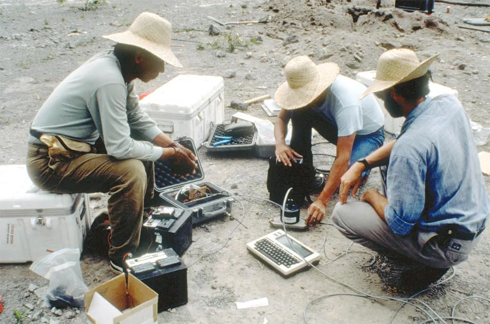
Electronic tiltmeters are being installed along the rim of Pinatubo's caldera to monitor the ground's inflation (a sign that magma is reaching the surface), on June 1, 1991.
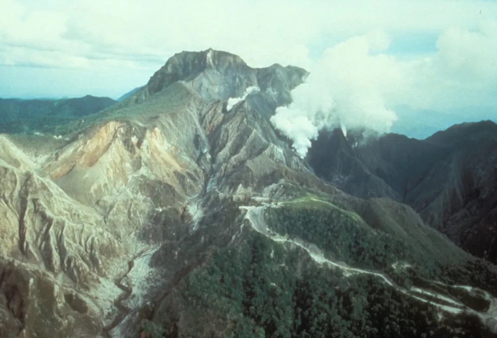
Looking for clues
Field assessments of the volcano's activity were undertaken just before the colossal eruption.
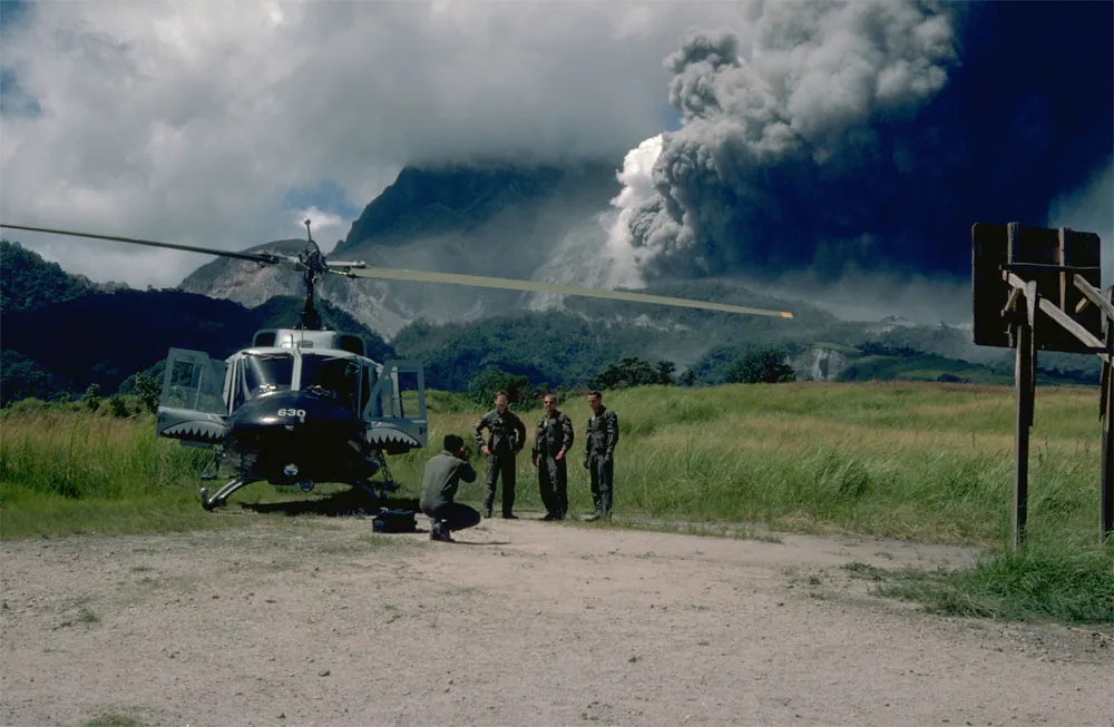
First Explosion

A large eruption occurred at Pinatubo on June 12, sending up a cloudy plume that reached an altitude of nearly 12 miles (19 km). This was the first in a series of powerful eruptions that would culminate on June 15 with the largest land eruption living history has seen.
The Big Day
Then, on June 15, the volcano blew its top in the second largest volcanic eruption of this century. The eruption caused high-speed avalanches of hot ash and gas (pyroclastic flows), giant mudflows (lahars), and a cloud of volcanic ash that spanned hundreds of miles across.
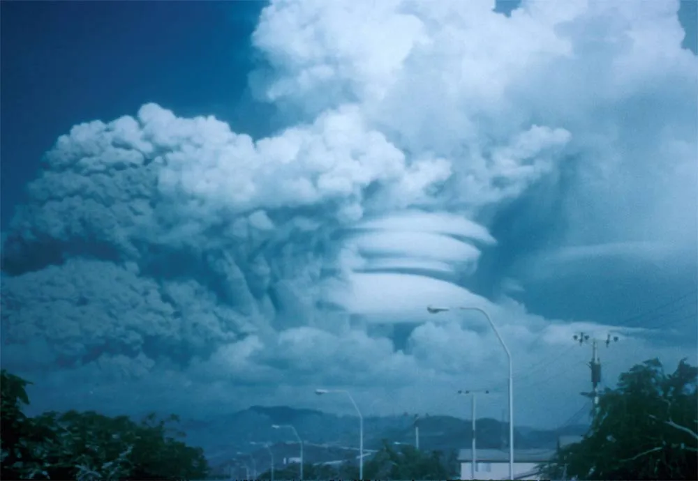
Mushroom Cloud

The eruption plume from the June 15 eruption (shown here from Clark Air Force Base) shot some 25 miles (40 kilometers) into the air, creating a giant mushroom cloud in the middle to lower stratosphere and injecting twice as much sulfur dioxide into the air as the 1982 eruption of El Chichón, Mexico. The resulting sulfate aerosols spread rapidly around the Earth in about three weeks, reaching global coverage by about one year after the eruption, according to the USGS.
Get the world’s most fascinating discoveries delivered straight to your inbox.
Caldera Collapse

The June 15 eruption created a 1.5-mile-wide (2.5 km) collapse caldera (shown here on June 22, 1991) and filled valleys around Pinatubo with pyroclastic-flow deposits. The new summit elevation of Mount Pinatubo dropped from its pre-eruption elevation of 5,725 feet (1,745 meters) above sea level to 4,872 feet (1,485 m).
Lateral Blast

This view to the west from Clark Air Base shows Pinatubo's lateral blast cloud of eruption at 5:55 a.m. on June 15.
Ash-Covered Cars

Ash-covered cars at Clark Air Force Base, on June 16, 1991.
Widened River

Cars and people traverse the flooded river after mudflows wiped out the bridges after the Pinatubo eruption in June 1991.
Jeanna Bryner is managing editor of Scientific American. Previously she was editor in chief of Live Science and, prior to that, an editor at Scholastic's Science World magazine. Bryner has an English degree from Salisbury University, a master's degree in biogeochemistry and environmental sciences from the University of Maryland and a graduate science journalism degree from New York University. She has worked as a biologist in Florida, where she monitored wetlands and did field surveys for endangered species, including the gorgeous Florida Scrub Jay. She also received an ocean sciences journalism fellowship from the Woods Hole Oceanographic Institution. She is a firm believer that science is for everyone and that just about everything can be viewed through the lens of science.